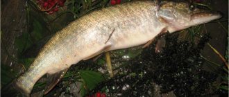
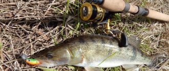
A hole in the river is a very catchy place - proven by practice. It is in it that the toothy mouth of a predator waits for its prey - your bait; peaceful fish also spend a lot of time in it, which may also be interested in your bait. Therefore, you just need to know how to find holes on the river. A hole in the river is a very catchy place - proven by practice. It is in it that the toothy mouth of a predator waits for its prey - your bait; peaceful fish also spend a lot of time in it, which may also be interested in your bait. Therefore, you simply need to know how to find holes on the river - we will tell you about this today. But let's start with a definition so that it is clear what to look for.
What is a pit
So, a hole is a clearly expressed deepening of the bottom of a reservoir, be it a river, lake, pond, and so on. In practice, there is at least one, but every water area has it. And almost any hole is a catchable place, since fish are attracted by changes in relief, in which they can hide, rest, or even spend the winter. Having found it and made a bait point there, you can count on good catch.
The pit consists of the following parts:
- foothills - starts 20-30 m before the area with maximum depth, the bites here are the same as everywhere else along the river;
- entrance (dump) - a place with a gradual decrease in relief, very loved by predators;
- the pit itself is an area of maximum depth with the usual frequency of bites (with the exception of bottom-dwelling fish, for example, catfish, which are best caught here);
- exit - a place with a gradual increase in relief, catchable, although not as much as the entrance;
- post-pit - lasts 40-50 m after the area with maximum depth; asps and pike often bite here.
The shape of the pit can be:
- longitudinal - in the form of an ellipse, the more elongated part of which is located parallel to the flow;
- rounded - if they have steep edges, they are called whirlpools.
What is an "edge"
Those who are not familiar with the terminology and have not encountered the concept of a river edge should figure out what it is.
In places where fast currents or strong turbulences of the flow wash away soil from the bottom, the depth of the river changes. Sometimes the bottom goes down slowly, almost imperceptibly, sometimes it ends abruptly. The slope is called a slope, the flat parts are called a table, and the places where the breaks are called edges. Some call the entire slope the edges, but this is incorrect.
Eyebrows are distinguished according to the following main characteristics:
By location relative to the water surface:
- The upper one is closer to the surface of the water, it marks the transition from a flat table to the beginning of the drop;
- The lower one, accordingly, is located lower, where the slope goes back into the table or shelf, if there are several height differences.
By distance from the coast:
- Beregovaya – located closest to the shore;
- Channel - frames the edges of the channel.
When the water is warm, fish accumulate near the shoreline. It is convenient because it has access from the shore. Later, with the arrival of cold weather, the fish go to feed deeper, to the riverbed edges.
Depending on whether it belongs to one of the elements of the bottom topography, the edge can be:
Sometimes the current creates oblong depressions - ditches. Of these, the channel one, located in the center of the stream, is at the lowest point. In fact, this is an additional deepening in the riverbed. Those that appear closer to the banks are near the riverbed, higher. They are much smaller in size. A short riverbed ditch is often considered a pit. It is only possible to accurately determine the size using an echo sounder.
The edge of the river is not always a straight, even line. There are parts protruding into the channel. They are called "tongues". The bends towards the shore were given the nickname "pocket".
Rivers are mobile; currents, channel locations, and bank boundaries change over time. Consecutive depth differences are formed. Then you get whole ladders of steps, with horizontal sections - shelves. Medium-sized predators like pike, pike-perch or perch lurk here. The design of the shelves allows you to successfully lure fish onto the hook. But determining their location without available means is quite difficult.
Occasionally there are irrigations - smoothly rising wide areas between two edges or an edge and the shore.
Bottom irregularities are considered important for a reason. Small food accumulates on the sloped surface. It attracts small fish, which rush to collect food before it is carried away downstream. Small fish attract large predators. They hide in the depths and catch their food at the lower break. So, if a friend tells you that he caught a huge catfish on the edge, he is definitely talking about the bottom.
Much depends on the depth of the hole and the river itself. If the river itself is small, then you need to look for fish at the very bottom. If it is full-flowing, then the bends of the relief are interesting.
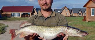
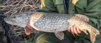
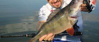
Catfish, bream, and large pike perch climb the lowest. Among the daredevils who get closer to the dump there are perch, pike, ide, roach, and small pike perch. Pike hunts at any time of the day; catfish and pike perch prefer the night. Good fishing spots are never empty, so there is often a queue.
Finding a hole by examining the bottom
It’s easy to “feel the terrain” and find a deep area - just jig tapping the bottom.
- Hang a “drop” on the feeder rod and cast.
- Wait until the weight sinks to the bottom.
- Make 3-5 rotations of the reel handle and note how many seconds it takes for the “drop” to reach the bottom.
- Repeat the third step, constantly recording and checking the time.
With even terrain, the weight will fall to the bottom in the same number of seconds.
If, with steps, the time it takes for the “drops” to reach the bottom increases, you have reached the entrance (if you go with the flow) or the exit (if against) the hole. If the number of seconds is the maximum and it does not increase step by step, then you are going through the deepest part. All the time spent exploring the bottom will pay off with a good bite. By the way, in the same way - by jigging - you can find not only holes, but also edges on the river. Good luck in finding the most catchy spots - we want you to return home with a good catch.
River terminology in fishing
For fishing to be successful and bring moral and material satisfaction, it is worth classifying and shedding light on a number of basic bottom elements that exist on all rivers:
- A dump is a change in the bottom topography in different directions. It can be sharp and smooth.
- Watering is a wide section of the bottom located between the edges or the shore and the edge. It has a slight slope and a so-called table - a horizontal plane of the bottom.
- The channel is the main part of the river during the period between two floods.
- The floodplain is the area around the river that is flooded during a flood.
- A channel ditch (most often called a fairway) is the deepest section of a river, which is often confused with a riverbed.
- A riparian ditch is a depression parallel to a channel ditch.
- Delta is the area where a river connects to the sea or ocean.
- A channel (erik) is a narrow channel connecting two or more bodies of water.
- Spit is an area of shallow water (mostly with a sandy bottom). Forms where the river turns.
- A riffle is an area with a depth difference perpendicular to the current.
- The navel is a slide at the bottom of a reservoir.
- The pit is the bottom topography most beloved by all species of fish.
- A return flow is a place with a reverse current that arises due to the characteristics of the bottom topography and coastline.
- The edge is the boundary of two planes, inclined and horizontal. This is where most fish come in search of food.
Often fishermen, even experienced and experienced ones, mistakenly call the edge a step. This is fundamentally wrong. A step always consists of two edges - lower and upper. Usually they fish on the lower one, as it is the most promising in terms of finding underwater inhabitants.
Edges can be both coastal and channel. Coastal - the one that is located closer to the shore. You can successfully fish here from mid-spring to mid-autumn.
How to find a catchable edge on a pond?
Finding a catchable edge occurs in several ways. The easiest way to determine the depth of the slope is by the angle of the fishing line or braided cord going into the water. But this will be only an initial and imprecise definition. Next, you should cast to the point of maximum distance from the shore from which the cast is made. The depth at a given location can be determined by the time the marker weight falls to the bottom. But the drop time of the weight must be tested in advance on some familiar body of water where the depth is known.
After determining the depth of the reservoir at different distances of casting the weight, an approximate map of the bottom relief is created. All that remains is to stretch the weight along the bottom to determine where the edge is. This will be noticeable by the way the weight begins to clearly touch the shell rock and grass, rest against it and forcefully climb onto the edge. In a hole, the bottom is usually smooth and there are rarely snags, unless of course it is a channel hole and not a pool under a steep bank, where there are a lot of driftwood. When the edge is found, you can clip the cord and start fishing on the feeder.
Formations and obstacles on the river
Sediments are solid particles formed as a result of erosion of watersheds and riverbeds, as well as coastal reservoirs, carried by watercourses, currents in lakes, seas, rivers and reservoirs and forming their beds. Sediment in the river bed creates sand ridges. This is the main type of sediment. Because of the ridges, the sandy bottom of the river is uneven and wavy. The ridges move downstream at a speed hundreds of times less than the flow speed, but on large rivers it reaches several meters per day. The size of the ridges depends on the shape of the channel, depth and flow speed. Their height is proportional to the depth of the flow. Therefore, the ridges on the reaches are higher than on the rifts. As the water level rises, the ridges become higher and vice versa. The length of the formed ridge can be equal to 10-12 flow depths.
Sastruga is an accumulation of sediment in the form of large ridges adjacent to the sandy shore (Fig. 1). The end of the sastrugi is called the ear, and the lowering of the bottom between the sastrugi is called the sub-sastrugi pit. The size of the sastrugi depends on the shape of the channel, the depth and speed of the current. Sometimes large sastrugi stretch to the opposite bank. The height of sastrugi on large rivers reaches 2 m. The patterns of growth and movement of sastrugi are the same as those of ridges. Above the sastrugi there is usually an uneven current, causing ships to yaw.
Rice. 1.
The spit is a low sand bank, jutting into the channel like a long wedge (Fig. 2). On rivers, spits usually adjoin convex sandy banks. The braids are formed from large sastrugi as a result of their gradual growth and movement.
Rice. 2.
Over the course of a year, the spit can move several hundred meters. The bay between the shore and the tail of the spit is called a backwater, a small sandy spit is called a zakosk, a large underwater sastrugu with a steep rear slope protruding far into the channel is called a zamanika, the ridge part of a large ridge crossing the channel, usually flooded during high water and drying out during low water, a side (Fig. 3).
Rice. 3.
During low-water times, the flow that erodes the ravine sometimes encounters solid rock and deviates to the opposite bank. Below the solid rock, a quiet water is formed, where sediments are deposited, and sidewalls are formed (Fig. 4) - deposits of large sediments at the places where small tributaries or ravine outlets flow into the river. Below the rash, in the area of quiet flow, a sidewall may form. As a result of local channel reformations on riffles with easily moving sediments, as well as behind ships that have run aground on a riffle, or behind sunken large objects, shalygs appear, separately lying underwater shoals formed on a ship's passage or riffle (Fig. 5).
Rice. 4.
Rice. 5.
A riffle is a form of bottom relief characteristic of lowland rivers, formed by sediment deposits, usually in the form of a wide ridge crossing the channel at an angle to the general direction of the flow, causing it to deviate from one bank to the other. A riffle is an accumulation of sediment deposited across the entire width of a channel. They cause a local decrease in depth, and during periods of low levels - a backwater of water in the overlying area - the reach. Riffles are the main obstacle to the movement of ships on rivers.
The main elements of the roll (Fig. 6): upper and lower sides (braids); upper and lower reaches; saddle - a shaft of sediment connecting the upper and lower spits; trough - the deep part of the saddle where the shipping passage usually passes; pressure upper slope - the upper flat part of the saddle; basement (rear or lower slope) - the lower part of the saddle, steeper than the pressure slope; ridge - the upper edge of the basement, which has the smallest depth; backwater part - the upper part of the lower reach hollow, located behind the mouth of the upper spit (rifts may not have a backwater part, in this case the reach hollows do not overlap one another); pothole - a depression developed by the flow in the upper part of the lower spit, directed with its mouth against the flow. On plans of rifts, depths are depicted by isobaths - lines of equal depths. The number on the isobath shows the depth from the design level at which the intersection of the water surface with the banks forms a water edge line, indicating the configuration of the river bed.
Rice. 6.
During the low-water period, the cross-sectional area of the riffle is smaller than on the reaches, and therefore the slopes of the water surface and the flow speed are greater. From the upper reach of the valley to the ridge, the flow speed increases, and towards the basement it reaches its greatest value, and behind the basement, as a result of an increase in the depth of the channel, it decreases significantly. Such a difference in current speeds negatively affects navigation, making it difficult for ships to pass through a riffle. During floods and floods, the distribution of speeds changes: on the riffles the speeds become lower, and on the reaches they become higher. This is explained by the fact that the riffles are located in widened sections of the channel and during high water, the cross-sectional area of the riffles is larger than that of the reaches. The directions of the current on the riffle are determined by its characteristics and the position of the level; they are different in the spring and low-water periods. During high water, the direction of the current on the rifts and on the reaches is parallel to the banks of the river valley. During this period, the rolls do not affect the direction of the currents. During the low-water period, the direction of the flow onto the riffle depends on its type, shape, type of basement, contours of the riverbed, etc.
When the water level rises during a flood, large amounts of sediment are deposited onto the riffles. The alluvial roll begins in the middle of the water level rise. They reach their greatest height at the time when the water begins to recede. The height of the alluvium on navigable rivers reaches 3 m. The higher the level of the spring flood and the longer it lasts, the greater the rise. Annual reclamations increase the height of the riffles and require repetition of work to improve the navigability. As the water decreases, the layer of sediment washed up on the riffle begins to be washed away. As the level decreases and the slope increases, the river flow, constrained by the spits, cuts a trough at the saddle of the riffle. With a rapid drop in level, the river does not have time to wash away the sediment, so by low water the condition of the riffle deteriorates significantly and the movement of ships along it becomes difficult. With a slow decrease in water, sediments are eroded for a long time, and by the low-water period the previous shape of the riffle can be restored. On rivers with a very unstable bed during high water, a large layer of sediment remains on the riffle; the flow does not have time to develop it even during the entire low-water period.
The riffles constantly move downstream - much the same as sastrugi. The movement of the roll has different speeds and depends on the flow rates and slopes of the water surface, the size of soil particles, etc. In the middle reaches of large lowland rivers, the shift of the rift can reach 100 m per year. Over a long period of time, the migration of rocks, their complete destruction, significant reformation, or the emergence of new ones can occur. Constant changes in the state of the riffles require annual repetition of dredging work to improve their navigability. As a result of intensive dredging, the riffles degenerate into underwater channels. Thus, as a result of intensive dredging on the Upper Lena, the riffle ridges lengthened, and some of the stretch hollows, due to a decrease in water level, became shallow and almost merged along the bottom with the riffle ridges. As a result, the Lena channel in the area from Ust-Kut to Kirensk turned into a kind of channel with extreme navigable depth.
Rocky riffles are found on rivers flowing in areas of mountainous regions or moraine deposits (Upper Irtysh, Yenisei, Lena, Aldan, Zeya, etc.). Rocky rifts, having only common features with ordinary rifts, differ from them in stability of position due to the presence of rocky ridges, a scattering of individual stones or large pebble deposits. On rocky deposits, sand deposits form in the form of spits, slopes, and sandbanks. Such riffles are usually very stable and rarely undergo seasonal changes with the rise and fall of water. Rocky rifts are difficult for navigation due to shallow depths, narrow and winding shipping channels, high flow velocities and irregular currents.
To control a vessel, study a special route and ensure navigation safety, the division of riffles according to navigability and the degree of difficulty of navigating ships and rafts through them is of particular importance. The difficulty of navigating through a riffle is influenced by the following factors: the type of basement, the width, depth and shape in terms of the ship's passage, its bending radii, the type and location of the riffle and visibility conditions, the position of the water level, the features of the flow - the direction and speed of the drift currents, the presence of waterways and Maidans, etc. (see also Currents), the difficulty of entering and exiting the rift from the side of the reaches, etc.
There are four types of rifts (Fig. 7).
- A riffle without a backwater part is usually located on gentle bends of sections of a narrow river bed. The rolling valleys do not overlap one another, so it does not have a backwater part. This riffle is stable and retains its shape and location in the riverbed for a long time. The ship's passage and the trough on it smoothly roll from one bank to the other. The smooth flow onto the riffle coincides with the direction of the trough, a. drift flow is usually absent. In most cases, such a roll without a backwater does not cause difficulties for the movement of ships.
- Reach hollows enter the riffle with the backwater part one after another. The trough is located at a large angle to the direction of the channel, the ship's passage slopes steeply from one bank to the other. This roll is unstable. When the water level is low, sometimes the trough is washed almost across the riverbed. With further reformations, the trough riffle may become even more distorted and take the shape of the letter S. Part of the water flow is drained onto the riffle along the shortest path - from the upper reach to the lower one, and therefore the water dump is directed to the backwater part. When the water level is low, a strong drift current is created on the riffle, directed towards the lower spit. A roll of this type (especially with a developed backwater part) is difficult for vessel movement due to the narrow shipping channel with a steep pass, shallow depth and strong drift current.
- Rifles occur in widened sections of the riverbed. Due to the excessive width, the stream cannot transport sediments, form spits and reaches, so the channel is filled with disordered thick deposits (sastrugi, spits, sedges, shalygs), from which a riffle is formed. The riffle has no definite shape. Under the influence of the current (especially during sharp fluctuations in level), sand deposits, continuously moving, change the shape of the riffle. The trough does not have a clearly defined depression or shape. This riffle is very unstable, here the ship's passage is winding and shallow, and during the low-water period it can change its position several times. The flow on the rifts is chaotic and uneven. Shallow depths, uncertain navigation, and uneven currents create great difficulties for the movement of ships.
- A group riffle is a section of the channel on which several riffles of various types are located close to each other. The spits at the group riffle are located so that the lower spit of the upper riffle is the upper spit for the lower riffle. They are separated by small reaches. Sometimes such a hollow is so small that it creates, as it were, a double basement of one riffle. The length of a group riffle can reach several tens of kilometers. Group riffles include those formed from the division of the channel by islands or large midstreams at the confluence of rivers or the flow of a small tributary into the channel. The ship's passage to the group rifts is tortuous, sometimes crossing several times from one bank to the other. Group riffles are usually unstable, their regimes are interconnected; the erosion of one riffle can cause the shallowing of another, and vice versa.
Rice. 7.
The narrow and winding channel, sloping and protracted currents turn the group riffle into an area difficult for ships to navigate.
The basement is the most difficult place when guiding ships through a riffle. All basements can be divided into three types (Fig. 8), and each type of rift considered can have any type of basement.
- The level basement is formed by the smooth rear slope of the saddle riffle, located normal to the axis of the trough. The flow in the basement is smooth and coincides with the axis of the trough. In some cases, two large sastrugi of the upper and lower spits, approaching the middle of the trough, create a level basement with a significant decrease in the ridge. The spits and sastrugi of such basements direct the water to the middle of the trough, creating a concentrated flow. The level basement does not present much difficulty for ship traffic.
- A convex basement has a convex shape in plan and cross section. It is created by a large movement of sediment through the saddle roll; it is very unstable and does not have a deep trough. The current in the basement is fan-shaped, weak, sometimes with two-way drainage of water on both sides of the bulge. In most cases, the current at the upper spit is weak, and the stronger one is directed towards the lower spit. The basement is unfavorable for navigation.
- An uneven (curved or indefinitely shaped) basement is created by two sastrugi or scythe tails that overlap one after the other. Such a basement is very unstable, the flow on it is uneven, and a different direction of water drainage is created near each spit. With high sediment mobility, a basement of indeterminate shape is formed. Such a basement is very curved or does not have a clearly defined outline; it is also very unstable, so uneven basements are most unfavorable for navigation.
Intensive dredging work is underway in some sections of the rivers. As a result, the stretch hollows are connected by a continuous channel-slot, so the riffles do not have a clear basement. In terms of navigation, such a basement is more favorable compared to previous types.
Rice. 8.
Navigation conditions mainly depend on the type of riffle, the type of its basement, as well as on the size and draft of the vessel, the direction of movement of the vessel and other factors. For ships of small and large displacement, pushed convoys, towed ships or rafts, the difficulty of sailing through a riffle is not the same. If, for example, for a raft the width of the channel and the direction of drainage of water are essential, then for a large vessel the depth of the riffle is very important. The position of the water level is very important. Usually, at a high level, sailing conditions are more favorable than at a low level.
According to the degree of difficulty for navigation, the riffle can be divided into two groups depending on the type of riffle, the type of its basement and other factors.
- An easy riffle is basically a riffle without a developed backwater area, which has a level basement, a straight channel with sufficient depth and width for large vessels. On such rapids the current is smooth, without maidans or cross-waters, and swell and prolonged currents are insignificant. The entrance to and exit from such a roll is convenient. Passing and overtaking on an easy roll is possible only for small vessels, and measures must be taken to fully ensure the safety of navigation.
- A difficult riffle is a riffle with a developed backwater part, placer riffles and group riffles. A difficult riffle usually has a small depth and width of the channel, a winding trough, and a drift or protracted current. Passing and overtaking on such riffles is prohibited for vessels of any displacement.
Middle - an accumulation of sediment in a river bed in the form of low, usually devoid of vegetation, flooded or partially exposed moving islands or shoals that are not adjacent to the shore. The middle is narrowed and the channel is bent and the depths are reduced. Sedations occur in quiet waters, for example, behind a cape, from a sand spit, at the confluence of two rivers, as well as over an obstacle in the channel of shalygas and large sand ridges.
A spit is a low and narrow strip of land running from the shore towards a lake or reservoir.
Splash is a narrow strip of sloping shore adjacent to the water edge of a reservoir or river bed.
Shoal - a shallow section of a reservoir or river adjacent to the shoreline.
How to find an edge, what is its meaning
fishx 09/01/2018, 17:39 12.7 thousand
The meaning of the edge in the feeder, why they are looking for it. In this article I will talk about the importance of the edge for effective fishing on large rivers. How to find the edge?
Content:
Sometimes we don’t attach much importance to things that were once discovered by feeder fishing professionals and have become classic postulates and norms. Ignoring these seemingly truisms often does not lead to any negative results and does not affect the success of fishing. This often happens on small rivers, where the channel is so narrow that the concept of an edge here is rather conditional. Everything is measured almost in centimeters from the core of a small river to its shoreline. In another case, there is no edge on a shallow village pond, where the depth is approximately the same, and the stream that founded this pond has long silted up and now it is impossible to find its bed even if one wants to.
Why look for an edge on the river?
Despite the reluctance to find an edge, often caused by ordinary laziness and reluctance to engage in tedious preparatory operations, the presence of a catchable edge on large rivers often has a noticeable effect on the effectiveness of fishing. This happened on a recent fishing trip with my son. We took with us short homemade feeders made from spinning rods and intended, in general, for fishing on ponds and small rivers. The casting range of these donk feeders was quite enough to reach all the catchable points on crucian carp ponds, where the fish adheres to the shoreline, and the same catchable points on small rivers. Usually these were casts of 20-40 meters .
Arriving at the rather large Vetluga River, we were faced with a peculiarity of the river, where it was impossible to reach from one shallow bank with our homemade feeders to the pit, and from another steep, steep bank to the drop from the pit to the shallow water. Both here and there, in these intermediate areas between the hole and the border with shallow water, only the medium-sized white-eyed owl pecked. Therefore, my son did not come across any relatively large fish at all. Of course, we were unlucky and, in fact, there was almost no bream on our visit. But nevertheless, on my branded feeder with a length of 3.9 m and with test indicators of 60-90-120, from time to time I came across bream, I took a bream weighing one and a half kilograms and a dowry. Another cat broke loose, I believe because of the small hooks my feeder was equipped with. Still, the size of the hooks on Vetluga should clearly be larger than on a small city river (report on our fishing on Vetluga).
What is the reason for this difference?
The difference in the type and size of the prey was that the branded feeder, which I almost abandoned when fishing mainly on a small river, allowed me to throw the feeder and hooks with bait over a distance of more than 50 meters . And this was quite enough to throw us up to the slope onto the pit , which was located under our steep bank. All casts into the pit itself brought only a medium-sized white-eyed sop, although it seemed that all the large fish should be in the pit. But this is a common misconception.
The edges and slopes of the pit are the most inhabited horizons, where mollusks and vegetation settle. And this is food for many fish, including bream. The upper part of the edge is especially rich in various forms of life. The thermocline is often located here - the boundary between cold and warm layers of water. Fish for the most part prefer warm water, especially if they are representatives of the carp family. Only in the summer heat, when the water warms up to the state of fresh milk, do the fish go to deeper places, where the water is cooler and saturated with oxygen.