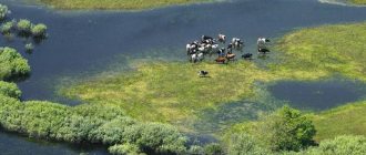
There are not as many large water sources and resources in the Middle Urals as in some other neighboring regions. This part of Russia is more famous for its industrial facilities and hills. Nevertheless, the rivers of the Sverdlovsk region optimally complement the climate of the region, are rich in fish and are an excellent vacation spot for local residents and guests. Let's consider the features of the region's reservoirs, their locations and their role in the formation of natural resources.
List and description of rivers of the Sverdlovsk region
Let's start the review from the Bolshaya Nyasma River. It also flows in the Tyumen region, its length is 92 kilometers. The mouth is located on the right bank (171 km from the Lyalya River). The source is located in the eastern part of the village of Srednyaya Usva. Also on the banks are the settlements of Staraya Lyalya and Chernichny. The catchment volume is 635 sq. km. This river is not very large in size, but is distinguished by its stormy character, the presence of creeks and riffles. The bottom is muddy, the water is muddy, and the popular fish for fishing is pike. Tributaries: Malaya Nyasma, Listvyanka, Vogulka.
Ivdel is a mountain river with many rapids and riffles in the Sverdlovsk region, the mouth of which is located 330 kilometers along the right bank of Lozva. Length - 116 km, both coastal parts are framed by Devonian limestones.
Volchikha Reservoir
August 19, 2014
Walk on a river bus. Traveling around Iset
How to get there
— by car along the new Moscow highway, 1.9 km from the interchange bridge at Chusovodstroy/Novoalekseevskoye (between 330 and 329 kilometers of the Perm-Ekaterinburg highway) there will be a turn (across the dividing strip) to the Cape Verde base (left). You pass through gardens that go under power lines, then along a good dirt road you drive out to the area of the “1624 km” stopping point, where the road passes under a railway embankment. We pass under the railway, move along the road to the Cape Verde tourist center and after ~50 meters turn right into the forest. We drive along the dirt road until we reach the beach area. — by train to Druzhinino and Revda to Flux or Sportivnaya station.
There is a nudist beach.
Reservoirs not suitable for swimming
Tura
A large river in the Sverdlovsk region serves as a left active tributary of the Tobol. Short description:
- Length – 1030 km.
- The basin area is 80,400 sq. km.
- The variety is raftable, navigable from the mouth to 635 km.
- Tributaries - Tagil, Pyshma, Aktai.
- Features - Verkhoturskaya hydroelectric power station, three reservoirs.
The water regime of the river is determined by certain annual cycles, like most other reservoirs in the region:
- Spring high flood.
- Low water in summer and autumn with minimal water level.
- Minor floods associated with autumn precipitation.
- Stable winter low water when the minimum water level is reached from January to March.
Tavda
We begin the description of the river in the Sverdlovsk region with its brief characteristics:
- The mouth is located 115 kilometers along the left bank of the Tobol.
- The source is located on the eastern slope of the Ural Mountains (at the confluence of the Lozva and Sosva rivers).
- Length – 719 km.
- Swimming pool – 88001 sq. km.
- Features - the settlement of Tavda is located on the banks.
The riverbed is distinguished by its tortuosity; it flows across the West Siberian Plain along the bottom of a wide valley. Food is of mixed type with predominant snow inputs. The water level changes about six meters throughout the year. The river is navigable along its main length, freezes in early November, and opens closer to May.
Pyshma
This river in the Sverdlovsk region is included in the Ob basin as a right tributary of the Tura. With a length of 603 kilometers, the basin area is 19.7 sq.m. The river forms on the eastern Ural slopes, flowing along the Trans-Ural and West Siberian plains. The main food supply is melted snow; Pyshma freezes in November and opens in the second half of April. The banks are occupied by the settlements of Sukhoi Log, Kamyshlov, Talitsa. The main purpose is industrial water supply, timber rafting, maintenance of three reservoirs, and a tourist destination.
Braid
For fishing, a river in the Sverdlovsk region called Tesma is one of the best options. Pike, roach, perch and trout are found here (catch is limited by law). The source is a small mountain river 18 kilometers long. The catchment area is 147 square meters. km. The river flows rapidly and intensely, in the spring the flood begins in April, the right bank is quite high, the left bank is partially swampy. The upper and middle reaches pass through coniferous forests (the territory of the Taganay nature reserve). The lower coastal part is occupied by the city of Zlatoust. The main tributary is Malaya Tesma.
It is worth noting that in spring the water is high for several days, after which it drops sharply. In May, the level rises again due to snow melting; sharp rises in water are often observed during rainstorms, which makes crossing difficult or impossible.
Neiva and Nitsa
The rivers of the Sverdlovsk region, the list and description of which are given above, are among the major sources of the region. To this list we can add the Neiva River, which, by merging with the Rezh, forms Nitsa, a tributary of the Tura (belongs to the Ob basin).
Peculiarities:
- Length: 294 km.
- Swimming pool area – 5600 sq. km.
- Beginning – Eastern Central Ural slope.
- The main direction is Verkh-Neivinsky pond.
- Availability of several reservoirs.
- Food is of mixed type with predominantly snow content.
- It becomes covered with ice in November and opens in April.
- Water consumption (average annual) is about 10 cubic meters/second.
Neiva is heavily overgrown with algae in the summer and is mainly used for water supply to populated areas.
Another significant and navigable river in the Sverdlovsk region is Nitsa. It is a right tributary of the Tura, length - 262 km, basin - 22,300 sq. km. The diet is mixed, the average flow is about 42 cubic meters per second, it freezes in the second part of October or early November, the ice melts in mid-April. The main tributaries are the Esaulka, Murza, Irbit, and Ilenka.
Lake Tavatuy
December 12, 2014
Hot springs in Rezha
Description
The lake is located in the Nevyansky district and belongs to the Neiva river basin. The surface area of the lake is 21.2 km², the water level is 263.5 m. The lake is connected to the Verkh-Neivinsky pond. Over 30 rivers and streams flow into the lake and the Neiva River flows out. Lake Tavatuy is a typical mountain type reservoir for the Middle Urals. The age of the lake is about 10 thousand years. Seasonal and annual fluctuations in the water level in the lake reach up to 1 m and largely depend on the operating mode of the control dam on the Neiva River. The greatest depth of the lake is 9 m, the prevailing depths are 6−8 m, the average is 5.8 m.
How to get there: by train towards Nizhny Tagil and Murzinka, Kalinovo station.
Additional entertainment: rental of boats, catamarans, boat ride. There is a nudist beach.
Other rivers of the Sverdlovsk region
We will continue the list with a brief description of other important water resources of the Sverdlovsk region:
- Vizhay is the left tributary of the Vilva, originating in the east of the region, length - 125 km, drainage indicator (total) - 1080 sq. km at an altitude of 375 m. The slope is about 2.2 m/km.
- Vishera is the Kama left tributary. Length – 415 km, basin – 31,200 sq. km, drainage area – 317 m, slope – 0.2 m/km. This river is the fifth longest in the region, has very picturesque places, mainly flows through the foothills of the Urals, and has many shoals and rapids.
- The Istok River in the Sverdlovsk Region also flows through the territory of the Chelyabinsk Region, Kaspinsky District, and Kamensky District. The mouth is located 25 kilometers along the left bank of the Sinara, length – 29 km.
- Sosva is part of the Tavda, in its upper reaches there is a natural protected reserve base “Denezhkin Stone”. Length – 635 km, basin area – 24,700 sq. km. The annual fluctuation of levels in the lower and middle reaches is about five meters, the average water flow is 113 cubic meters. m/s. The primary purpose is timber rafting; ships can sail at a distance of up to 333 km from the mouth.
- Chusovaya. The left tributary of the Kama also flows through sections of the Chelyabinsk region and Perm region. The river originates in Asia (the eastern slopes of the Ural ridge), then flows mainly along the western slopes and the European part, crossing the Sverdlovsk and Chelyabinsk regions twice, entering the Perm region. Length – 377 km, basin area – 23 thousand square meters. km. A special feature of the shores is their decoration with numerous rocky cliffs.
Lakes
Among the water reserves of the Middle Urals, it is worth noting the rivers and lakes of the Sverdlovsk region. Let's start the review with the Ayat reservoir. The lake is one of the largest representatives in the vicinity of Yekaterinburg. It is located on a swampy part of the Ural ridge, surrounded by dense forests. Area – 26 sq. km, length – 12 km, the northern and southern parts are connected by a narrow isthmus. The maximum depth is 4 meters. The Ayat natural reservoir is rich in fish and waterfowl, which makes it extremely attractive for fishermen and hunters. Gradually, the reservoir becomes overgrown and swampy, the bottom is muddy, and there is a lot of vegetation in the form of sedge and reeds. Among the fish most often found are perch, pike, ruffe, bream, and ripus. There are several small islands on the lake.
Nizhneisetsky pond
Swimming is prohibited! Here it is easy to pick up E. coli and become infected with helminths. There are many chemical impurities in the water, so it is dangerous for allergy sufferers and children. You can get there by bus No. 19, trolleybuses No. 1, 6 to Khimmash.
Reservoirs and beaches that do not meet sanitary standards: - Verkh-Isetsky pond; — Patrushikha River; — Lake Chusovskoye; — Lake Peschanoe; — city pond; — Uktussky pond; — Kalinovsky sections; — Nizhne-Isetsky pond; — Lake Utyatskoe; - quarry on the street. Zoological; — pond “Spartak”; — beaches “Yuzhny”, “Vostochny”, beaches of recreation centers “Space” and “Ogonyok” on Lake Shartash.
You also cannot swim in the rivers and reservoirs: * Shabrovka, * Shilovka, * Maly Istok, * Mostovka, * Uktusskoye Reservoir, * Chaika, * Ogorodnoe. The content of E. coli and other parasites here exceeds the norm.
When preparing the review, materials from the site ural.kp.ru were used
Baltym
Considering the rivers and lakes of the Sverdlovsk region, one cannot help but note the Baltym reservoir, which is one of the most popular recreational places for residents of Yekaterinburg and adjacent settlements. The lake belongs to the Pyshma River basin, its area is 7.5 square meters. km. There are fish: bream, crucian carp, pike, chebak.
On the eastern part of the coast there is a fisherman’s house in which the fishermen and hunters of Uralmash are located. You can get to the site via the Verkhotursky or Tagil tract. The shores of the beautiful lake are occupied by numerous recreation centers, children's camps, cottages, beaches and other recreation and tourism facilities. The influx of vacationers is especially noticeable in the summer.
Lake Sandy
July 2, 2021
Beaches and boat stations in Yekaterinburg
Description: Lake Peschanoe is located in the area of Pervouralsk, 4 km north of the village of Severka and belongs to the river basin. Iseti. The water surface area of the lake is 0.36 km2. The lake is mainly fed by surface and groundwater from local runoff. The length of the coastline is about 3 km. The maximum depth of the lake is 3.5 m, the average depth is 1 m. The lake contains fish: perch, chebak, pike, crucian carp, minnow. The bottom of the lake is sandy, without sharp changes, and gently slopes down to the middle of the reservoir. There are no large settlements here, but along the shores of the lake there are numerous recreation centers, dispensaries, sports and recreational and pioneer camps.
How to get there
By car: highway Ekaterinburg - Pervouralsk, turn 24 km.
By train: towards Kuzino and Shali (Severka station) or towards Revda and Druzhinino (station 1638 kilometer).
Additional entertainment: rental of boats, catamarans. There is a nudist beach.
July 13, 2012
Beaches of Verkh-Sysertsky pond. Summer 2013
Description
This reservoir on the Chusovaya River serves as a compensator for the Volchikhinskoye reservoir: water reserves accumulated in the spring-summer period are released into the Volchikhinskoye reservoir as needed, and from it flow into Yekaterinburg. The Verkhnemakarovskoe reservoir spilled from the village of Verkhnemakarovo upstream Chusovaya for 20 kilometers (in the southeast direction) and represents a narrow branch up to 1-1.5 kilometers wide, stretching to the village of Kurganovo. This reservoir is smaller in volume than the Volchikha reservoir (approximately 70 million cubic meters). It is home to perch, pike, bream, and chebak. Around the reservoir there are low ridges with soft contours of the peaks, cozy meadows, dense mixed and pine forests. You can swim almost all summer; the water blooms only in August.
How to get there
Bus number 110 from the Yuzhnaya stop in Yekaterinburg to Gorny Shchit.
Additional entertainment: rental of boats, catamarans, water skiing, boat trips. There is a nudist beach.
Vashtym and Shartash
Vashtym is located on the watershed between Kymta and Iset, and the Vashtynsky Istok River flows from it. The almost circular shape of the reservoir is only about 1.5 km in cross-sectional size. The average depth is 1 meter, the banks are partially swampy. Inhabitants: crucian carp, pike, perch.
Lake Shartash is located in the northeast of the outskirts of Yekaterinburg. Surface area – 6.9 sq. km, the water level in absolute terms is 275 m, the catchment area is 41 sq. km (watershed between Iset and Pyshma). Length – 12 km, maximum depth – 4 m. The reservoir is fed by precipitation and runoff. Fauna – crucian carp, roach, gudgeon, ripus, tench.
Lake Shartash
Description
Articles on the topic
July 9, 2014
Beaches of Lake Tavatuy. Summer 2016
This is the most popular holiday destination for Yekaterinburg residents. The entrance is a mound of gray granite stones, Stone Tents. At first glance, these granite rocks resemble the ruins of an ancient castle. From here, along the road and numerous paths leading through the forest, you can reach Lake Shartash. The area of the lake is 715 hectares. It is surrounded by a ridge of huge granite boulders. The greatest depth is about 6 meters. Most of the bottom is covered with silt, with the exception of the southern and eastern shores of the lake, where the bottom is rocky-sandy or rocky-clayey. This part is most convenient for swimming. There are several boat stations, cafes and eateries on the lake.
How to get there
buses No. 25 (Vysotskogo stop), No. 36 (Rest House Shartash stop), No. 10 (Magazine stop)
Additional entertainment: boat rental, water skiing, boat ride, jet ski. Lake map

