Content
- Helix 12: description of CHIRP technology
- Helix 12: AutoChart Live
- AutoChart Pro - advanced cartography
- Humminbird Helix 12 Built-in GPS Features
- Scanning modes SI, DI, Sonar. Split screen
- Other features of the Humminbird Helix 12
- Screenshots of Helix 12
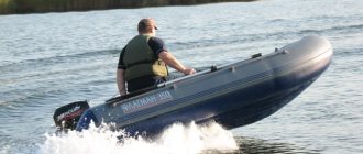
Friends, here is the second part of a review article on the Humminbird Helix 12 echo sounder. In the first part, I talked about how we adapted the device for use in a PVC boat, what difficulties we had to face, touched on some principles of side scanning, and also told how I work with him. Today I will talk about what CHIRP technology is and why it is important for an echo sounder to support it, about the capabilities of an echo sounder in cartography and navigation, I will give examples of working with different scanning modes to make it clear why, having a side view, we still, most often , we place all three modes on the screen. I’ll also give examples of screenshots and try to understand them.
All about echo sounders
When buying a fish finder you should know
Recently, there have been more and more cases of people contacting our company regarding the maintenance of Humminbird echo sounders that were purchased abroad or imported and sold in Russia through unofficial channels.
New MEGA 360 Imaging sensor
Humminbird has announced the new MEGA 360 Imaging 360-degree sensor.
Echo sounders for winter fishing: features and selection rules
Most fishermen prefer winter fishing to summer fishing, finding it its own special charm. However, fishing in winter has one small drawback, which is that at this time of year the water surface is covered with ice, and this makes it much more difficult to find places where fish accumulate. But for any problem you can find a solution - in this case it can be solved with the help of an echo sounder for ice fishing.
New Humminbird MEGA Imaging™ scanning technology
Humminbird has once again demonstrated its commitment to creating innovative devices in the field of marine electronics. The company introduced new scanning technology for MEGA Imaging™ fishfinders.
Down Imaging™ technology in Humminbird fish finders.
Down Imaging, as the name suggests, is a collection of sonar software and hardware that can display detailed images of the bottom and structure directly below the boat.
Humminbird Side Imaging™ technology.
In 2005, Humminbird revolutionized the fishing world when it introduced Side Imaging technology. The benefits of the technology quickly caught on with fishermen, and now, more than a decade later, Side Imaging technology is found in models from almost every brand.
Description of AUTOCHART® LIVE
Creating detailed maps of your favorite fishing spots in real time is easier than ever with AutoChart® Live.
“The Magnificent Seven” New generation of Humminbird Helix 7 fish finders
Humminbird has introduced a new line of HELIX 7 Series fish finders.
Description of how AutoChart™ works
In 2014, Humminbird, from its mapping division LakeMaster™, released a full release of the program for creating custom maps for Humminbird fish finders - AutoChart™. This is a further continuation of the development of the famous DrDepth depth mapping program, which Humminbird acquired in 2013.
Using Autochart charts on Humminbird devices that do not support Autochart software.
Create your own maps in AutoChart.
Many of our customers who have already purchased AutoChart or are considering purchasing ask the question, “Can I use AutoChart or AutoChart Pro if my body of water is not on the Zero Line map?”
Description of CHIRP technology
More and more modern fish finder models have built-in CHIRP technology. In this article we will try to describe in simple words the essence of this technology and show its advantages over conventional sonars.
Description of Humminbird 360 Imaging technology
This unique technology works similar to Side Imaging, but provides a full 360-degree view of the underwater environment.
Description of the Fish ID function
Most Humminbird fish finders have built-in Fish ID and a Fish ID Alarm.
What is HumminbirdPC™ software?
The HumminbirdPC™ program is used to receive and save navigation data received from Humminbird fish finders/chartplotters.
Humminbird NMEA 2000 Network
What started out as a great day on the water can suddenly turn dangerous. Humminbird NMEA 2000 helps you stay on top of any upcoming troubles...
Setting up the echo sounder
After purchasing a sonar for fishing from many fishermen, most often for beginners, a completely logical question arises about how exactly the settings should be set in order to get the best result.
Additional equipment for echo sounders
The popularity of echo sounders and the scale of their use are, of course, great, because modern devices are equipped with a huge number of additional functions, which allows them to be used not only for searching for prey in the depths of water. Marine adventurers also use this equipment, as many sonars are equipped with GPS functions, speed sensors, radars, etc.
How to choose a fish finder
Echo sounders for fishing are no longer a luxury, as they were just a few years ago. The cost of these devices varies and has a fairly large price range. The opportunities they provide to their owners are extensive. In addition to the fact that thanks to them you can evaluate the structure of the bottom and the location of fish accumulation, additional options that come with some models further expand the horizons of using sonars.
Classification of Humminbird echo sounders
Humminbird – Simple, Clear, Visual.
This article is devoted to
Humminbird
- modern electronic devices that are used to find fish, display bottom topography, measure the depth of reservoirs and search for objects on the bottom.
1 >
Helix 12: description of CHIRP technology
Today, a fairly large number of fishfinders are equipped with technology that has been used in radar systems since the 1950s, namely Compressed High Intensity Pulse Radar (CHIRP). In our country this is more often called linear frequency modulation. It is this system that allows us to achieve the clarity of the picture that we need. For example, an echo sounder that does not support CHIRP, in most cases, will not allow us to see the presence of fish in a dense branchy snag, separating it from the branches. Namely, with the help of CHIRP, we can, by observing a cluster of fish, identify the largest of them, as well as recognize the fish that are most pressed to the bottom.
The simplest explanation of how this technology works, as well as the main point that distinguishes an echo sounder with CHIRP from a device without it, is revealed by a picture from Humminbird
The first picture shows the principle of operation of a conventional scan, the second shows the operation of a compressed high-intensity radar pulse. I'll try to explain the picture in words.
The essence of scanning, as such, is that the sensor sends a signal that reaches an obstacle and reflects it on the screen of our device. So, conventional echo sounders send signals with a single frequency, respectively, receiving a minimum of information about the reflection object, while a sensor with CHIRP technology sends a multi-frequency signal in each sending, each frequency of which is processed separately. Due to this, we can separate objects that are as close to each other as possible, receive much more information about the fish we see and, in general, receive much less noise.
Approximately, those who sell it also represent this technology. The fact is that I have more than once come across the opinion that chirped echo sounders are not much different from non-chirped ones in fact. In any case, many users of devices with standard sensors with CHIRP that support only Sonar write that it does not particularly help them. In our case, CHIRP is superimposed on DI with SI. I can only judge as a user: the picture clarity of the Helix 12 is really high. I can easily distinguish small fish from medium ones, and medium ones from large ones. Also, it’s easy to capture fish stuck in snags. Advantage of CHIRP? I think yes.
It should be noted that the entire series of the first generation Helix does not support CHIRP; it is available only in the Helix 12 model. But in the second generation of these devices, all models are already chirped.
I am far from an expert in this matter, but I recommend that when choosing an echo sounder with bottom and side scanning, you still pay attention to its support for this technology.
Model overview
The Humminbird Fishfinder 718 fish finder has a standard housing arrangement. The device is reliably protected from moisture and dust. Monochrome FSTN LCD screen with a diagonal of 5 inches. There is a special backlight that allows you to use the echo sounder at any time of the day. The XNT-9-20-T dual beam standard transducer is transom mounted. The beams operate at frequencies of 83 and 200 kilohertz. Targets as small as 0.65 cm are easily recognized. The maximum scanning depth is 305 m. With a 20-degree view, a small area of the bottom is clearly visible, and with a 60-degree view, the coverage area increases. There are FishID+ and SwitchFire functions, due to which continuous reliable information about the detection of fish or underwater objects is displayed on the screen. It is possible to connect an additional QuadraBeam PLUS sensor. Can be used at low temperatures.
Helix 12: AutoChart Live
We used the cartography function quite a bit, since we mostly fished in familiar places and didn’t really want to waste time on drawing. In most cases, in order to fish from a point, we did not need it. But, I would like to say that technologies such as drawing the bottom in vast water areas during fishing are a crazy action function, in my opinion, extremely useful and revealing many secrets at relatively low cost. Also, it is important to understand that the use of ready-made maps, which, by the way, can only be purchased for money in the case of a reservoir, cannot be called 100% applicable in real conditions. Many areas of the terrain change even between the beginning and end of the open water season, not to mention over a longer period. Therefore, the most accurate map is the one that is drawn not long before its practical use.
How AutoChart Live works is as follows:
Having discovered an interesting section of the reservoir and visually determined its boundaries, we walk along it in parallel, conventionally horizontal lines. The closer the passes are to each other, the more accurately the map will be drawn, so after one complete pass over the entire area, it is better to make another one, but with vertical lines. The ideal route would be to walk through the area shown in the picture below.
Passing through the water area, the sensor detects changes in depth and draws this on the echo sounder screen, using a color scheme, which, by the way, can be selected to suit your taste. So for example, if we look at the screen image
then we will see that in this case the echo sounder displays two modes to us: side scan and AutoChart Live. On the map drawing screen, we see a color scale from 0 to 30 meters, where each depth corresponds to its own color. Accordingly, the different shades of yellow that we now see in the area covered are depths of approximately 7 to 11 meters. The exact numbers are displayed on the already drawn map and in real time in the lower left corner of the screen.
AutoChart Live can support 8 hours of recording, after which you will need to free up space by deleting existing charts to continue drawing new areas of water.
I bring to your attention a video in which you can see how the map drawing function works. Required footage from 6:57 to 16:00 >>> Video here
Basic features of the echo sounder
With two scanning technologies, the Humminbird PiranhaMAX 4 DI fish finder allows you to view more realistic bottom conditions and find fishing spots. The device automatically adjusts to depth detection so that the display always shows the bottom surface. Fish ID+ fish detection allows you to determine the approximate size of a fish and the depth at which it is located. For ease of use, the depth of the reservoir and water temperature are displayed in large numbers on the screen. The maximum depth at which the beams operate is 200 meters. A combination of buttons and special menu functions allow you to configure and control the operation of the echo sounder depending on the situation.
AutoChart Pro - advanced cartography
To be able to draw after the 8-hour mark, you will need an SD card on which almost all the boundaries of bodies of water in many countries are marked - Zero Lines Map Card, which comes with the AutoChart Pro mapping program for the personal computer. With AutoChart Pro, you can easily convert records of your own drawings into maps of a reservoir, and also draw the boundaries of reservoirs yourself at home, using your PC.
It must be said that the Zero Lines Map Card contains a great variety of reservoirs from various countries, but with Russia, as often happens, there is an embarrassment. It contains only a part of the reservoirs of the European part of our country. You will not see our Siberian reservoirs and, in general, reservoirs of the Trans-Ural region. Therefore, if you are not a resident of the European part of Russia, you will not receive any ready-made borders and coastlines in finished form until you do this yourself.
Also, the AutoChart Pro program will allow you to quickly overlay a ready-made Google map of a reservoir, for example, the Ob Reservoir, and use it immediately. When your device already has the complete boundaries of the water area with all coastlines, islands, inflowing rivers and streams, you can fully use navigation and quickly make the correct settings at the marked points.
Users of similar devices from other manufacturers know that obtaining ready-made cards takes a lot of time and often requires a separate fee. In the case of Humminbird, everything is done independently and instantly. In addition, you can be sure that no one will receive money for your work in the future - after all, this is your work, which is available only to you.
Humminbird Helix 12 Built-in GPS Features
Another function that not so long ago was available only on certain devices, and which makes life much easier when fishing for fish that require results. Yes, exactly, demanding - after all, it is unlikely that a contemplative fisherman, who likes to sit in silence and relax rather than turn fishing into the hard work of constant searching in any weather, will be interested in all this amount of advanced technologies collected in one device. But, I consider myself, rather, to be the latter and I never hide the fact that fishing is, first of all, a sporting interest for me. Therefore, I naturally consider everything that I describe in this article to be very useful, effective and necessary functions. But, I digress... Moreover, navigation is something that is useful for everyone, because without it it is difficult to do even the simplest thing - return to a cool point in conditions when there is no way to properly navigate .
This is precisely the key point of navigation technology in fishing conditions - marking points in order to, having recorded them, be able to return to exactly the same place. And if someone can say that in the conditions of the river he does not need this, then there is nothing to do on the reservoir without navigation.
In the picture above, the screen is again divided into two parts, where the right side displays the progress of the craft and the previously marked points above which its distance to them is displayed. The camera icon marks the point where the screenshot was taken. By the way, by default, the function for displaying the distance to a point in the device is disabled - a thing that you can hardly do without, so I recommend turning it on immediately in the corresponding section of the menu.
Looking at the picture, I want to talk about the inconvenience associated with the lack of that same AutoChart Zero Line card with the boundaries of water areas, which I mentioned above. When setting up a point, we do not see the shores on the map and are forced to navigate the emptiness of the screen. To approach a point from the desired side, you need to raise your head, fix the coastline and walk parallel to the shore in close proximity to the mark. Now, focusing on the line of travel of the craft relative to the point, it is possible to correctly calculate the desired direction of approach and approach it from the desired direction. Not the fastest solution to the issue and not very convenient.
But, it must be said that such things as the direction from which you need to enter are a rare case. Most often we just need to get to the point, no matter what. And here, having stood on it, we are faced with a new problem, the origin of which is the same - the absence of boundaries of water areas and coastlines. Having dropped the anchor and fixed on a point, we cannot visualize the desired casting direction if we have not previously controlled the coastline with our eyes. In principle, this is a completely adequate setup scheme, but since we always strive for the fastest, most convenient and accurate, there is some drawback here.
Let's hope that soon the benefits of civilization will be available to us and the manufacturer will also have our reservoirs. Despite this inconvenience, we still use navigation to the fullest today, I can’t imagine my fishing without it, not counting some days.
Using the joystick on the screen panel, you can place a point directly on the side scan screen - be it an interesting piece of terrain or a fish. To quickly identify and understand what kind of mark we see on the map, the device contains many different symbols for marks: fish, trees, stones, etc., etc. We haven’t used this until today and remember the point by the number that is assigned to it automatically.
Scanning modes SI, DI, Sonar. Split screen
Having a side-view function, you should not think that the other scanning modes are meaningless - this is far from the case and is a common misconception of those who have not used a structural scanner. For example, one of my friends, when fishing together, was practically indignant that when entering a coastal snag, I completely removed the side view, switching to the bottom scan. It seemed to him that the side view could not show worse, everything was visible so well on it. Later he understood everything.
Let me give you an example:
passing through this clearing with some interesting performances above the bottom, in only side scanning mode, it did not immediately become clear to us that there was a clearing with stumps below us. Maybe there were such guesses, and nevertheless we immediately switched to a triple screen. In the lower scanning window, we saw those very stumps quite clearly and all the guesses were made instantly.
Further study of the site showed that this section of the water area is a former coastal section of the flooded bed of a small river, which is located nearby. Previously, a river flowed nearby, and there was a small forest around. Today it is a background depth of 8 meters with dumps into the riverbed up to a depth of 11 meters.
Or another example:
in conditions of coastal snags passing through the windows, I am primarily interested in what is underneath me, because this is where my baits will pass. And in the picture above, there is a vivid example of a useful combination of the two modes SI and DI: on the side scanner I see a concentration of fish in the traversed area. The fish that sticks to the top of the drop is smaller and stands a little to the left, while the one that stands under the drop is larger and stands to the right. The DI picture, in this case, helps me see them all together and relate the sizes of these fish. As further fishing showed, the silhouettes of large fish belong to large carp, and the smaller silhouettes belong to medium-sized bream.
Sometimes, it’s just convenient to look at the display in the correct plane:
In other words, very often, additional scanning modes are necessary in finding the right fish and studying water areas. You should remember this and use the device's capabilities to the maximum.
By the way, there are three “hot” buttons on the echo sounder panel, on which you can immediately set the three most frequently used combinations of screen display modes. In our case it is:
1. Side view
2. Three modes: side scan, down scan and sonar
3. Side view and map
Transfer Waypoints Between Humminbird Units \u0026 A Couple Really Funny Minutes Of Video
⌚ — 10 minutes 34 seconds
Humminbird Mega Side Imaging: Sonar Tips And Tricks To Catch Big Fish In Shallow Water!
⌚ — 7 minutes 25 seconds
Humminbird Mega Live On-The-Water - How Good Is It?
⌚ — 11 minutes 3 seconds
Humminbird Helix Depth Map
⌚ — 3 minutes 16 seconds
Humminbird Helix Bottom Hardness Map
⌚ — 2 minutes 43 seconds
New Deal Humminbird 710267-1 XPTH 14 20 MSI T SOLIX/Onix DualBeam (MEGA Side Imaging, MEGA Down Ima
⌚ — 47 seconds
Settings For Better Side Imaging On Humminbird | SCHEELS
⌚ — 6 minutes 9 seconds
Best Quality Humminbird 600045-4 LakeMaster Plus Northeast V2 Digital GPS Maps Micro Card
⌚ — 47 seconds
Echolot Vergleichstest 2021 – Teil 1 – Humminbird Vs. Raymarine Vs. Lowrance Vs. Garmin
⌚ — 25 minutes 45 seconds
Top Rated Humminbird 600043-4 LakeMaster Plus Mid-Atlantic V2 Digital GPS Maps Micro Card
⌚ — 32 seconds
Best Review Humminbird, Helix 7, CHIRP MSI GPS G3N
⌚ — 52 seconds
Best Deal Humminbird 410220-1 HELIX 5 CHIRP DI (Down Imaging) GPS G2 Fish Finder
⌚ — 58 seconds
Humminbird Solix 10
⌚ — 1 minute 37 seconds
Limited Humminbird 710205-1 XTM 9 HDSI 180 T DualBeam (HD Side Imaging) Trolling Motor Mounted Tran
⌚ — 56 seconds
Deal Product Humminbird 740178-1NB Humminbird 740178-1NB ICE PTC UNB2 XI 9 1521 FB Portable Ice Cas
⌚ — 1 minute 12 seconds
Best Deal Humminbird 710200-1 XNT 9 SI 180 T Side Imaging/Down Imaging Transom Mount Transducer
⌚ — 42 seconds
Featured Product Humminbird 410220-1 HELIX 5 CHIRP DI (Down Imaging) GPS G2 Fish Finder
⌚ — 1 minute 19 seconds
The Sky Is Not Falling! - Humminbird Solix 15 - The Bass Tank
⌚ — 46 seconds
Tags:
By dates: 06/30/2021 - 07/01/2021 - 07/02/2021
Commented video:
A girl saved a dog from icy water
⇒ “I agree with you, and I understand it too, and I’m not angry, honestly, it’s like explaining something to a mentally ill person, he’s sick, how can you be angry with him.. It’s just that sometimes you want to upset him, because he’s on he can write on his own wave, but some fragile mind will read this philo..." View in full... Added - 07/01/2021
Tarot online.
Where are we going? Problems in the union? 4 Kings Tarot layout ⇒ “Well done, everything is on point” View in full... Added - 07/01/2021 On
May 5th, be sure to wash your hair in the evening - Watch online
⇒ “I didn’t know that May 5th was such a special day.
But I always believe in folk beliefs and omens. I’ll definitely put on something white and wash my hair in the evening. I really want that on this day both I and all my relatives would be healthy and happy and there would be no negativity.” View in full... Added - 07/01/2021 Objects grown into trees!
Items Buried in the Trees! ⇒ “How, after all, plants and trees can adapt!
I was amazed by the tree that had grown through the car...: guys, what a will to live and strength you must have! Most of all, I noticed, trees “care” about bicycles and weapons. They wrap themselves carefully, without giving back. With weapons p...” View in full... Added - 07/01/2021 Grandmother - Song about grandmother - INDIGO.
⇒ “The song touches the soul, because I’m a grandmother and I really miss my granddaughter with whom I listened to this song.”
View in full... Added - 07/01/2021 BRAWL TOWN MAP LIKE HADES IN MINECRAFT PE!
⇒ “cool” View in full... Added - 07/01/2021
Other features of the Humminbird Helix 12
The capabilities of this device go far beyond the limits of our use and it must be said that we have not yet revealed all its capabilities. Some of these capabilities will be available when fully used on a fishing boat. For example, the fish finder supports the Minn Kota I-Pilot Link feature, which is equipped with Minn Kota electric motors. The device allows you to control your engine, follow specified routes, and return to specified points independently, without your intervention in the process. All this can be done from the remote control of the electric motor and save the display you need on the echo sounder screen.
I-Pilot Link can also return your boat to its point if strong winds or waves cause the craft to drift. If the boat moves more than 1.5 meters, the program detects the movement and activates the trolling motor, which returns you to your place.
Also, there are a number of other useful things that are not yet available to us for one reason or another, but which you can read about in the manufacturer’s description of the device. There's a lot to read there.
Let's think about what we expect from an echo sounder?
Of course, this is a measurement of depth and, of course, this is a determination of the bottom topography and information about the presence of fish in the water column. Additional functions may be needed - water temperature, vessel speed, the ability to measure pressure, or a navigation system.
Anglers who prefer different fishing methods treat this data differently. More precisely, they set priorities differently, what is more important - the bottom topography or the fish icons on the echo sounder screen
So, in my opinion, correctly set priorities should be the basis or, so to speak, the criterion for choosing an echo sounder. The main thing is to understand and decide what is more important to you, and based on these considerations, select an echo sounder. Then, having understood what we need from the echo sounder, and knowing what it can do, we need to figure out how it does it.
As a very successful example, in my opinion, we can consider the echo sounders of the American company Humminbird. Unfortunately, I do not have accurate statistics, but it seems to me that this is one of the most popular companies on our market. In any case, over a long time spent on various reservoirs of our Motherland, I got the impression that Humminbird echo sounders feel great in almost every second boat.