Geography of Mordovia: a brief overview
The Republic of Mordovia is located in the eastern part of the Russian Plain, 400 kilometers southeast of Moscow. It borders Chuvashia, Nizhny Novgorod, Ulyanovsk, Penza and Ryazan regions. The area of the region is 26.13 square meters. km, and the population is about 800 thousand people. The capital of the republic is the city of Saransk.
From the point of view of orography and relief, the territory of Mordovia can be divided into two parts: the western lowland and the eastern upland. The maximum point of the earth's surface is 324 meters above sea level. The climate in Mordovia is temperate continental with a clearly defined seasonality; up to 500 mm of precipitation falls in the region per year.
There are three types of landscapes on the territory of the republic: steppe, meadow and forest. The forests of Mordovia contain oaks, ash, maples, elms, birches, spruces and pines. The fauna is typical for the forest-steppe natural zone. Here you can find moose, wild boars, hares, foxes, squirrels, muskrats, beavers, martens, jerboas and other types of animals.
The national composition of the population of Mordovia is represented by Russians (53%), Tatars (5%), as well as Mordovian ethnic groups (about 40%) - Mokshans and Erzyans. Administratively, the territory of the republic is divided into 22 districts. There are seven cities, 13 urban-type settlements and over a thousand villages in Mordovia.
Springs, springs and healing springs of Mordovia
From time immemorial, natural springs have been revered on Mordovian soil. Nowadays, some springs are well-maintained and famous for their miracles, and therefore the flow of pilgrims to them never stops.
Feodorovsky spring
- Address: Temnikovsky district, Sanaksar village.
On the territory of the Sanaksarsky monastery there is one of the most visited springs in Mordovia, consecrated in honor of the Monk Theodore of Sanaksarsky. The spring is located at the bottom of a large ravine, and a covered wooden staircase leads to it.
The area around the shrine is beautifully landscaped. Above the source there is a log chapel with an icon of St. Theodore, and fonts for men and women are built to the side.
Kazan Holy Spring
- Coordinates: 53.830111, 43.137806.
Two kilometers from the village of Mordovian Pimbur there is another revered holy spring. The spring was consecrated in honor of the Kazan Icon of the Mother of God. According to local legend, many years ago a miraculous icon of the Blessed Virgin Mary appeared above the spring.
The image was placed in a rural church and then transported to the city, but the next morning the icon was discovered near a spring. The shrine was moved to the temple three times, but it returned to its original place again and again. Then the ruling bishop blessed the construction of the Kazan Church next to the source.
A few years later, the wooden building burned down, but the image was saved. A new church was erected at the water spring, which stood until the 1917 revolution. The communists who came to power dismantled the temple and built a club for workers out of logs. The icon was irretrievably lost. Pilgrims continued to go to the spring, believers secretly gathered for the patronal feast and organized a religious procession.
Atheists have repeatedly tried to desecrate the source; they covered it with earth and garbage and even filled it with concrete, but the water made its way out again. At one time, a certain monk Nikanor took care of him, but the elder was brutally killed. In the 80-90s, the villagers built a chapel and a bathhouse, and since then access to the shrine has been open to everyone.
Spring "Memory"
- Coordinates: 55.011418, 45.569772.
The spring on the outskirts of the village of Bolshoye Ignatovo is not developed, like many other Mordovian springs, but is recognized as a natural monument and is known outside the republic. A stream of water gushes from under a large stone lying at the bottom of a ravine. A simple wooden cross stands above the spring.
Spring Keredyeshi (Keredi-Eshi)
- Coordinates: 53.897373, 43.942159.
Another wonderful water spring is located in the village of Staroye Drakino at the foot of a large hill. Residents of surrounding villages have always used clean spring water for drinking and household needs.
The spring was named after its discoverer, a rural shepherd. A wooden font was erected over the spring. A stream flows from the spring, which flows into the Seitma River.
Turgenev holy springs
- Coordinates: village. Turgenevo, Ardatovsky district.
In the vicinity of the village of Turgenevo there are 18 water springs. In the 18th century, a single spring flowed near the settlement, and it was above it that the Kazan-Alatyr Icon of the Blessed Virgin Mary miraculously appeared. At the site of the apparition, a wooden temple was built, of which not a trace remains today.
Later, 17 more springs appeared, which became famous for their miraculous healings. One of the springs is called “Tears of the Mother of God”; many believe that its waters can cure eye diseases.
Rivers and lakes of Mordovia
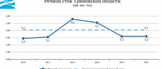
The total number of natural watercourses (rivers and streams) in Mordovia is 1525. This is quite a large number for such a small region. If you look at the physical map of the republic, you can see that its surface is evenly and quite densely “decorated” with thin blue veins. Here is the deep-flowing Alatyr, the measured Sivin, and the unusually winding Moksha...
Rivers in Mordovia are fed mainly by groundwater and rainfall. The low water on them is established in early June and lasts until about mid-October. Freeze usually forms in the first ten days of December. By the end of winter, the thickness of the ice shell on Mordovian rivers can reach 40-60 centimeters, and in particularly harsh winters - up to one meter.
The main rivers of Mordovia are the Sura and Moksha. All other watercourses of the republic belong to their basins. But they all ultimately carry their waters to the majestic Volga. The ten largest rivers of the Republic of Mordovia are listed below:
- Moksha.
- Sura.
- Insar.
- Xivin.
- Issa.
- Alatyr.
- In hell.
- Windray.
- Rudnya.
- Drunk.
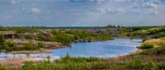
Mordovia can safely be called a lake region. The total water area of the republic’s natural reservoirs is 21,000 hectares, which corresponds to 0.9% of the total area of the region. Most of the lakes in Mordovia are oxbow lakes (oxbow lakes are fragments of old river channels) and are located in river floodplains. The largest of them is Inerka. The name of this reservoir is translated from the Erzyan language as “great lake”.
Next, we will briefly tell you about the largest rivers of Mordovia.
Team Nomads
There are 1,525 rivers in the Republic of Mordovia, their total length is more than 9 thousand km, 86% of them are less than 10 km long. 47% of the total area of the republic belongs to the Sura basin, 53% to the Moksha basin. Of the 12,260 km2 of the Sura drainage area, 7,880 are occupied by the Alatyr basin, 3,860 by the Insar basin. Of the 13,920 km2 area of the Moksha basin, 4,330 are occupied by the Vada basin, 2,200 by the Partsa basin. 24 small rivers and 206 very small rivers and streams flow into Sura, 30 small rivers and 185 very small rivers and streams into Moksha.
The rivers of the Moksha basin flowing through the Oka-Don lowland, in conditions of flat terrain, form wide valleys with well-developed floodplains and above-floodplain terraces. The rivers of the Sura basin (Volga Upland) are characterized by active erosion and deep valleys. In the summer they become shallow to small watercourses, and in the spring they overflow violently. Rivers, especially the Moksha basin, are characterized by a slight fall and relatively slow flow (0.1–0.4 m/s). The width of channels (as well as valleys) increases downstream, but this pattern in some areas is violated by local features (tectonic structures, lithological formations, etc.).
The rivers have a mixed supply: snow predominates - 60-90%, underground - 7-20, the amount of rain summer-autumn flood flow is 5-10%. Water consumption is largely influenced by the catchment area. The highest average annual consumption occurs in Sura, Moksha, and Alatyr. According to the nature of the intra-annual flow distribution, the rivers belong to the Eastern European type, which is characterized by high spring floods, low summer and winter low water periods, and increased flows in the autumn.
The flood begins in late March - early April, reaches its maximum in mid-April, and subsides by mid-May. The rise lasts 10–12, the decline – 20–25 days. In years of early or late spring, the flood phases shift by 1–2 decades. On average over a long-term period, snow runoff is 87–99%, rain runoff is up to 3, underground runoff is 1–10%. In early June, a stable low-water period sets in on most rivers, lasting until early to mid-October. An increase in runoff in the warm season is observed annually, but there are no clearly defined rain floods in some years. At the end of November - beginning of December, winter low water sets in.
The average annual flow module ranges from 3.5 to 5 l/s per 1 km.
The water temperature depends on the time of year and the length of the rivers; it changes under the influence of tributary waters and groundwater discharge. The maximum temperature at the surface in summer is about 20 ºС. Freeze-up usually forms at the end of November - the first half of December and lasts 4-5 months. The thickness of the ice at the end of winter is 40–60 cm, and in cold winters with little snow - up to 1 m. The sediment runoff of rivers is determined mainly by the processes of planar washout. The predominant part of the annual sediment runoff (75–95%) occurs in the spring months, the smallest – in the winter (1–4%). Water turbidity depends on planar erosion in the basin. The average annual turbidity varies from 100 to 500 g/m3 during the spring flood to 25–50 g/m3 during the summer-autumn and winter seasons. According to the chemical composition, river waters belong to the hydrocarbonate class. Their mineralization is on average 200 – 500 mg/dm3. HYDROCHEMICAL CHARACTERISTICS OF SURFACE WATER In terms of mineralization, the surface waters of Mordovia during the spring flood period belong to waters with very low and low mineralization. This is explained by the fact that with the onset of snowmelt, water with low mineralization is formed on the surface of the catchment areas. They are partially filtered into the aeration zone, the remaining part flows into the river network, thereby reducing the mineralization of river waters. The salinity of water during floods ranges from 60–130 mg/dm³. The lowest values are observed during high water floods. During the summer low-water period, when rivers are fed mainly by groundwater, the mineralization of surface waters increases significantly, varying from 350 to 680 mg/dm³. During the winter low water period, when there is no surface nutrition, the mineralization of river water reaches 750 mg/dm³.
RIVER SEDIMENT FLOW The coefficients of variation of solid runoff flow vary from 0.35 to 0.64, the ratio of the asymmetry coefficient to the coefficient of variation is generally 2.0. The intra-annual distribution of sediment runoff for all rivers in the region is characterized by unevenness. The predominant part of the annual sediment flow (95%) occurs in the spring months, increasing to the east of the region. Most spring runoff occurs in April. The average annual turbidity in the rivers of the study area varies from 14 to 1,580 g/m³, the average long-term maximum - from 250 - 500 g/m³ in the western regions to 500 - 1,000 in the center and 1,000 - 2,500 g/m³ in the eastern regions .
RAFTING ON THE TRIBUTARIES OF THE OKA RIVER
For most rivers, a brief geographical description is given - length, position of sources and mouths, the nature of the territory through which it flows; route line and the length of its individual sections; brief tourist description - the nature of the banks and riverbed, main obstacles, excursion sites; transport - routes of entry and exit, intermediate points where you can interrupt or start the route.
basin of the Oka River and tributaries
Moksha, Atmis, Lomovka, Issa, Sivin, Vad, Partsa, Vindrey, Tsna, Chelnovaya, Kersha, Kashma, Bol. Lomovis, Vysha, Oka
Moksha is a large right tributary of the Oka. It originates south of the town of Vyglyadovka, Penza region. on the northwestern slopes of the Kerensko-Chembar Upland. The river is flat and flows through the Penza and Ryazan regions. and Mordovia. It flows into the Oka below the city of Kasimov. Length 656 km. The main tributaries: on the left - Azya, Atmis, Lomovka, Sheldais, Vad, Tsna; on the right - Issa, Sivin, Urkat, Satis, Sarma, Varnava, Ermish. To s. The Mokshan flows through hilly, treeless terrain. Below the left tributary of the Azyasi, the Moksha becomes more full-flowing. In the upper reaches the width of the river is about 5 m. Within the Penza region. the right bank is elevated, the left bank is low and sandy. Below the banks are almost everywhere sloping, rising 3-5 m above the water during low-water periods. The width of the river in the south of Mordovia is up to 30 m, below - up to 85 m, and in the lower reaches - up to 150 m. The channel is winding, there are many oxbow lakes in the floodplain. Moksha is navigable to Kadoma.
Atmis is a left tributary of the Moksha, flows in the Penza region. Starts north of the village. Fedorovka in the center of the region, flows down from the slopes of the Kerensko-Chembarskaya Upland and flows into Moksha below the village. Rajki. Length 114 km. It receives a noticeable tributary of the Kevdu on the left. Other tributaries: Varezhka, Michkas, Nizovka, Virga.
Lomovka is a left tributary of the Moksha. It flows in the Penza region. The source is below the village of Alekseevka, the mouth is at the village. Pryanzerki. Length .83 km. It receives a significant left tributary Nor - Lomovka.
Issa is the right tributary of the Moksha. It originates in the north of the Penza region. south of the village of Anuchino. In the middle and lower reaches it passes through Mordovia, flowing into Moksha when crossing the latter. line Sasovo - Ruzaevka. Length 149 km. The banks are mostly treeless; there are isolated islands of forest mainly on the right bank. The main tributaries: on the left - Insarka, Sentma, on the right - Potizh.
Sivin is the right tributary of the Moksha. Flows through Mordovia. It originates south of the village of Pushkino in the south of the republic. Flows into Moksha opposite the village of Krasnaya Podgora. Length 124 km.
Vad is the left tributary of Moksha. Flows through the northwestern Penza region. and SW Mordovia. The source is south of the village of Markine. The mouth below the village. Kadom in the Ryazan region. Length 222 km. The general direction of the flow is NW, the river is winding, the banks are mostly wooded, there are remains of mill dams. The main tributaries are right: Parna, Yavas.
Partsa is the right tributary of the Vada. It originates in the northwestern part of the Penza region. east of the village of Spishchevo and flows to the northwest along Mordovia. The mouth is below the village of Podlyasovo. Length 117 km. The main tributaries: on the left - Lundan, on the right - Windrey, flowing through Mordovia. Rivers of Mordovia
The Windray is a right tributary of the Parna. It flows on 3 Mordovia. It originates west of the village of Zhukavo and flows to the north-west towards Partsa. The main tributary, Shustruy, flows in from the right. From the village of Windray the river flows through a wooded area. The length of Shustrui is 49 km, the length of the river. Windray 58 km.
Tsna is a large left tributary of the Moksha. Flows through the Tambov and Ryazan regions. It begins southwest of the village of Verkhnetsenye in the south of the Tambov region. and flows to the north past the mountains. Tambov, Morshansk, Sasovo, flowing into Moksha near the village. Mouth. Length 451 km. The banks of the Tsna are mostly meadow, the channel is winding, the speed is low: from 0.4 km/h on the reaches to 1.5 km/h on the rifts, there is a lot of algae and reed thickets. The right bank is sparsely populated, the forest is beyond the meadows, and sometimes comes close to the water. The left bank is almost entirely lined with fields and villages. Six waterworks were built on the Tsna, and therefore the river is navigable. Main tributaries: on the left - Karian, Lipovitsa, Chelnovaya. Sickle, Shacha; on the right - Lesnoy Tambov, Kersha, Kashma, Vysha.
RIVERS OF MORDOVIA
_________ ALATYR RIVER Rivers of Mordovia
Alatyr (Chuvash. Ulatăr, Erz. Rator) is a river in Russia, a left tributary of the Sura River.
It flows through the territory of the Nizhny Novgorod region and the Republic of Mordovia, in the lower reaches - through the territory of the Chuvash Republic. It flows into the Sura near the city of Alatyr. Length 307 km, basin area 11 thousand km²; within Chuvashia length 24.2 km, basin area 187 km²; within Mordovia, the length is 130 km, the basin area is 7880 km². Large tributaries: Rudnya (right), Insar (right). Food mainly comes from snow.
It freezes in November and opens in early April. Splavnaya. There are cities on Alatyr: Alatyr, Ardatov, the urban-type settlement Turgenevo; villages: Syryatino, Baykovo, Puzskaya Sloboda and others. Watercourse Istok Volga Upland • Location of the village of Alatyr (Pervomaisky district of the Nizhny Novgorod region) • Coordinates 54°52′26.76″ s. w. 43°37′55.93″ E. d. (G) (O) (Ya) (T) Mouth of the Sura River • Location of the city of Alatyr (Chuvashia) • Coordinates: 54°52′11″ s. w. 46°35′54″ E. d. (G) (O) (I)
_________ RIVER PYANA Rivers of Mordovia
Piana is a river in the European part of Russia, flowing almost entirely through the territory of the Nizhny Novgorod region and for a short distance through the territory of Mordovia, the left tributary of the Sura.
The length is 436 km, the basin area is 8060 km², the distance from the mouth to the source is about 65 km. Average water flow 25 m³/s. Very winding; in the basin there are karst landforms. Navigable in the lower reaches. The width of the river in the upper reaches is 10-25, in the middle and lower reaches 40-50, sometimes up to 90 m. The depth is no more than 2-3, and in some reaches up to 6-7 m. The flow speed is low, only on the rifts during low water it reaches 3 -4.5 km/h.
The banks of the river are high - up to 5-7 m, sometimes very steep and steep. The left slope of the valley is heavily indented by short, deep ravines. In the upper and middle reaches of the valley there are many karst sinkholes and failures on the slopes and in the floodplain. The floodplain is large, two-sided, open, predominantly meadow.
The channel of the Piana, especially in the lower reaches, is unbranched with a small number of islands and a large amount of algae.
_________ SURA RIVER Rivers of Mordovia
Sura (Chuvash. Săr, mountain mar. Shur, erz. Sura lei) is the right tributary of the Volga, one of the most picturesque rivers of the Volga Upland. It should be assumed that the Kama tribes, having come to Sura, could have found here the ancient Mordovian name - rau (river), the meaning of which they did not know.
Living on the shores of Sur for several hundred years, the newcomers added the native word Shur to the name Rau. The result was a hybrid name Shur + Rau. Then Prisurye again became the patrimony of the ancient Mordovians.
As a result, the hydronym could be pronounced Surau, the final “a” arose under the influence of the Russian word for “river”. It flows through the Ulyanovsk, Nizhny Novgorod and Penza regions, Mordovia, Mari El and Chuvashia. The length of the river is 841 km, the basin area is 67.5 thousand km². It originates on the Volga Upland near the village of Surskie Vershiny (Baryshsky district of the Ulyanovsk region - Height 301 m), and flows along it first to the west, then mainly to the north.
_________ MOKSHA RIVER Rivers of Mordovia
Moksha (Moksh. Moksha or Yov) is a large river in the Penza, Nizhny Novgorod, Ryazan regions and Mordovia, the right tributary of the Oka, flows into the Oka at Pyatnitsky Yar, below the city of Kasimov.
Length - 656 km, basin area - 51 thousand km². In the 1950s, several waterworks with hydroelectric power stations were built in the middle reaches of the river, but without shipping locks. In 1955, 2 km below the mouth of the river. Tsna, on the Moksha River, the Rassypukhinsky hydroelectric complex with a hydroelectric power station and a wooden shipping lock was built. Navigation on the river continued until the mid-1990s. Tributaries: right - Sivin, Satis, Ermish; left - Vad, Tsna. Cities: Temnikov, Krasnoslobodsk. On the river Moksha is the Nativity of the Mother of God Sanaksar Monastery.
ISSA RIVER
Issa is a river in the Penza region and the Republic of Mordovia of Russia, the right tributary of the Moksha (Volga basin). The length of the river is 149 km (of which in the territory of Mordovia - 98 km), the basin area is 2350 km² (in the territory of Mordovia - 1790 km²).
The width of the channel in the lower reaches of the river is up to 50 m, the average depth is 1-1.5 m.
Issa originates from the village of Bereznikovsky, Luninsky district, Penza region. The largest settlements on the river are the city of Insar and the urban-type settlement of Issa.
Issa River near the village. Paevo
Issa River in summer Rivers of Mordovia
The Issa has 3 small tributaries (Seitma, Insarka and Potizh) and 30 very small tributaries. The total length of the Issa river network with all its constant tributaries is 480 km.
Tributaries (km from the mouth] 19 km: Seitma (Selma) River 44 km: Tarsa River 68 km: Shishkov Stream 71 km: Paska Stream 78 km: Insarka River 85 km: Vyazera Stream 90.7 km: Bolshoy Stream 91 km: River Stsevka 98 km: Potizh River (Prorva, Potish, Portizh) 105 km: Shishov River 114 km: Sukhoi Shirokois River 128 km: Kostylyayka River.
INSAR RIVER
Insar (erz. Inesaro) is a river in Russia, the right tributary of the Alatyr River , the largest tributary of this river. It flows through the territory of Mordovia. Length - 168 km, basin area - 3860 km². The food is predominantly snowy. Spring flood with maximum in April; low water in summer. The average flow rate in Saransk is 7.71 m³/sec. It freezes in November and opens in April. The cities of Ruzaevka and Saransk are located on Insar. The city of Insar is not located on the Insar River.
the city of Saransk on the Insar River
pond near the village of Aleksandrovka - at the source of the Insar River
Insar begins near the village of Aleksandrovka, Insar district of Mordovia. Further it flows through the territories of the Ruzaevsky district, the city of Saransk, Lyambirsky, Romodanovsky and Ichalkovsky districts of Mordovia. From the source it flows in a general northeast-east direction, flows through the village of Boldovo (on both banks), then receives the left tributary Muromka. Further along the left bank is the village of Nizhnyaya Muravyovka, then a tributary of the Kartli and the village of Makarovka (Ruzaevsky district), along the right bank - the village of Insar-Akshino, the villages of Stary Usad, Trusklyai and Krasnoe Seltso. In Ruzaevka, the large left tributary Pishlya and the right tributary Shebdas flow into the Insar, then the river turns to the northeast. Below Ruzaevka along the river to the mouth and further there is a railway line Ruzaevka - Saransk - Krasny Uzel - Alatyr - Kanash. The road passes from one bank of the river to the other: left between Ruzaevka and Saransk, right from Saransk to Romodanovo, then left again from Romodanovo to the mouth of Insar.
Below Ruzaevka, on the left bank of the Insar, there are the villages of Krasny Klin, Nadezhdinka and Novye Polyanka, on the right - Zykovo and the village of Monastyrskoye. Near Monastyrskoe, the Insar receives the right tributary Karnai and the left tributary Levzha. Further along the left bank of the river are the urban-type settlements of Yalga and Nikolaevka, and on the right - the village of Pushkino. Insar flows through Saransk, dividing the center (left bank) and the Posop and Zarechny microdistricts. In Saransk, the Saranka River flows into the Insar on the left, and the Tavla on the right.
RIVER VYSHA
Vysha (Noksa) is a river in the Penza region, Mordovia and Ryazan region of Russia, the right tributary of the Tsna (Volga basin). Pool of Moksha. Length - 179 km, basin area - 4570 km². Powered by snow and rain.
Freeze-up usually occurs from November to April.
The sources of the river are in the Penza region.
Flows through the regional center of Zemetchino. The administrative border of the Penza region with Mordovia runs along the river for 15 km, on the territory of which the village of Vysha is located (3 km from the river). It flows into the Tsna on the territory of the Ryazan region. At the confluence is the village of Vysha, Shatsk district, Ryazan region, famous for the Holy Dormition Vyshinsky Monastery. Rivers of Mordovia
Tributaries (from the mouth): right - Izvest (3.5 km), Purlya (24 km), Shuvarka (53 km), Ushinka (147 km); left - Kermis (23 km), Pochkar (72 km), Torcha (84 km), Sych (87 km), Raevka (94 km), Mashnya (107 km), Noksa (147 km); further r. Noksa Burtas (148 km), Olshanka (155 km).
RIVER VAD
Vad (Big Vad) is a middle river in the Penza region, Mordovia and Ryazan region, a left tributary of the Moksha River (Oka basin). The length of the river is 222 km, the basin area is 6500 km². A winding, mostly forest (although there are also meadow areas) river. The average annual water flow in the upper reaches (near Avdalovo) is 7.5 m³/sec. It originates in the forests of the Penza region, 17 km southeast of Vadinsk, near the villages of Kopovka and Krasnaya Polyana, Vadinsky district.
upper reaches of the VAD river
A 700-meter dam was installed in the southeastern part of Vadinsk. The volume of the reservoir formed by this dam is 21 million m³ of water. It flows in the Penza region through the settlements of Kopovka, Vadinsk, Bolshaya Luka, Sergo-Polivanovo, Lugovoe.
It flows through Mordovia in a swampy plain, surrounded by forests. Below the village of Shiringushi it receives the left tributaries Udyov, Marchas, Pichkiras and the right tributaries Partsa and Yavas. The last 15 km flows through the territory of the Ryazan region, flowing into Moksha near the urban-type settlement of Kadom. Rivers of Mordovia
Tributaries (km from the mouth] 22 km: Shvara stream 27 km: Tast river 39 km: Yavas river 46 km: Yuzga stream 55 km: Partsa river 73 km: Sankelyan stream 78 km: Pichkiras river 83 km: Vadaksh river 86 km: river Zhuravka 93 km: Vyachka River 109 km: Lyastma River 114 km: Marchas River 126 km: Udev River 144 km: Kita River 157 km: Latos River 173 km: unnamed river, near the village of Tenevo 174 km: unnamed river, near Tenevo village 185 km: Karenka river (Kerenka, Dalnyaya) 186 km: Tyuryev stream 204 km: Kotel river
SMALL RIVERS OF MORDOVIA The Sivin River Sivin is the main river of our area. The life of every person living in the village is connected with it by invisible threads. And the name of the village itself comes from the river of the same name.
The Sivin River originates in the Insarsky region of the Republic of Mordovia. It quietly and calmly carries its waters for many kilometers. In winter it is encased in ice. And during the spring flood, it gains strength, overflows its banks and rushes uncontrollably, showing a violent temper. Numerous tributaries help it free itself from the icy oppression: Ozhga, Vizlyayka, Gruznoleyka, Lisina, Avgurka, Skal, Vikhlyayka, Serebryanka, Kivchey and others. You won’t recognize a peaceful, quiet river in a stormy spring stream. She gets into an argument with everyone and floods Naberezhnaya Street. At this time, you cannot walk or drive along it. But spring passes, and the river returns to its channel.
Along the banks of the river there is a riot of flora. Either it meanders through the forest among the giant trees, then it carries its waters in the middle of the meadows. And how many medicinal herbs are there! Products are in short supply, but in essence, come in and get them! Here is tansy, and here is a series. How many healing tinctures are made from them? And here are the hops. It improves digestion, heals gastritis, treats kidney inflammation, neuralgia, and radiculitis. There is also a sedative - valerian, medicinal bird cherry, alder. Rose hips also thrive in damp places – they are both beautiful and useful. And the banks are also rich in viburnum. How many healthy delicacies are prepared from it in folk cuisine! Fragrant strawberries grow on the elevated banks, and blackberries spread along the water. There are many willow thickets along the banks of the Sivini. It is known to be a honey plant, a source of tannins, and animal feed. Willows do not require any maintenance. They quickly restore their reserves. Algae grows in the Xiwin River. Here we will meet both the yellow water lily and the beautiful white water lily. Rivers of Mordovia
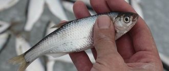
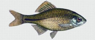
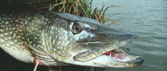
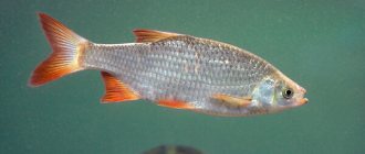
There are a lot of fish in the river: ruff, burbot, pike, rudd, perch, roach, gudgeon and others. There are a lot of shells at the bottom. Among the algae we see many frogs and waterfowl. There are also crayfish in the river. But this indicates that the water in it is quite clean. Muskrats, beavers, and minks live along the banks. There are many nests of swallows - shorebirds and waterfowl.
The water of the Sivin River is used very actively. On the banks of the river there is a Republican recreation area. Many factories in Saransk and Ruzaevka have their own children's health camps here. It is a pity that the Solnechny camp from the Ministry of Agriculture, which specialized in vision diseases, was liquidated. There are natural baths on the river. There is also healing blue clay.
Water is also used for watering wild and domestic animals, for watering gardens, and for fishing. A large supply of drinking water has been discovered in the Sivini area. It is planned to build a water intake from the Sivin River to the city of Saransk. Village residents hope that this will not affect the water level in the wells.
At the bottom of the river lies a ridge of limestone. In the 70s, development of this stone for construction was carried out.
The river is also rich in its history. Along the river, the remains of mammoths and stone tools were found, which are in the school local history museum and indicate the sites of an ancient man, whose life is inextricably linked with the river.
It was once navigable. Barges with products from the Sivinsky Iron Foundry pulled along it and ore was delivered for smelting these products. And the plant’s mechanisms themselves were driven by a water wheel. The mill also ran on water. A dam was built. The existence of this dam, which was built in the 19th century, is reminiscent of the huge embankments and oxbow river. Some of the embankments were used in the construction of the modern bridge in 1989. Black bog oak was extracted from the river, which was the most valuable raw material for making furniture. From the village of Sivin, the river moves further and flows into the Moksha River. The confluence of rivers occurs in the meadows of the Staro-Goryashinsky branch of the Alliance cooperative in the Krasnoslobodsky district of the Republic of Mordovia.
Augura River
One of the left tributaries of the Sivin River is the Augura River. It flows from the northwest, emerging from forest springs. It flows through the Staro-Augur pond and carries its waters through the meadows. The current in the river is fast. The Augura has no tributaries. It is born from forest springs and is fed by melt and rain water. There is little water in the river, but it is very clean. Along the banks of the river there are bushes, alder, bird cherry, and blackberry thickets. In the floodplain of the river there are many grasses that animals feed on. The river is home to fish such as perch, pike, and roach. Muskrats build their huts along the banks. There are a lot of insects and frogs in the river. In spring, wild ducks fly to the river and nest. A man fishes in it and hunts ducks. In the village of Starye Avgury, a fish farm has been established on the river, where carp, silver carp, and grass carp are bred. The fish is sold both in the Krasnoslobodsky district and beyond. People choose vines from willow thickets to weave baskets. People keep the river clean. Along the river, people do not plow the soil or cut down trees. At the outlet of the water intake of the Staro-Augur fishery, a primitive treatment facility was installed. It is low-power, technically outdated and only natural filters: sand and small pebbles help the river remain crystal clear when it flows into the Sivin River. Rivers of Mordovia
The Gruznoleyka River The Gruznoleyka River originates in the deepest ravine in the northeast of the village of Sivin from many forest icy springs that flow into it from the border with the Nizhny Novgorod region. The ravine along the bottom of which the river flows is so deep that the water in it does not freeze even in winter. The current at Gruznoleyka is slow. It has no tributaries. The gruznoleyka flows through the village from Nagornaya Street to Naberezhnaya Street and overflows widely in a place called Buchilo, after which it flows into the Sivin River. The river is interesting because in summer the water is cold. It does not warm up in a forest ravine. But in winter it often overflows, and even in severe frost, forming a layer that reaches up to two meters thick. In the spring, the river changes its course and floods the vegetable gardens of Nizhnyaya Bazarnaya Street and the lower part of Kooperativnaya Street. Shrubs grow along the banks of the river. Many medicinal herbs: mother and stepmother, succession. Since the water is very cold, there are few living organisms in it.
To prevent water from eroding the banks, people plant trees. They say that the most delicious tea comes from water taken in Gruznoleyka. This is why we should protect the river like the apple of our eye, but... You can often see people throwing garbage and household waste into it. Schoolchildren take care of the river. Clean-up days are carried out to clean the banks of debris. The geography teacher and his students planted trees along the river. The riverbed was deepened so that during a flood the river would not carry away fertile soil from the gardens. From the history of the village we know that at the beginning of the 20th century the river was blocked by a dam. A water mill was built on the river, which is only remembered today by a small pond on Sadovaya Street.
Vizlyaika River One of the right tributaries of the Sivin River is the low-water Vizlyaika River. It flows from ravines that stretch on the north-eastern side of the extinct village of Krasnaya Zarya and flows near the village of Sredneye Pole. There is little water in the river, but it amazes with its crystal purity. Born from the purest forest springs, it carries its waters through forest ravines, along which there are no settlements, all the way to the village of Sredneye Pole. After a kilometer it merges with Sivinho. Vizlyaika has no tributaries.
Thickets of viburnum and willow stretch along the river. Muskrats live on the banks of the river and waterfowl live there. There are no fish in the river. Vizlaika is used to collect water for agricultural needs. Even in winter, people cut ice holes and take water for drinking, washing and watering livestock.
In the spring, the river is blocked with a dam to fill the meadows for hayfields, and in the summer the dam is removed. And even though man has interfered in the life of this small river, he takes care of it. Vegetation along the banks is not cut down, water from sewers does not enter it, and the fields next to it are not plowed up. And the river pays people for their care with the purest spring water.
The Lisina River The Lisina River is a right tributary of the Sivin River, carrying its waters from the northeast side. Its current is slow, there are no tributaries. Willow and alder grow along its banks. In summer, the river is decorated with blooming rosehips, in autumn - with scarlet bunches of viburnum, in spring - with blooming bird cherry. Many herbs grow in the floodplain of this river. There are tansy, whitecap, and sedge, and closer to the water there are reeds and cattails.
Trees and shrubs save the river from drying out in the summer. There are no fish in the river, but there are many frogs, snakes and, of course, insects. The water amazes with its coolness and purity. There is always a ladle hanging near the small bridge that is crossed to get to the village of Sredne Pole, so that a tired traveler can enjoy delicious water. Hayfields stretch along the river, where people cut a lot of fragrant hay. Since the liquidation of the Sivinsky state farm, the fields along the river have not been plowed, and natural grasses now grow on them: timothy, alfalfa, mouse peas and others. There are no settlements along the river, maybe this saves it from pollution. The Lisina River may be small, but it is undoubtedly important, because it is a source of environmentally friendly water.
Serebryanka River The source of the Serebryanka River is located in forest ravines, near the extinct village of Semenovsky, and flows towards the village of Sivin. A river is born from forest springs. It is small and its flow is slow. There are no tributaries. Only meltwater and springs give it their water. Near a place called Klimna, Serebryanka flows into the Sivin River. Sedge and other plants grow along the river. Beavers build their dams on it, and muskrats, frogs and various insects live on it. Fish comes only when the Sivin River is flooded. People use this river to irrigate hayfields and to water cattle. At its confluence with the Sivin River, the water is very cold, since Serebryanka flows through the forest and is not warmed up by the sun. An interesting phenomenon is observed at the confluence of Serebryanka and Sivini. The water on the right bank is very cold, but as soon as you swim two or three meters away, you already find yourself in the arms of warm water. During the formation of the Sivinsky state farm, the wetlands along the river were drained in order to provide additional hay. Sewage ditches were dug, as a result of which the river was divided into several branches. This place is now called Maps.
The river flows through a deep ravine, which has many branches. It is very easy to get lost in those ravines, and only the direction of the river flow tells the traveler the way home. The river requires a lot of attention, as people cut down forests along Serebryanka, which leads to erosion of the banks of ravines and shallowing of the purest spring water in the river. The attention of forestry workers must be drawn to this.
PARZA RIVER Partsa is the right tributary of the Vada. The length is 117 km (in Mordovia 92 km), the basin area is 2,700 km2 (in the territory of the republic 2,200 km2). Originates from the village. Abashevo in the Penza region. The density of the river network is 0.33 km/km2, the channel width is up to 15 m, the depth is up to 1.5 m. The average long-term flow module is 3.42 l/s per 1 km2. The regional center of Zubova Polyana is located on the river.
_____________________________________________________________________________________
SOURCE OF INFORMATION AND PHOTO: Team Nomads https://geo13.ru/atlas/nature/7 Website of the Administration of Mordovia https://kopilkaurokov.ru/geografiya/uroki/156038 Textbook of geography of the Russian Federation. https://www.microarticles.ru/article/reki-mordovii.html
Sura
The Sura flows along the southeastern outskirts of the republic, playing the role of its natural border with the neighboring Ulyanovsk region. This is the third largest tributary of the Volga and the second longest river in Mordovia (120 km within the region).
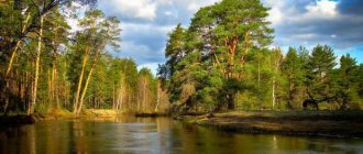
The Sura is a typical lowland river, one of the most picturesque on the Volga Upland. The watercourse is characterized by moderate sinuosity, a sandy and pebble bottom, and an abundance of shallows and spits. The right bank of the river is, as a rule, steep and steep, with outcrops in the form of chalk or limestone rocks. The left bank is lower and flatter. Sandy beaches alternate with thickets of willow and bushes.
The bed of the Sura within Mordovia is ideal for simple tourist kayaking. There are several children's camps and recreation centers on the banks of the river. There are many lakes in the Sura floodplain, including the above-mentioned Inerka.
Parks, tracts and reserves of the Republic
A special place in the list of Mordovian natural attractions is occupied by botanical and geological natural monuments.
Simkinsky Natural Park
- Address: Bolshebereznikovsky district, Simkinskoye forestry on the left bank of the river. Sura.
A rich natural park with an area of about 1000 hectares is located in the valley of the Sura River. The park was founded in 2001 on the basis of the landscape reserve of the same name. The nature of the protected area is diverse: wonderful forests, flowering meadows, marshy swamps, picturesque clean lakes.
There are several dozen species of animals and more than 1000 species of plants in the forests. One of the plots is home to 11 species of orchids. There are funny wooden sculptures dotted around the park. The park's specialists are engaged in science and environmental education; the biological station of the Mordovian University operates on its base.
Sanctuary of medicinal plants
- Coordinates: 54.388954, 43.811245.
The botanical reserve in the Kovylkinsky district began operating in 1979. Here, on an area of pine forest of 200 hectares, wild plants are found in abundance, which are used to prepare medicines. One of the most common plants in the reserve is St. John's wort.
Scientists are periodically prohibited from collecting and procuring medicinal raw materials in order to give the local flora time to recover. Strict rules apply on the territory of the reserve; cutting down, plowing and collecting herbs is prohibited, but ecotourists are allowed to walk and relax around the attraction.
Tract "White Lakes"
- Coordinates: 54.300353, 42.804292.
In the Zubovo-Polyansky district, a priceless island of relict nature has been preserved. The White Lakes tract is a truly unique place: within a radius of 10 kilometers there is not a single populated area, so the virgin corner almost does not suffer from human intervention.
The territory of the natural monument is home to rare fauna and endangered species of mammals, birds, reptiles and insects, including endemics.
The relict area is home to muskrat, gray crane, gray heron, otter, bittern, and many others. Tourists should be careful, as there are vipers in the grass. The tract is considered a model of self-healing nature.
Arboretum of the pedagogical college
- Coordinates: 54.099684, 42.760303.
One of the few Mordovian arboretums was established in the village of Zubova Polyana around the local pedagogical college. Biological teachers and their students planted rare plants. The first trees were planted in the 70s; seeds for the arboretum were sent from different parts of the world: the Far East, North America, and European countries.
After 20 years, there were already about 110 species of trees and shrubs in the park. Unfortunately, in the early 90s, part of the plantings was cut down for construction, but the college staff managed to preserve the surviving section of the arboretum and achieve the status of a natural monument for it.
Landslide "Koshel-mountain"
- Coordinates: 54.053631, 42.677637.
The curious tract is located in the Zubovo-Polyansky district on the banks of the Vad River. Contrary to the name, this is not a mountain, but a ravine, which in its outline resembles an old bag-purse, that is, a wallet. Numerous springs at the bottom of the ravine eroded the slope, caused a landslide and exposed geological layers.
The tract is always humid, so all the boulders and trees are overgrown with moss. In summer, the ravine is cool and beautiful: a stream gurgles below, horsetail and ferns grow green next to the water, and the aroma of coniferous trees wafts in the warm air.
Limestone slope
- Coordinates: 54.157877, 45.641037.
There are relatively few truly high hills on the territory of Mordovia. The most noticeable hill is the limestone hills on the left bank of the Pixaur River. You can find a delightful snow-white slope between the villages of Gart and Degilyovka.
The chalk deposits are especially impressive in spring and summer in sunny weather, when lush green grass emerges at the top and bottom of the hills. The white slope is of interest not only to lovers of spectacular photographs, but also to botanists: very rare plants, listed in the Red Book of Russia, grow on the hills.
Tract Od Moda
- Coordinates: 54.461944, 46.458889.
A small tract in the Dubyonsky district has an interesting, eventful history. Until 1917, this wonderful piece of land between the Cheberchinka and Shtyrma rivers belonged to a convent. After the Revolution, the monastery was deprived of all its possessions, the territory was nationalized and given to a newly created collective farm. The tract was given the name “Od Moda”, which translated into Russian means “New Earth”.
Collective farmers plowed the land and sowed grain. In 1979, for the abundance of valuable plants, the area was recognized as a botanical natural monument. In recent years, the area has ceased to be used for crops, and the fields are overgrown with weeds. Now the tract delights ecotourists with picturesque oak forests, green meadows and fragrant herbs.
Moksha
Moksha is the largest river in Mordovia. Within the region, its length is 320 km, which is equal to half the total length of this watercourse. Moksha begins in the Penza region. In Mordovia, it receives a number of large tributaries - Issa, Sivin, Urey, Satis and others. The mouth of Moksha is also located outside of Mordovia. The river flows into the Oka already in the Ryazan region.
Moksha is a flat river with a calm flow. Its bed forms many meanders and oxbow lakes. The left bank of the river is steep almost throughout its entire length, while the right bank is flat, which is not typical for watercourses in the Northern Hemisphere. The width of Moksha varies from 5 meters in the upper reaches to a record 85 meters near the city of Krasnoslobodsk.
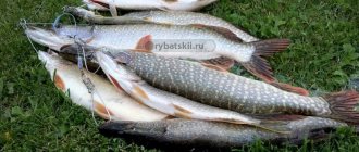
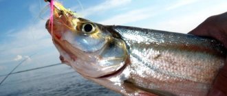
Fishing on Moksha Mordovia
The Moksha River - loves the skillful and lucky a little Moksha differs from the Sura in its more serious depths (the average is 7-8 meters). There are an abundance of sand spits and deep pools, riffles and shallow reaches.
Those who come here are by no means new to the art of fishing, and the river often rewards their experience. It is from the banks of the Sura that photos with enviable specimens of catfish, pike perch and bream constantly appear on the Internet.
The best places on Moksha are:
- The banks around the city of Temnikov. Here the river makes a sharp turn literally 90 degrees and here, a few kilometers from the city limits, Moksha splits into five branches, and this is an ideal environment for the accumulation of fish;
- The banks of the Moksha near the villages of Kabanovo - Mordovian Poshaty are never empty of fishermen, as well as at the confluence of the Moksha and Issa. These are famous places for pike hunting lovers.
Article on the topic: Fishing with a donk with heavy sinkers
Alatyr
Alatyr is the largest tributary of the Sura. The middle and lower reaches of the river are located within the borders of Mordovia. The length of this watercourse within the republic is 130 kilometers.
Alatyr stands out in the relief as a fairly wide floodplain. So, near the village of Kemlya its width reaches five kilometers. In spring, almost all of this space is periodically flooded with water. At the same time, the width of the Alatyr channel itself does not exceed 80 meters. Both banks of the river are steep and steep; there are many lakes and swamps in the valley.
Note to fishermen
Rain and accompanying mud flows make river water cloudy, which significantly reduces the bite. And post-rain clearing is a sure harbinger of the activity of the inhabitants of local reservoirs.
A characteristic feature of Mordovian reservoirs is crystal clear water at relatively shallow depths, and therefore trophy catfish are an exceptional rarity here.
Numerous shallows, coupled with the moderate and slow flow of the local rivers, are ideal conditions for fishing around the clock and all year round. The coastline of the reservoirs is rich in vegetation and picturesque landscapes, which makes it possible to combine fishing with a family vacation.
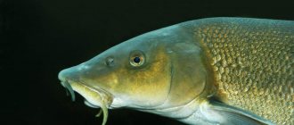
Article on the topic: What are the characteristics of carp, what are its habits?
Insar
This is the largest inland river of Mordovia. The Insar originates in the vicinity of the village of Aleksandrovka, and then flows through the central part of the republic. The watercourse is characterized by snow feeding. Insar freezes in November and opens in early April.
A number of cities, towns and villages are strung on this river like beads, including the capital of the region, Saransk. By the way, it was on the banks of the Insar that the Mordovia Arena was built, a football stadium that hosted four matches of the 2021 FIFA World Cup. It is curious that the city of Insar is not located on the watercourse of the same name, but on the Issa River.
When to fish in Mordovia
The nature of the reservoirs of Mordovia and the species composition of fish guarantees successful fishing without vacations. However, in order to preserve the fish resources of its reservoirs, the Government of Mordovia annually introduces restrictions for fishermen from April 15 to June 15.
Article on the topic: Choosing a place to catch carp in the spring
This is primarily due to the spawning season. Restrictions apply to both certain places and fishing gear. During these two months, fishing enthusiasts are allowed to fish with only two gears (rods or spinning rods) with a maximum number of hooks - a pair on each.
At the same time, during the spawning season there is a ban on catching certain types of fish with a minimum size. For information on species and sizes during spawning, see table:
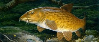
- Carp 40 cm.
- Pike perch 40 cm.
- Bream 25 cm.
- Pike 32 cm.
- Freshwater catfish 90 cm.
- Carp 40 cm.
Ideally, banned prey should be released into the wild with minimal damage. The rest of the time, no one is forbidden to try their luck. So, with the onset of the first frosts, the time for local pike to become active comes.
All winter, without adjusting for temperature, you can become the owner of a collection of pike perch, bersh and perch. With the arrival of spring, the bream awakens. It was after the ice melted on the rivers of Mordovia that there was an influx of fishermen from neighboring regions, obsessed with the desire to test themselves in the dexterity and skill of catching Sur and Mokshen bream.
Drunk
Another large tributary of the Sura captures a small piece of Mordovian land - this is the Piana River. It flows through the territory of the Bolsheignatovsky district for only 28 kilometers. The width of the Piana riverbed in Mordovia does not exceed 5-7 meters. Within the region, its appearance varies from “rivulet-type” sections to wider areas dammed by village bridges.
The etymology of the river's name is curious. There are several hypotheses about this. The most common and most obvious version connects the hydronym with the bizarre and unusual tortuosity of the watercourse itself. Here is how the Russian writer and publicist Melnikov-Pechersky wrote about this river:
Even the first Russian inhabitants called the Drunken River because it staggers, it sways in all directions, like a drunken woman, and, having traveled about five hundred miles with twists and turns, it runs up to its source and almost pours out into the Sura near it.
Xivin
Sivin is the right tributary of the Moksha, 124 kilometers long. The river flows from a swamp near the village of Pushkino. This, by the way, is the largest river in Mordovia, the basin of which is entirely located within the republic.
The river has a mixed supply; Sivin provides its water content both from rain and melted snow waters. During the summer low water period, it also feeds on underground springs. The width of the channel reaches 30 meters in the lower reaches. The river is quite deep (up to 3 meters). The bottom is mostly sandy, sometimes rocky (in particular, near the village of the same name Sivin). Within Mordovia, the river receives 12 tributaries. The largest among them are Ozhga, Avgura and Shishkeevka.
In hell
The Vad is another large tributary of the Moksha, the source and mouth of which are located outside of Mordovia. The river begins in the Penza region and flows into Moksha already on the territory of the Ryazan region. The total length of the watercourse is 222 km, within the borders of the republic – 114 km. In Mordovia, Vad receives the waters of several tributaries. The largest among them are Partsa and Yavas.
The river's nutrition is mixed, with a predominance of snow. The depth of the channel varies from one meter to 20-30 centimeters at the riffles. In Mordovia, the Vad flows mainly through wooded and marshy areas.