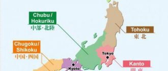
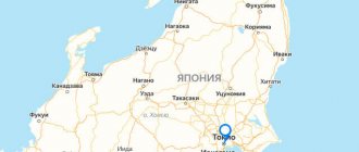
Metropolises and prefectures of the Kansai region
The Kansai region is the western part of Japan. Literally, the name of the prefecture is translated as “region under the capital.” The total area of the region is about 28 square meters. km., the population in 2010 was about 20.5 thousand people.
The region includes seven prefectures:
- Wakayama;
- Nara;
- Mie;
- Whitefish;
- Kyoto;
- Hyogo;
- Osaka.
Mie metropolis
It is difficult to imagine the megacities on the island of Honshu without one of the largest areas - Mie. It is located in the southern part of the island. The district extends over 5770 square meters. km, the population in 2015 was about 1.8 million people. The administrative center is officially considered the city of Tsu. The region acquired its final name in 1872, at which time the city of Tsu became the official capital.
Most of the landscape is mountainous, with settlements mainly located on the coast. The structure of Mie is 14 cities and 15 villages.
Whitefish
The area of Shiga Prefecture is about 4000 sq. km, the total population is 1.4 million people as of 2015. The capital and administrative center is the city of Otsu. The structure of the district is 6 villages and 13 urban areas.
Among the attractions of the prefecture, Lake Biwa can be highlighted. This lake is recognized as the largest and deepest in Japan. The area of the lake is one-seventh of the total area of Shiga. The northern shore of the lake, due to its clean water and white sand beaches, is more suitable for recreation; the tourism theme is actively developing there.
On the lake coast lies the picturesque town of the same name, Biwa. Since the beginning of the 19th century, an ancient theater of facial expressions and puppets - bunraka - has been operating in Biva. The pond and theater are favorite places for tourists. The prefecture is also famous for the Hikon Castle, which is rightfully considered a national pearl, preserved from early feudal times.
Kyoto
Kyoto Prefecture is located in the center of the island of Honshu and is one of the largest metropolitan areas. The area of the district is 4600 sq. km, the population (as of October 2021) is 2.6 million people, with an average population density of about 564 people per square kilometer. The heart and economic center of the region is the city of Kyoto.
The geographical feature of the prefecture is that it is divided in half by the Tamba mountain range, which significantly affects the climate of the northern and southern parts of the district.
Megacities on the island of Honshu, including the city of Kyoto.
The prefecture consists of 10 towns, 1 village and 15 cities. The flower of the prefecture is the weeping cherry, the bird is the petrel, and the tree is the cryptomeria. The district's sister regions are the Leningrad region, Quebec, Oklahoma, and Occitania (France).
Hyogo
Megacities on the island of Honshu in Hyogo Prefecture (Hyogo) rank second in size. Hyogo County is also located in the center of the region. The district is quite large in terms of territory - 8.4 thousand sq. km., with a population of 5.5 million people as of 2014. The population density exceeds 660 people per square kilometer. The city of Kobe serves as the capital of the prefecture.
At one time, the south of the prefecture was seriously damaged due to the large-scale Hanshin earthquake. The disaster almost completely destroyed the capital of Kobe, the cities of Takarazuka and Awaji, and also partially affected neighboring Osaka. The natural phenomenon claimed the lives of more than 5,000 residents.
Hyogo County includes 12 towns and 29 cities. Among the attractions of the prefecture, Himeji Castle should be highlighted. This building, dating back to the early feudal era, is a UNESCO site and is under its protection. The district is also famous for the historical area of Aka-Khan - the birthplace of 47 ronins.
The flower symbol is the Japanese chrysanthemum, the tree is the camphor tree, the bird is the stork.
Osaka
Osaka County is located in the southwestern part of the island. The center of the region, which is also the largest city, is Osaka. The area of the district is almost 1900 square meters. km., population - 8.9 million people as of August 2014, population density for the same period - 4.7 thousand people per square kilometer, which also makes the area one of the densely populated places on the island of Honshu.
The structure of the district includes 9 towns, one village and 33 cities. The emblem consists of a stylized "O" symbol and several circles around it, which is a symbol of harmony, prosperity and eternal hope. The symbol is located on a blue background. The flower of the district is the primrose and Japanese plum, the tree is gingko, the bird is the Japanese shrike.
Nara
Nara County is located in the center of the island. The settlement of the same name Nara is the main administrative unit of the region. In the past, Yamato Province was located on the site of the prefecture.
Nara County is landlocked and surrounded by Wakayama Prefecture as neighbors. Kyoto, Mie and Osaka. The structure of Nara consists of 15 towns, 12 cities and 12 villages. The area of the district is 3690 sq. km., population in 2014 – 1.38 million people.
The prefecture is famous for its numerous historical monuments included in the UNESCO list. These include the Buddha monuments located in Horyu-ji. The symbols of the prefecture are a multi-meter statue of Buddha and mountain sakura.
Buddhist temples and Shinto shrines are other attractions of the district.
The official flower symbol is the cherry, the tree is cryptomeria, and the bird is the Japanese Robin.
Wakayama
Wakayama County occupies the southern part of the island. The central population center is Wakayama. The area of the district is 4725 sq. km., population – 0.98 million people. Wakayama is adjacent to the districts of Osaka, Nara, and Mie.
Most of the region's territory is crossed by mountains, most of the cities are located on the coast of the Inland Sea of Japan. Of all the metropolitan areas on the island of Honshu, Wakayama County is the least populated. The district consists of 20 towns, 6 counties and 11 cities.
The prefecture boasts one of the first Buddha temples in Japan. This shrine is a place of constant pilgrimage for Shinto adherents. Also in the south of Wakayama you can visit the Kumano Shrine.
Don't miss the most popular article in the category: Barnaul. Attractions where it is located on the map of Russia.
Administrative regions and prefectures[edit]
The island is divided into five nominal regions and consists of 34 prefectures, including the capital Tokyo. Administratively, these prefectures include some smaller islands, notably Ogasawara Islands, Sado Island, Izu Oshima and Awaji Island.
Regions and its prefectures:
- The Tohoku region
consists of six prefectures. Akita Prefecture - Aomori Prefecture
- Fukushima Prefecture
- Iwate Prefecture
- Miyagi Prefecture
- Yamagata Prefecture
consists of seven prefectures, including the capital of Japan, Tokyo.
- Chiba Prefecture
consists of nine prefectures.
- Aichi Prefecture
consists of seven prefectures.
- Hyogo Prefecture
consists of five prefectures.
- Hiroshima Prefecture
Metropolises and prefectures of the Kanto region
Megacities on the island of Honshu are mostly represented by the Kanto region. After all, it is the Kanto region that is considered the most developed in urban terms. The capital of the Japanese state, Tokyo, is located in this area. The government of the country and the imperial residence are also located there.
The region includes 7 districts:
- Ibaraki.
- Tochigi.
- Gumma.
- Saitama.
- Chiba.
- Tokyo.
- Kanagawa.
Ibaraki
The southeast of Honshu Island is represented by Ibaraki District. The total area of the region is 11,640 square meters. km., population as of August 2014 – 1.04 million people. The settlement of Mito is the main administrative unit of the district. The district consists of 10 towns, two villages, 7 counties and 30 large cities.
The officially chosen and recognized symbols of Ibaraki are the rose, the tree - the Japanese plum, the bird - the lark, and the fish - halibut.
Tochigi
Tochigi Prefecture is also located in the southeastern part of Honshu, just above Ibaraki District. The area of Tochigi is about 6400 square meters. km., the total population as of 2014 is 1.9 million people. The center of Tochigi District is the town of Utsunomiya.
The structure of the district is 11 villages and 14 cities. The symbols of the district are rhododendron, horse chestnut, blue flycatcher and Japanese serow.
Gumma
Gunma County occupies the center of the Kanto region. The area of Gumma is 6340 sq. km., population as of July 2014 – more than 2 million people. The county seat is Maebashi. One of the largest settlements in the district is the city of Takasaki.
The prefecture includes 15 towns, 8 villages, 7 counties and 12 cities. This district is one of the few that do not have access to water. The territory of the district has both mountainous and flat areas.
Gumma is often called the “crane region”, because the outlines of the district resemble a flying crane in its shape.
The symbols of the prefecture are pine, rhododendron, pheasant and ayu fish.
Saitama
Saitama County is located in the southeast of Honshu. Its area is almost 4000 sq. km., population – 7.2 million people. Saitama City is the central administrative unit. The structure of the region consists of 22 towns, 1 village, 8 counties and 40 cities.
At the same time, the average population density is about 1900 people per square kilometer. The official symbols of the prefecture are the primrose, the serrated zelkova, the turtledove and the stickleback fish.
Chiba
Chiba Prefecture is a multimillion-dollar region. Its area is more than 5000 sq. km., population is 6.2 million people, population density is 1200 people per square kilometer. The city of the same name, Chiba, is the center of the prefecture.
The district has full access to water on both sides - the Pacific Ocean and Tokyo Bay.
The district consists of 1 village, 16 towns, 6 counties and 37 cities. The close location to Tokyo gave impetus to the development of industrial sectors. Chiba is ahead of many prefectures in the field of agriculture, namely in growing vegetables. The Boso Peninsula is famous for its actively developing rice growing industry.
On the ocean and bay coasts, seaweed is collected in large quantities. The officially recognized symbols of the district are the turnip flower, large-leafed footcarp, red-eared bunting and red tie.
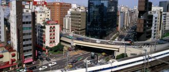
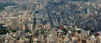
Tokyo
Megacities on the island of Honshu are rightfully headed by Tokyo. The literal translation of the name “Tokyo” is “Eastern City”. Tokyo is the permanent capital of Japan, its political, financial and industrial core. The city occupies the southeast of the island of Honshu, in the heart of Tokyo Bay.
The metropolis in 2021 is one of the most densely populated: with an area of 2200 sq. km., population is almost 18 million people. The peculiarity of the structure of the prefecture is that it consists of 23 self-governing municipalities. In addition to them, the structure also includes 26 large cities, 4 districts, 1 county, 5 towns and 8 villages.
Tokyo is the center of the economy and trade of the Japanese island. Mechanical engineering, instrument making, intellectual and creative fields of activity are considered widely developed.
Since its founding, Tokyo has been the political and cultural foundation of the country. One of the main historical monuments is Edo Castle - the pearl of the Japanese capital, the oldest cultural monument with a special status. It also houses the famous Imperial Palace.
Kanagawa
Kanagawa County is in the southern part of the region. The district has an area of about 2400 square meters. km., population – 9.1 million people. The center and main administrative unit is the metropolis of Yokohama.
The district includes 13 towns and 1 village. 6 counties and 19 cities . Among the total number of cities, the largest are Kawasaki, Yokohama, and Sagamihara. Fujisawa and Yokosuka.
The prefecture is famous for its special industrial status. It is in Kanagawa that the production facilities of such industrial giants as Mazda, Mitsubishi, Nikon, Toshiba, Hitachi are located. The symbols of the district are the glaucous gull, the gingko and the lily.
Guides to Honshu
All guides in Honshu
Excursions by Elena Nikitinskaya
- Osaka in summer
- Walking around Kyoto
- Nara - the ancient capital of Japan
All 9 excursions
Excursions Liya Murakami
- Odaiba - the island of entertainment
- Yokohama - the sea gate of Japan
- Kamakura - the futuristic capital of Japan
All 19 excursions
Excursions by Marina Silina
- Cherry blossoms - what could be more beautiful!
- Himeji - White Heron Castle
- On the outskirts of Kyoto. Uji - the famous tea district of Japan
All 8 excursions
Excursions Oksana Ito
- Sightseeing tour of Odaiba Island, Tokyo
- Mount Takao and Hot Spring Visit
- Japan is an unusual country...
All 10 excursions
Excursions by Eduard Revidovich
- Kyoto. Pearl of Japanese civilization
- Hakone. Beauty at the foot of Mount Fuji
- Nikko. Mountain beauty of Japan
All 7 excursions
All guides in Honshu
Metropolises and prefectures of the Tohoku region
Translated from Japanese, Tohoku sounds like “northeastern lands.” The area is washed by the waters of the Sea of Japan, the Pacific Ocean and the Tsugaru Strait. In general, the region occupies almost a fifth of the state. Much of the region's terrain is covered with hills and mountain formations; The climate is continental.
Aomori
Aomori is the center of Japanese agricultural development. The area of Aomori is about 9650 square meters. km., population – 1.35 million people. The structure of the region consists of 8 villages, 22 towns, 8 counties and 22 cities. The basis for the development and economy of the region is agriculture, namely the cultivation of fruit crops. Fishing and forestry are also actively developing.
Among the features of the district are Lake Towada, known for its volcanic origin, and the Shirakami Mountains. These mountains are recognized as an official UNESCO heritage site.
The region is famous for its many ancient monuments. These include the Sanai-Maruima site, founded in the Neolithic era. In addition to the parking lot, the ancient settlement of Hirosaki should be highlighted - it is also a UNESCO-protected monument. The official symbols of the district are apple blossom, swan, cypress and halibut.
Iwate
Iwate County is located in the central part of the region. The center of the prefecture is the town of Morioka. From the east the region has access to the Pacific Ocean. The climate is mostly dry and quite cool. The district includes 5 villages, 16 towns, 11 counties and 13 cities.
The predominant sectors of economic development are livestock farming and rice cultivation. Fishing, food production, and logging are well developed. The prefecture is a center for copper and iron ore mining.
Among the popular tourist places, it is worth highlighting many national natural parks - Sanriku Fukko, Towada Hachimantai. Tourists pay special attention to the Tsunagi hot springs. Hanamaki and Geto. Cultural features of the district include dancing with swords, cast iron products, and kokeshi dolls. The symbols of the prefecture are the paulownia flower, red pine, Japanese pheasant and chum salmon.
Miyagi
Miyagi County is the smallest in terms of area and population density. With an area of 7280 sq. km., population is only 2.3 million people. The locality of Sendai serves as the capital of the prefecture. It is the political and economic core of the Tohoku region as a whole. The composition of the prefecture: 20 towns, 1 village, 10 counties and 13 cities.
The basis of economic development is the actively developing agriculture, namely, rice cultivation. Most of the rural products produced are sold to the capital. In addition to rice growing, wood processing, fishing, paper production and machine construction were widely developed. The symbols of Mayaga are the gray elm and the wild goose.
Akita
Akita occupies the northern part of the region. Akita City is the main administrative division of the prefecture. The area of the district is 11.6 square meters. km., population – more than 1 million people. Akita includes 3 villages, 9 towns, 6 counties and 13 cities.
The economic foundation of the region is made up of mechanical engineering, tourism, agriculture and trade. It is in the Akita district that mountain beech forests are located, a UNESCO protected site. The significant distance from economically developed areas played a role in the formation of the spiritual and material cultures of the region.
In the temples of the district, processions, masquerades, and ancient traditional holidays are held at least twice a month. It was in Akita Prefecture that the famous dog breed, the Akita Inu, began to be bred. The symbols of the prefecture are the copper pheasant, cryptomeria and hairtooth fish.
Yamagata
Yamagata County occupies the northern part of the island of Honshu. Literally translated, the name means “mountain shape.” The area of Yamagata is 9320 square meters. km., population – 1.1 million people. The city of Yamagata is recognized as the center of the prefecture. The western part of the region has access to the Sea of Japan.
The structure of the district consists of 3 villages, 18 towns, 9 counties and 12 cities. The official symbols of the region are the cherry tree, Japanese serow and mandarin duck.
Fukushima
Fukushima is located north of Yamagata County. The area of Fukushima is 11,630 square meters. km., population over 1 million people. The city of the same name, Fukushima, is the central population center of the district.
The mountainous terrain divided the district into three parts: Hamadori, Aizu and Nakadori. Fukushima includes 15 villages, 30 towns, 13 counties and the same number of cities. The most famous incident is the large-scale accident at a nuclear power plant in 2011.
The disaster occurred as a result of a powerful earthquake of magnitude 7, after which most of the nuclear power plant collapsed almost to the ground. The symbols of Fukushima are the rhododendron, elm and Japanese flycatcher.
Geography[edit]
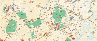
Map of Honshu
The island is approximately 1,300 km (810 mi) long and 50 to 230 km (31 to 143 mi) wide, and has a total area of 227,960 km 2 (88,020 sq mi), [1] making it's little more than an island. from Great Britain 209,331 km 2 (80,823 sq mi). [10] Its land area increased with land reclamation and coastal uplift in the north due to convergent plate tectonics. Honshu has a coastline of 10,084 km (6,266 mi). [4]
Mountainous and volcanic, Honshu experiences frequent earthquakes (the Great Kanto Earthquake heavily damaged Tokyo in September 1923, and an earthquake in March 2011 shifted the northeastern part of the island by a varying amount of 5.3 m (17 ft) [11] [12] , causing destructive tsunamis). The highest peak is the active volcano Fuji at 3,776 m (12,388 ft), making Honshu the 7th highest island in the world. There are many rivers, including the Shinano River, the longest in Japan. The Japanese Alps span the width of Honshu, from the "Sea of Japan" coast to the Pacific coast. The climate is generally humid subtropical in western Japan and humid continental in the north.
Extreme points [edit]
Bridges and tunnels[edit]
Honshu is connected to the islands of Hokkaido, Kyushu and Shikoku by tunnels and bridges. Three bridge systems were built across the Inland Sea islands between Honshu and Shikoku (Akashi Kaikyo and Ōnaruto Bridge; Shin-Onomichi Bridge, Innoshima Bridge, Ikuchi Bridge, Tatara Bridge, Ōmishima Bridge, Hakata-Oshima Bridge, and Kurushima-Kaikyo Bridge; Shimotsui- Seto Bridge, Hitsuishijima Bridge, Iwakurojima Bridge, Yoshima Bridge, Kita Bisan-Seto Bridge and Minami Bisan-Seto Bridge), the Seikan connects Honshu with Hokkaidō, and the Kanmonkyo Bridge and Kammon connects Honshu with Kyūshū.
Metropolitan areas and prefectures of the Chubu region
"Tyubu" is literally translated as "central region." Indeed, the Chubu region is the central part of the Japanese state. The total population is almost 22 million people. It is in the Chubu region that the famous Mount Fuji is located. The region is characterized by mountainous and rocky terrain. Mountain ranges conditionally divide the region into two parts.
Niigata
Niigata is a large county with a population of one million, one of the largest in the region. Niigata area is 12600 sq. km., population 2.3 million people. The prefecture boasts the largest number of Shinto shrines and temples in Japan. In addition to its spiritual heritage, the district is famous for ski tourism.
In the north, the district has direct access to the Sea of Japan. The region is located in an extremely unstable and dangerous seismic zone. The district includes 4 villages, 6 towns, 20 counties and 20 cities. The official symbols of the area are the ulpan, the primrose, the Japanese camellia and the red-footed ibis.
Toyama
Toyama is the main industrial district of the sea coast. Toyama area – 4250 sq. km., population – 1.07 million people. Toyama consists of 10 cities, 2 counties and 6 towns. The district received its title of industrial giant thanks to cheap electrical energy. The symbols of the region are officially recognized as the tulip, cryptomeria, partridge and Japanese antelope.
Ishikawa
The area of Ishikawa County is 4185 square meters. km., population 1.15 million people. Kanazawa City is the main administrative division of the region. The district includes 8 villages, 5 counties and 11 cities. The official symbols of Ishikawa are the golden eagle, black lily and ate tree.
Fukui
The prefecture is located in the very center of the region. Its area is 4200 sq. km., population – 0.8 million people. The center of the district is the town of Fukui. The region includes 8 villages, 7 counties and 10 cities.
Residents chose pine, thrush and snow crab as symbols of the region.
Yamanashi
Yamanashi County is located in the southern part of the region. It is also one of the smallest in area and density. So, the area of Yamanashi is 4460 square meters. km., population – 0.84 million people. The main administrative unit of the district is the city of Kofu.
6 villages, 8 towns. 5 counties and 13 cities - this is the structure of the region.
Residents chose the cherry blossom, maple, serow and bamboo warbler as symbols of the prefecture.
Nagano
The district with more than a million people is located in the central part of Chubu. Nagano area 13500 sq. km., population – 2.1 million people. The city of Nagano is the center of the prefecture. The district consists of 14 counties and 19 cities.
The prefecture is famous throughout the world for ski tourism. It was in Nagano that the Winter Olympic Games were held in 1998. Birch, partridge, Japanese serow and gentian were assigned as symbols of the district.
Gifu
Gifu County is located to the west of other prefectures. Its area is about 10,600 square meters. km. Population – 2.04 million people. Gifu consists of 19 towns and 20 cities.
The officially recognized symbols were the partridge, the yew, the ayu fish and the Chinese astragalus.
Shizuoka
The name of Shizuoka Prefecture translates to "Silent Mountain". The district's terrain is indeed mostly mountainous. Its area is 7780 sq. km. Population – 3.7 million people. The structure of Shizuoka includes 12 towns and 23 cities.
The district has a reputation for being an unstable seismic zone. Every 150 years, a large-scale earthquake occurs here, causing enormous losses to the local population. Residents chose the azalea as the flower of the district, the black flycatcher as the bird, and the fragrant osmanthus as the tree.
IT
The southwest of the region is occupied by Aichi District, the administrative center of which is Nagoya, which is the 4th largest city in Japan. Aichi area – 5160 sq. km., population – 7.44 million people. The region includes 37 cities and 15 villages. Residents of the prefecture have chosen the iris, hananoki, tiger shrimp and Japanese scops owl as national symbols.
Entertainment and attractions of Honshu
The Chugoku region is home to three UNESCO World Heritage sites: the Iwami Ginzan Silver Mine; the Genbaku Dome (or Atomic Explosion Dome) and Itsukushima Shrine, one of the most revered Shinto shrines.
Only twelve original castles remain in Japan, and the Chugoku region is home to two of them: Japan's tallest castle, Bitchu-Matsuyama Castle, and one of Japan's few black castles, Matsue Castle. Chugoku is also home to three famous Japanese parks - Koraku-en in Okayama, Kenroku-en in Kanazawa and Koraku-en in Mito.
In the Oku Hida area of Takayama, it is worth paying attention to the traditional Japanese gasho-zukuri houses with a roof in the shape of hands folded in prayer. In Nagano, visit the Zenkoji Buddhist monastery, which is considered a national treasure of the country.
In Tokyo, it is worth visiting the Kokyo Imperial Palace, Toshogu Temple, the Orthodox Cathedral of the Resurrection of Christ Nicholas-do, the Tokyo National Museum, the New Edo-Tokyo History Museum, the National Science Museum in Ueno Park, the Shitamashi Historical Museum, the Temple of the Goddess Kannon, the National Theater of Japan with performances of the troupes "Kabuki", "No" and "Bunraku". Well, the most recognizable landscape of Central Honshu is, of course, the conical outlines of Fuji.
Unrivaled Kansai attracts tourists with its treasures and five UNESCO World Heritage Sites: Kyoto and Nara, the ancient capitals of Japan, are chock-full of temples and historical sites, and Himeji is famous for its magnificent castle.
Metropolitan areas and prefectures of the Chugoku region
Chugoku is the middle lands of the island of Honshu. The total area of Chugoku is 32,000 square meters. km., population - almost 8 million people.
The region consists of 5 districts:
- Tottori;
- Simane;
- Okayama;
- Hiroshima;
- Yamaguchi.
The region is considered to be quite developed in the agricultural and industrial areas. The region is actively mining copper, coal, tin, uranium ore, and molybdenum. The largest metropolis is Hiroshima, the center of the automobile industry.
Tottori
Tottori County is located in the northwestern part of Chugoku. The area of the area is 3500 sq. km., population – 0.57 million people. The city of Tottori is the central administrative unit. The structure of the district includes 4 cities and 14 villages.
The official symbols were the pear flower, the mandarin duck and the halibut.
Simane
Shimane Prefecture is located adjacent to Tottori District. Its area is 6700 sq. km., population – 0.7 million people. The city of Matsue is officially recognized as the administrative center of the district. Shimane consists of 10 villages and 8 large cities. The symbols of the district are the tree peony, pine, swan and flying fish.
Okayama
Okayama County is the southern neighbor of Shimane Prefecture. Okayama area is 8480 sq. km., population – 2.8 million people. The district consists of 2 villages, 10 towns and 15 cities. Residents chose peach blossom, densely flowered pine and Japanese pheasant as symbols.
Hiroshima
Hiroshima is the central region of Chugoku. It is also adjacent to more than 100 islands of the Inland Sea of Japan. The main administrative unit is the city of Hiroshima. The area of the district is 8470 sq. km., population – 2.87 million people. The structure of Hiroshima includes 14 large cities and 9 towns.
Hiroshima has always been famous for its highly developed heavy industry, in particular the military-industrial complex. That is why Hiroshima was subjected to atomic bombing, as a strong, powerful and dangerous potential enemy. Atomic bombs were dropped on the city center by American bombers in August 1945.
However, this did not prevent the city from reviving and developing the entire urban infrastructure from scratch. There are about 350 monuments in the district, both of historical significance and landscape significance. These are mounds, canyons, seaside parks, gardens, and the remains of ancient castles. The county is also notable for its large number of officially recognized traditional holidays.
| February | big oyster festival |
| April | flower parade |
| June | celebration of music and flower planting |
| August | anime festival |
The officially chosen symbols of the district are the loon, Japanese maple leaves and oyster.
Yamaguchi
To the west of Chugoku is Yamaguchi County. Its area is about 6110 sq. km., population – 1.4 million people. The central administrative unit is the city of Yamaguchi, and the largest city of the district as a whole is Shimonoseki.
The district includes 6 villages and 13 cities. The official symbols of Yamaguchi County are the black crane, pine tree, sika deer and puffer fish.
On the island of Honshu it is difficult to identify the most and least developed megacities. Features of the relief, weather conditions, as well as comprehensive access to the seas and oceans allowed the Japanese to adapt to any type of activity. That is why the state is highly developed in both industrial and tourism areas.
Article design: Oleg Lozinsky