Greetings, dear fishermen. Today’s article is about choosing a place to fish with a feeder on a river in an unfamiliar place. It happens that when you arrive at a reservoir, there are no external landmarks indicating a promising place.
Usually the first thing we look for is traces of civilization. These could be various spears left by fishermen, any anomalies on the surface of the water, and other signs of a fishing spot.
Today I will tell you how to effectively probe the bottom topography and study the fishing area with an accuracy of up to a meter, well, let's go.
What you will need
To determine the relief we will need:
- Paper, definitely a checkered piece of paper
- A pen, or better yet a pencil
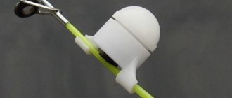
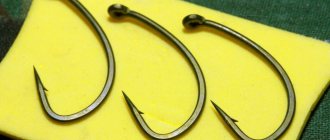
- Marker weight
- Well, actually the feeder
If you’re not going fishing alone, it won’t hurt to ask a friend to help with your notes.
I also advise you not to choose a place right away, perhaps we won’t find the relief we need here. In this case, you will have to cross 50-100 meters upstream or downstream, in general, in any direction.
You also need to know how much line your reel winds in per turn of the handle. To do this, just turn off the stopper and pull out the line, following the handle, and then measure. This condition is not necessary, but any angler must know his gear by heart. And if they suddenly ask at what distance you caught so many fish, it will be easier to answer in meters.
Let's start studying the terrain
To begin with, we assemble the tackle almost into working position. Some fish with a shock leader, some without, in general, it’s a matter of habit. We hook on a marker weight, select a landmark on the other bank, and cast as far as we can.
Having thrown the load, we fix the line in the clip (we won’t touch this clipped line anymore), and pull out our load. Now we cast again until the clip stops the sinker, and from the moment the weight hits the water we count the seconds of the fall.
You can find out that the load has reached the bottom by the receding tip of the feeder. After this, we write down the number to which we counted at the top of the piece of paper.
We make 3 turns of the reel handle (it can be 2 or 4 turns, depending on how accurately you want to probe the bottom), and again fix the fishing line in the clip without removing the previously fixed one.
Now we unwind our load from the water and count the turns of the handle. I got 48 turns, I add 3 turns that I wound up, and write 51 at the bottom of the piece of paper under the first number. The lower numbers can be added to the end of the sheet in increments of 3 turns (or however many you will do).
As you can see, I didn’t have all the numbers, so you take a larger piece of paper.
Next, we throw the load again, count the seconds of the fall, and record it. After that, we pull the line out of the clip, make 3 turns again, clip it, and do it all over again.
A brief overview of popular wireless echo sounders.
The popular echo sounder, judging by the reviews on the site, is quite working.
- Accurately detects depth;
- Accurately determines the bottom topography;
- Displays the presence of fish.
- Accurately determines depth up to 36 meters;
- Works at a distance of up to 30 meters;
- Accurately determines the bottom topography;
- Displays the presence of fish.
The most standard option, which is usually considered by fishermen, is fishing on a turn. The logic is simple - there will always be a depression or hole at a turn, and where it’s deeper, it’s better! And trips to the place itself show that fishing is very popular at the turns: the shore is trampled, there are traces of “ancient man” sites everywhere, “pokes” are stuck into the shore, etc.
Author: Yura Lisovsky · March 8, 2015
I would like to talk about such an interesting topic as choosing a place for fishing on the river. Not choosing a point and searching for an edge (which is well discussed in neighboring topics), but a general choice of “where should I go?” (article from the forum)
For me personally, new places are always interesting. Going to fish at an old, well-known point is also not bad, but what a joy it is when you find a completely new place for yourself and manage to catch a good fish there! Every year I practice such trips and the very first tool for finding a new place is, of course, satellite images.
I usually use the wikimapia service, because... there you can sort through images from several “manufacturers”: Google, Yandex, Bing. Sitting at home on winter evenings, you can carefully, kilometer by kilometer, scan the river, look for interesting places and explore the possibilities of accessing them (which is no less important!).
And always, when considering the next site, the same question is in my head: “Is this place interesting? What prospects might there be for fishing?
The most standard option, which is usually considered by fishermen, is fishing on a turn. The logic is simple - there will always be a depression or hole at a turn, and where it’s deeper, it’s better! And trips to the place itself show that fishing is very popular at the turns: the shore is trampled, there are traces of “ancient man” sites everywhere, “pokes” are stuck into the shore, etc.
However, practice shows that the situation is much more complicated than it seems at first glance. Many trips with sitting “in the pit” were completed with near-zero or mediocre results. And most often, productive fishing turned out to be in completely different places. We are, of course, talking about “one day” fishing. I have no doubt that with a long session of several days, bait turns into bait and you can catch almost any more or less suitable place.
Of course, there is no escape from the turns. They are always interesting. But not the pits at the turn itself, but the beginning of the run after the pits or the run itself after the pit.
A classic example in the picture above: points 2 and 3 usually turn out to be better in terms of catch than point 1. This, of course, is only my personal observation, so I never claim to be the absolute truth
By the way, when choosing a turn, I always pay attention to its shape: neat semicircular turns may not always be interesting, but bends at a large angle with a sharp change in the direction of the flow are more attractive. Most often in such places there is a lot of stone both on the shore and at the bottom. Therefore, in fact, the river changes its flow dramatically. And the presence of stones at the bottom is always much more preferable than a flat sandy or clay bottom. Again, these are conclusions only from my practice.
Well, that’s probably all the basic rules, from the more general to the more specific and precise, that I apply when looking for another new place.
The riffles still remain a mystery to me. Fishing next to them at very similar points gave completely different results: from complete zero to very successful fishing. But there is little experience with them yet.
I would like to hear your methods of finding new places in this thread. Which places do you consider catchable and which are unpromising and why. Well, thank you for reading this “sheet” of text.
Brain is a manufacturer of fishing products for feeder, float and carp fishing.
Brain is a manufacturer of fishing products for feeder, float and carp fishing.
We are a fairly young brand and have been operating since 2013. But today our assortment includes a wide range of fly, feeder and carp rods and reels, high-quality boilies and aromatic additives, clothing and various accessories for fishing. The development of the product involves both keen fishermen and recognized athletes who know first-hand what bait mixtures should look like and what characteristics rods should have for fishing in our conditions.
And so it happened. At the chosen point, a slightly disguised passage was discovered to an amazingly beautiful place, located exactly at the bend of the river. Light littering of the area indicated that the selected point had been visited by fishermen in the past.
HomeArticlesAll articlesArticle
Not only is man a conservative creature by nature, but this applies doubly to fishermen. Once successfully caught in any place, they will never want to change it to a new one. A new, unexplored place threatens with unpleasant surprises like “overflight”, “steering wheel”, etc. However, the thirst for pioneering also naturally lives in each of us, and sometimes it overpowers conservatism.
What is there, around the bend of the river, what if the trophy of a lifetime will be caught? Or at least this season? Sometimes, however, everything turns out much more prosaically, and circumstances simply force us to take up exploration of new territories.
I had to take a short excursion, first using a kilometer-long map, refreshing my memory of the exact contours of the river in the chosen area, and then along the shore in search of a suitable new place for fishing.
Choosing a fishing spot
The first task arose while viewing the map. Where exactly to fish? Here, here, or maybe there? Fortunately, within two kilometers of the coastline, a seemingly suitable place was discovered - the river narrowed and made a meander. Even sitting at home, using only a map, one could say with confidence that this would be a pretty interesting place for fishing.
And so it happened. At the chosen point, a slightly disguised passage was discovered to an amazingly beautiful place, located exactly at the bend of the river. Light littering of the area indicated that the selected point had been visited by fishermen in the past.
A superficial inspection of the river “dotted all the i’s” regarding the correct choice of location. Exactly opposite the fisherman, the river in the bend is quite narrow, the current intensifies and the rip current leaves at an angle of approximately 30 degrees from the shore. A little further on, the river widens sharply before turning in the opposite direction; at the widening, an impressive bay with a reverse flow is formed. There is practically no aquatic vegetation under the shore - a decent depth begins right from the shore. My intuition told me that there must be fish here!
Studying the bottom topography
So, the place has been chosen. But the trouble is that it is completely new and unexplored. Where to fish? Where to throw the feeder? At one time I heard different advice: from “throw as far as possible” to “fish under the bank”, etc. For fishing an unexplored place with a feeder, the only correct solution is to study the bottom topography in more detail before starting any fishing. Let's look at this in more detail, because this is the most important key to success!
In the meantime, having laid out the rod and passed the braid through the rings, instead of the feeder I installed a weight with a swivel weighing 40 grams (the impressive current required a weighty load), and focused on finding out the bottom topography in the chosen fishing spot as accurately as possible.
The method is quite simple in words, but in reality it requires some skills to understand the information that is provided by “tapping” the bottom in a jig style. It is also necessary to understand that you are not holding an underwater video camera in your hands, and you most likely will not be able to feel the micro-irregularities of the bottom. Those who own a jig spinning rod can safely skip the next couple of paragraphs.
Making sense of the results
So, it took 20 minutes to study the underwater terrain in detail. You should not regret the time spent, which, it would seem, could have been added to the actual fishing. Then you can sit for much longer and still not see a single bite!
Laying out the gear
Catching
While the fish is thinking about a treat, you shouldn’t sit idly by, and one after another the feeders go to the bottom, creating an appetizing carpet of bait at the fishing points.
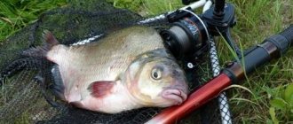
The fish, it seems, have finally come to the table richly covered with food, and bites follow almost immediately after lowering the feeder to the bottom! And the fish is quite marketable size - bream weighing 500-600 grams. Occasionally you come across smaller specimens, 300-400 grams. There is no talk of small fish; they are completely replaced by medium-sized fish from feeding points.
This is where the two feeders begin to interfere with each other and the fisherman. Not only is the fish torn between two relatively closely located feeding points, but it is also physically difficult, and sometimes impossible, to have time to “serve” both gear at the same time. How can one not remember the saying about two chairs! In the end, there is only one tackle left in the work and the time allotted for fishing comes to an end.
The catch included 8.5 kg of selected bream. From experience we can say that for a completely new place there is a very good catch, and without a detailed study of the bottom topography in the fishing place and careful preparation it would hardly have been possible.
According to tradition, after photographing, I release all the fish back into the reservoir and collect my gear, adding this promising point to my list of fishing spots.
published in the magazine “Fisherman's Compound” No. 8/2005
Cloudflare Ray ID: 63a804adf9747b63 • Your IP: 195.64.208.251 • Performance & security by Cloudflare
Cloudflare Ray ID: 63a804b10beecaf8 • Your IP: 195.64.208.251 • Performance & security by Cloudflare
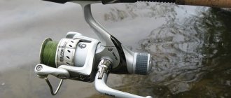
Recommendations are given for fishing in the current, this is a very important point. Rigs in still water will differ from those shown. You need to choose a reel somewhere around 4000, it is better to use a well-adjusted drag and a braided cord on the reel, which will allow you to feel neat bites over long distances - these are the basic items of equipment.
Today we have a wonderful opportunity to discuss an interesting issue. If we turn to the origins of this type of fishing, it received its recognition not so long ago, around the seventies of the last century. Now a huge number of fishermen decide to try this method and there are several important reasons for this.
First of all, you can be on the shore and still fish at a fairly decent distance. Not everyone has a boat. Even if the weather fails and is not the most favorable, the fisherman will not have any problems in terms of responding to small and fairly cautious bites. In addition to all this, I like this type of fishing because it is cheap.
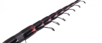
Rod selection
At the moment, there are a huge number of different feeders in fishing tackle stores. The consumer can independently choose completely different models, which differ from each other not only in appearance and design, but also in cost, as well as technical characteristics.
Remember that if you want to fish on a fairly large river where long casts are required, it is best to choose an “ extra-heavy ” or simply “ heavy ” rod with a length of 4 to 4.5 meters. Interestingly, this classification is quite arbitrary and will vary depending on. When discussing the permissible weight, the most optimal would be ½ or ¾ of the maximum possible weight, which is indicated on the rod itself.
Determining what's at the bottom
When we reached the shore, our paper looked like this:
This is only half the battle, we need to find out what is at the bottom, sand, shell, stones, etc.
To study the contents of the bottom, you need to be able to read it. It’s very easy to learn this, just drag the load along the shore and see what it gives to your hand and how it affects the tip.
Again we throw the load to the farthest point and begin to probe the bottom. To do this, we drag the load with the rod, then reel in the fishing line, and so on until we have twisted the handle 3 turns.
After that, we write down the result, for example, I felt sand between marks 51 and 48, the load moved smoothly as if on sandpaper, did not get stuck or knock. Let us denote the sand with the letter “P” and write it between the lower numbers.
The letters can be combined, for example, if you find a transition from sand to a shell, you can write “PR”, I think it’s clear. We do the same with the remaining intervals, pulled, recorded, etc. As a result, I got this picture:
Now we know where the edges are and where everything lies on the bottom, but for clarity, let's draw the bottom topography and mark where everything is.
Finding a fishing point in the feeder. Four main ways
What is the main feature of classic feeder fishing? Naturally - targeted and regular supply of food to the fishing point, feeding of the fish. However, before starting this procedure, the fisherman needs to find the very fishing point. The fish in the reservoir are distributed extremely unevenly, and any more or less significant anomaly will certainly attract its attention. The fisherman’s task is to find such an anomaly, and the faster he does this, the more time he will have for fishing.
There are four main ways to find a fishing spot, taking into account modern realities. And to be successful, an angler must be willing to use each of them.
Tapping the bottom
The easiest way to measure depth at a fishing point. Most often it is used by those who are close to spinning in general and jig fishing in particular. With its help, you can determine the depth at the fishing point with fairly high accuracy.
What is its essence? The fisherman casts to a point of interest and counts the time it takes for the weight to reach the bottom. Then he makes 3-4 sharp turns of the reel and records the time the load drops - when it reaches the bottom, the rod tip straightens. After this - again 3-4 turns and a pause, and so on all the way to the shore.
During the measurement, the weight moves along the bottom in jumps of uniform length. If the depth in the fishing zone is constant, the time the sinker reaches the bottom does not change. In the case when the fisherman finds a depression, the sinker sinks longer, but if, on the contrary, the equipment moves from depth to shallow, the time of contact with the bottom will decrease. It's simple!
Dragging a weight along the bottom
The method, which complements tapping, gives the fisherman the maximum amount of information about a specific place, albeit with a degree of convention. A marker spiked weight is attached to a tackle with a braided cord, the angler casts and begins to drag the weight along the bottom, monitoring the information received. A uniform movement of the sinker will indicate sand or hard peat, a jump-like trajectory with some “sticking” will indicate deep silt, and uniform crushing and hits in the hand will indicate stones or shells.
The fisherman’s task is to find the area where the nature of the bottom soil changes, to find all kinds of transitions, rocky ridges and colonies of shells. Found it? Clip the distance!
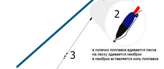
Using a marker float
This method allows you to kill the two “birds” described above with one stone. Thanks to a special marker float, the fisherman is able to clearly monitor the depth at the fishing point and record even ten to fifteen centimeter changes, and thanks to the marker weight sliding along the equipment, he can determine the structure of the bottom.
The design of marker gear is usually as follows. A float is attached to the end of the braided cord, above which a marker weight is attached to a special outlet. Being at the bottom, the equipment is in a fixed position. As soon as the fisherman begins to release the fishing line, the float gradually floats to the surface. To track the amount of fishing line given out, special marks are located on the butt part of the marker rod, usually having a 20-centimeter gradation. One of the main components of marker gear is a spinning reel with a baitrunner - with its help, casting line is quick and convenient. And you can’t do without a braided cord - only in this case the angler gets the most sensitive gear at his disposal.
Using modern echo sounders
Recently, these devices have become widespread. At their core, these are portable echo sounders that are thrown into the water using a fishing rod and transmit a signal to a compatible smartphone using a Wi-Fi connection. The operating range of such devices is 60-70 meters, which is more than enough for coastal fishing.
The interface of the programs used to work with the echo sounder is convenient and intuitive. Changes in depth, the presence of fish, debris in the water - these and many other features are clearly monitored by the fisherman.
But the most important advantage of a portable echo sounder is revealed when river fishing. The sonar carried by the current allows the fisherman to study the topography of the river not only in a perpendicular, but also in a plane parallel to the shore, which none of the methods mentioned above can provide.
Among the nuances of this method, it should be noted that it is necessary to have a powerful fishing rod and a thick braided cord - the device weighs 120-140 grams on average, and therefore not every feeder will be able to cast it the required distance. As for the braided cord, everything is simple here: a thick braid insures the angler against unplanned swimming and swimming behind a device that comes off during casting.
Drawing the bottom relief
In order to clearly see what kind of relief is in this place, let's draw a straight line here:
This will be the surface of the reservoir from which we will count our top numbers. We count down and put dots in the right places:
All that remains is to connect the dots and we will get a finished picture of the bottom.
Here is our bottom, in full view. We can already select two fishing points, at 39 revolutions and at 27. Let's finish our bottom map and label the coverage:
Now it’s generally great, if we talk about where it will be more promising to fish, then everyone decides for themselves.
At point 39 there is a good hole; fish will probably stand here during the daytime. At point 27 there is an excellent deepening, but the rise is too sharp, there is a risk of catching the feeder.
Places for fishing on the feeder. Study of the bottom topography. Feeder
In the summer heat, many city residents go to the pond, taking fishing gear with them. Since fish at this time move away from the noisy shores, they have to be caught at long distances.
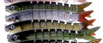
Feeder fishing in the summer allows you not only to have a good rest on the shore, but also to fill your fish tank with a variety of fish. The catch may include crucian carp and carp, roach and silver bream, bream and ide.
But for a pleasant pastime, it is important to choose the right place.
Selecting a location
During the summer, the behavior of fish in a reservoir differs significantly. This factor must be taken into account by the angler when going fishing.
- By the beginning of summer, many fish species finish spawning and begin active feeding. Weakened fish concentrate in bays, oxbows and quiet bays.
Attention!
This behavior is observed annually, therefore, having discovered promising areas, you can successfully fish after each spawning period.
- By mid-summer, the water in rivers and lakes warms up, increasing fish activity. But flocks move away from the shore in search of cooler waters. Feeder fishing allows you to reach feeding areas. It is best in July to fish for changes in depth, entrances and exits from holes, lower edges and river beds. Representatives of the ichthyofauna feel comfortable in the heat under boulders and snags. Using bait, you can try to attract fish from shelters.
- In August, the water in many reservoirs drops and becomes clearer. Rough rigs can alert fish, so it is important to use thin lines and small hooks. Night fishing on a feeder becomes interesting and romantic. August is the month when large fish begin to gather in schools and move to their winter camps. Therefore, with proper tactics, you can count on a rich catch.
The influence of weather on the summer bite
In summer, the fish bite directly depends on weather conditions. You can hope for a good catch if the pressure is stable and the wind direction is certain. Sudden changes negatively affect the behavior of fish. On such days, neither expensive gear, nor fragrant baits, nor delicious baits will help the fisherman. Therefore, when going to a pond in the summer, you should study the weather forecast for these days.
A good bite can be predicted when the pressure remains stable at the same level and the air temperature is warm, but not hot. Southern and western winds have a good effect on the behavior of fish.
Before the weather changes, there are times when the fish are hungry, but there may be a complete lack of bite. Light rain and wind help to increase fish activity, as the water is filled with oxygen. During prolonged bad weather, heat-loving fish species (crucian carp, bream) feed less often, so it is better to wait for the arrival of warmth.
How to accurately hit the chosen fishing point
Now I’ll tell you how to work with this scheme. For example, I chose point 39 for fishing. Remember the fishing line that we clipped at the very beginning and didn’t touch anymore? So, it was clipped on the 51st turn of the handle, subtract 39 from 51, and get 12.
Again we throw it at 51 turns, fortunately we have it clipped there. We begin to reel in the load, counting 12 revolutions, and lo and behold, we find ourselves at point 39. We clip on, hook up the equipment, and start fishing, as you can see, everything is simple.
That's all, dear fishermen. This method of studying the relief is quite long, but having felt the bottom relief in this way, you will discover your place, which you can return to again and again from year to year, and enjoy fishing. See you again!