History of the Krylatskoye district
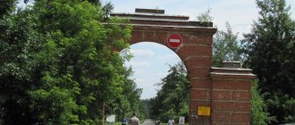
The name of the Krylatskoye district comes from the ancient village of Kryletskoye, which stood on the right bank of the Moscow River. Some historians believe that the village was named because of the features of the landscape: the local ravines spread out from each other like wings. Others prefer the word “porch”: since ancient times the village was located at the entrance to the capital, and only in 1960 the area became part of Moscow. Be that as it may, Krylatskoye was first mentioned in a spiritual document of 1417, according to which the village passed to Grand Duchess Sophia. For several centuries, these places were the royal patrimony: Ivan the Terrible often stayed in Krylatskoye, returning to Moscow from Volokolamsk or Mozhaisk. At the end of the 16th - beginning of the 17th century, the village belonged to the mother of the first tsar of the Romanov dynasty, Mikhail Fedorovich. In 1613, a royal hunt was organized in the local vicinity.
The golden key in a blue field symbolizes the “turnkey” method of urban development widely used in Krylatskoye. The silver rafter, in the shape of a decorative zakomara - decoration of the porch, reflects the historical name of the area - Kryletskoye. The silver gushing spring symbolizes a unique spring of holy water, which is a place of pilgrimage for Muscovites. The green field signifies the rich nature of the Krylatsky Hills, which in 1998 received the status of a landscape reserve.
Krylatsky hills. Photo: Denis VasilievAt the beginning of the 20th century, members of the Surikov musical and literary circle gathered in Krylatskoye. Sergei Yesenin read his poems here, and Vladimir Mayakovsky organized swims across the Moscow River. In the 1950s, a large poultry farm was built near Krylatskoye, which produced about 150 million eggs per year. In 1960, mass residential construction began in Krylatskoye and the poultry farm was moved outside the area.
Krylatskoe. Poultry farm 1977 Photo: pastvu.com In 1973, construction of the Olympic sports complex began in Krylatskoye: six streets in the village of Krylatskoye and five streets in the village of Tatarovo were demolished. In the Tatarovskaya floodplain, a Rowing Canal was built for the 1980 Olympics, and the world’s only 13-kilometer urban cycling track appeared on the Krylatsky Hills. World-class sports facilities continue to be built in Krylatskoye: the Moscow Skating Center, the Dynamo Sports Palace and the Ice Palace, the Technical Sports Stadium and the Table Tennis Center have been opened. There are plans to build a wave pool for surfing.
Construction of a cycling track in Krylatskoye (1978). Photo: pastvu.com
Ice Palace. Photo: Denis Vasilye
Sports Palace "Dynamo". Photo: Ivanko Igor (AGN Moscow)
Today, more than 80 thousand people live in Krylatskoye, and the area is considered one of the most environmentally friendly in Moscow: there are almost no industrial enterprises here. But there are five unique natural monuments that occupy an area of 300 hectares: the Krylatsky Hills landscape reserve, the Tatarovskaya floodplain and a spring in the Tatarovsky ravine, Serebryanoborskoye forestry, and the Moskvoretsky natural and historical park.
Natural-historical park "Moskvoretsky". Photo: krylatskoe.com Another attraction of Krylatsky is the famous “Yeltsin House” on Osennyaya Street, in which in the early 90s the Russian President settled all his associates: Chernomyrdin, Gaidar, Korzhakov, Grachev, Shakhrai. The satirist Zadornov also became their neighbor - however, due to a mistake by the apparatus. According to legend, along the “Yeltsin House” there is a secret “Metro 2”, which supposedly goes further into the region, to the state dachas. By the way, the Central Clinical Hospital, the famous Kremlevka, is located very close by.
"Yeltsin's House" on Osennyaya Street. Photo: krylatskoye.ru
Characteristic
The Krylatskoye district is part of 13 districts of the Western Administrative District of Moscow. The district covers an area of 1110 hectares and has 14 streets and 1 metro station (Krylatskoye). The population living here is about 62 thousand people. The district is managed by the Krylatskoye District Administration and other district authorities.
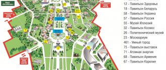
Map of the Krylatskoye district of Moscow
Related documents
Decree of the Moscow Government No. 365-PP dated August 16, 2011 On the territory planning project for functional zones No. 5, 6, 7, 25, 26, 30 of the Krylatskoye district in order to accommodate capital construction projects of the state enterprise of the city of Moscow “Olympic training and sports center “Krylatskoye” “at the address: Krylatskaya st., no. 2 Order of the Moscow Government No. 276-RP dated April 12, 2011 On the provision of the state-owned enterprise of the city of Moscow “Olympic training and sports center “Krylatskoye” for permanent (indefinite) use of a land plot at the address: st. .Krylatskaya, vl.2 Order of the Moscow Government No. 2193-RP dated October 8, 2010 On the completion of construction by the limited liability company "NA HOLMAKH-1" of a market complex at the address: Osenniy Boulevard, vl.12 (Western administrative district of the city of Moscow) Order Moscow Government No. 671-RP dated April 13, 2010 On the further implementation of the investment project at the address: Rublevskoye Shosse, 68-70 Moscow Government Order No. 132-RP dated January 30, 2009 On the further implementation of the project for the construction of a medical and health complex at : Rublevskoe highway, vl.68
All documents (25)
District boundary
The border of the Krylatskoye district runs: along the axis of Rublevskoye Highway, then along the city limits of Moscow (the outer border of the right of way of the Moscow Ring Road, including all traffic intersections of streets and roads), the southern and southeastern borders of the territory of Serebryanoborsky forestry, the axis of the Moscow River bed , the axis of Krylatskaya street to Rublevskoe highway.
Neighboring areas
Moscow districts that have a common border with the Krylatskoye district: Kuntsevo, Strogino (North-Western Administrative Okrug), Filevsky Park and Khoroshevo-Mnevniki (North-Western Administrative Okrug).
Districts of the Western District of Moscow
List of ZAO districts: Vnukovo, Dorogomilovo, Krylatskoye, Kuntsevo, Mozhaisky, Novo-Peredelkino, Ochakovo-Matveevskoye, Vernadskogo Avenue, Ramenki, Solntsevo, Troparevo-Nikulino, Filevsky Park and Fili-Davydkovo.
Church of the Nativity of the Blessed Virgin Mary in Krylatskoye
In the very center of the Krylatsky Hills park stands the Church of the Nativity of the Blessed Virgin Mary. Its slender blue bell tower is visible from anywhere in the park. It seems as if it is growing out of the green massif of the Krylatsky hills.
In the 16th century, on the site of the modern blue and white temple, made in the Byzantine style characteristic of Russian churches of the 19th century, there stood a wooden church. As is known from the chronicle, Ivan the Terrible himself came to illuminate the church. At the beginning of the 18th century it burned down.
Another wooden temple was built, which also did not survive the fire. In 1877, a stone temple was built, the building of which was preserved after the demolition of the village of Krylatskoye, and was later restored and acquired a modern appearance.
Krylatsky Hills Park
Great Eastern Krylatsky Hill
The observation deck of the Big Hill is not equipped, there are no benches or other amenities here, only nature in its pristine beauty. From the mound there is a beautiful view of the surrounding area of the park.
You can see the Zhivopisny Bridge, new buildings in the Krylatskoye district, the dome of the Lata-Track sports complex, the blue stripe of the Rowing Canal, Moscow City. There is a ski slope on the hillside on the north-eastern side.
Krylatsky Hills Park
HISTORY of the Krylatskoye districtThe village of Kryletskoye, known since the time of Vasily I, which was the favorite state fiefdom of Ivan the Terrible, gave its name to the Krylatskoye district. Krylatskoye was first mentioned in documents of 1417, in the second spiritual charter of the Grand Duke of Moscow Vasily Dmitrievich, according to which he gave it to his princess. A historical feature of Krylatskoye was that the village was constantly among the sovereign's estates for several centuries. It was especially loved by Tsar Ivan the Terrible, who, returning along the road from Volokolamsk or Mozhaisk, always stopped in Krylatskoye. In the fall of 1554, on the way back from a bypass of Klin, Volokolamsk and Mozhaisk, the tsar stopped at Krylatskoye on the occasion of the consecration of the Church of the Nativity of the Virgin Mary there. Nine years later, the Tsar’s son Fedor met his father here, returning victorious from the Lithuanian campaign. At the turn of the XVI-XVII centuries. Krylatskoye goes to the Romanovs. The village was listed as the property of the nun Marfa Ivanovna, the mother of the first tsar of the Romanov family, Mikhail Fedorovich. According to the 1646 census, there were 18 peasant households in Krylatskoye, where 24 people lived. In 1714, a new wooden church was erected to replace the burnt Church of the Nativity of the Virgin Mary, built under Ivan the Terrible. Three years later, a chapel in the name of St. Nicholas the Wonderworker was added to the church. In 1887, the wooden church on the hill was replaced by a white stone one with blue domes. And under the mountain there flowed a spring, popularly nicknamed the “holy well” after “the miraculous appearance of the icon of the Rudny Mother of God illuminated the face of this land” at the beginning of the 19th century. In memory of the appearance of the icon, a chapel was built above the source, in which the found image was placed. Every year on October 12 (25), people from all over Moscow came to the source to worship the miraculous image. The temple existed until 1936, and in the fall of 1941 the dome was dismantled and the bell tower was demolished down to the first tier, since the high points served as good reference points for German planes and artillery when bombing Moscow. The Alexander Railway passed through the territory of Krylatskoye, and at the beginning of the 19th century a summer theater and the first cinema theater in this area were built. At the end of the 19th century, Krylatskoye became a dacha area, a summer recreation and swimming area. At the beginning of the 20th century, members of the Surikov literary and musical circle gathered in a park near the village. Under a century-old oak tree, Sergei Yesenin read his poems publicly for the first time. On July 20, 1914, the day after the outbreak of World War I, a meeting of the Moscow Bolshevik Committee was held here, attended by about 20 representatives of party groups discussing attitudes to the war. After the revolution of 1917, Krylatskoye’s lands were divided among peasants, and at the end of the 20s, a collective farm was organized in Krylatskoye, mainly engaged in livestock farming. In the 50s, a poultry farm with a capacity of up to 150 million eggs per year was built near the village. The district entered Moscow in 1960 (became part of the Kuntsevo district). During the preparation for the 1980 Olympic Games, all six streets in the village of Krylatskoye were demolished, and the area became the object of mass housing construction. The poultry farm was moved beyond the 36th kilometer of the Minsk highway, and in 1973, construction of the Olympic sports complex began in the area. The Rowing Canal was built in the Tatarovskaya floodplain, and nearby in 1979 an indoor cycle track was built. The only historically preserved building is the church, the restoration of which began in 1989. In 1991, Krylatskoye received the status of a separate district and became part of the Western Administrative Okrug. The peculiarity of Krylatskoye is the absence of an industrial base here. On its territory there are enterprises, organizations and institutions serving the population. This is one of the most environmentally friendly areas of Moscow. Specific features of the area include the absence of significant undeveloped sites for new construction and oversaturation of private vehicles. Prominent statesmen, politicians, actors, artists, poets and writers live in this area. In Krylatskoye there are 5 unique natural monuments, which occupy 300 hectares. Among them: decorating the territory of the region - Serebryanoborskoye forestry, the Krylatsky Hills landscape reserve, Tatarovskaya floodplain. Active development of the area began in 1984.
PHOTOS of the Krylatskoye district
more photos →
Park attractions
Several routes are available for recreation in the park, covering the main attractions: temples, picturesque natural sites and a sports and environmental complex.
Church of the Nativity of the Blessed Virgin Mary in Krylatskoye
In the very center of the Krylatsky Hills park stands the Church of the Nativity of the Blessed Virgin Mary. Its slender blue bell tower is visible from anywhere in the park. It seems as if it is growing out of the green massif of the Krylatsky hills.
In the 16th century, on the site of the modern blue and white temple, made in the Byzantine style characteristic of Russian churches of the 19th century, there stood a wooden church. As is known from the chronicle, Ivan the Terrible himself came to illuminate the church. At the beginning of the 18th century it burned down. Another wooden temple was built, which also did not survive the fire. In 1877, a stone temple was built, the building of which was preserved after the demolition of the village of Krylatskoye, and was later restored and acquired a modern appearance.
Church of the Nativity of the Blessed Virgin Mary, © Evgeniy Golubev
Spring Rudny Mother of God
At the end of the 19th century, an icon of the Rudny Mother of God was brought to the Church of the Nativity of the Blessed Virgin Mary. According to local peasants, she was found not far from the temple. A chapel was built in this place, next to which a spring flowed. In 1936, the icon was burned and the chapel was dismantled. The spring has survived to this day. It is located in the “Stone Cage” ravine. Local residents believe in the miraculous nature of the holy spring and come here to get water.
Ravine Stone Cage
Between the Western and Eastern Krylatsky Hills, the oldest of the park’s ravines, the Kamennaya Kletva ravine, has been preserved. The Krylatsky stream flows along its bottom, fed by the waters of three springs - the Rudny Mother of God, the Kamennaya Kletva and the Small. The Kamennaya Kletva ravine has been a natural monument since 1987.
Gully Stone Infections
At the foot of the Church of the Nativity of the Blessed Virgin Mary there is another natural monument - the “Stone Infections” ravines. In ancient times, the word “infection” was used to describe steep slopes, swamps, ravines, that is, difficult to overcome places. The Stone Infections stretched for half a kilometer. Shrubs grow on the slopes, and water accumulates in the lower part, forming a small swamp.
Great Eastern Krylatsky Hill
© Lata Track
The observation deck of the Big Hill is not equipped, there are no benches or other amenities here, only nature in its pristine beauty. From the mound there is a beautiful view of the surrounding area of the park. You can see the Zhivopisny Bridge, new buildings in the Krylatskoye district, the dome of the Lata-Track sports complex, the blue stripe of the Rowing Canal, Moscow City. There is a ski slope on the hillside on the north-eastern side.
Mountain country
On the northern side of the Krylatsky Hills you can see a small copy of the mountain system. There is a main ridge, side ridges and intermountain valleys, dry basins and slopes of varying steepness. The local relief has been significantly transformed due to constant intervention in the rock structure. Previously, quarries were located here.
Sports and ecological complex "Lata-Track"
Tubing slope, © Lata Track
On the territory of the park at st. Krylatskaya, 1 there is a sports complex “Lata-Track”, where you can organize your leisure time both in summer and winter. In the warm season, the Olympic cycling road is open, in winter there are skiing, tubing and snowboarding trails.
Renting skis and boots for an hour will cost 900-1100 rubles for adults, 500-700 rubles for children. An hour rental of a snowboard with boots costs 1000-1200 rubles for adults and 600-800 rubles for children. The price of lifts starts from 50 rubles. On weekends and holidays it is more expensive.
Plan of the complex on the official website
Lata-Track opening hours
- bike rental is open from 8 a.m. to 11 p.m.;
- ski slopes are open on Monday from 14:00 to 23:00, from Tuesday to Friday from 9 to 23:30, on weekends and holidays from 8 to 23:30.
- Tubing trails are open on weekdays from 16:00 to 23:00, on weekends and holidays from 9:00 to 23:00.
How to get to Lata Trek
- from the Molodezhnaya and Krylatskoye metro stations by bus No. 829 stop. "Rowing Canal".
- from the Oktyabrskoye Pole and Sokol metro stations by bus No. 691 and T19 stop. "Krylatsky Bridge".
Old and new Krylatskoye: how it was built and how it lives today
For a long time, the name of the Krylatskoye district was associated with the wings, believing that their shape was reminiscent of the hills and ravines spread out here. In 1987, a sculpture in the form of a girl on a ball with wings behind her back was even installed on Rublevskoye Highway. And relatively recently it became known that at the beginning of the 15th century, the village of Kryletskoye (from “porch to Moscow”) was located in these places, which by the beginning of the 17th century belonged to the Romanov boyars.
Later, one of the most famous Moscow architects, Fyodor Shekhtel, built a dacha here.
Krylatskoye has always been one of the most environmentally friendly areas of the capital; industrial enterprises and factories have never been built on its territory.
Residents of the Krylatskoye district can look at archival photos and remember its long history, starting from the 20-30s of the last century.
There are uniquely beautiful natural monuments here - the Krylatsky Hills protected area, a spring with spring water, known since the beginning of the 15th century, Moskvoretsky Park, Serebryanoborskoe forestry, Rublevsky forest.
Krylatsky inherited a powerful sports base after the 1980 Olympics, for which an Olympic cycling track was built, below - the Rowing Canal and cycling track, a motocross track, and a ski complex. Later, golf courses, an archery course, an ice palace and other facilities appeared.
After the 1980 Olympics, housing construction began, and at first it was an experiment: for the first time in Moscow practice, an integrated approach to urban planning was implemented. Not only residential buildings were built on a turnkey basis, but also the infrastructure necessary for people’s lives: schools, kindergartens, shops, clinics.
The birthday is considered to be October 8, 1984 - on this day the first keys to the Krylatskoye residential complex were handed over to the new residents.
An entire area in Krylatskoye was intended for employees of the KGB, intelligence, and the Ministry of Foreign Affairs. Houses for the nomenklatura were built using non-standard materials. The entrances and entrances are finished with tiles that were not used in mass construction. All these houses are equipped with underground parking lots and powerful bomb shelters.
One of the most interesting buildings can be called the “Chazovsky” house on Osennaya Street - this is a communal house, a house of a new way of life, in which everything was built taking into account the realities and the very increased requirements for everyday life in the eighties.
Another noteworthy fact is that the first President of Russia, Boris Yeltsin, settled in Krylatskoye in the early 90s, on the same Osennaya Street, in house No. 4.
All other residential buildings in Krylatskoye were also built with apartments with an improved layout: with a larger area and higher quality finishes than in the rest of the typical multi-story Moscow.
Today, Krylatskoye remains one of the most prosperous districts of the capital from an environmental point of view. According to the consulting and analytics department, the average rental price of residential real estate in Krylatskoye is higher than the Moscow average and puts the district in second place in the ranking after Khamovniki. The results of the data, of course, were influenced by the cost of rent in the new residential complex “Fantasy Island” - a specific village for the rich, where the monthly rental price reaches 1 million rubles.
Krylatsky residents love their cozy area very much for the peace and quiet, for the opportunity to walk on the Krylatsky hills and breathe clean air... The improvement of the area continues and recently the head of the administration, Viktor Kutsev, announced that work has begun on the reconstruction of courtyard areas.
But at the same time, local activists and volunteers are fighting, protecting every meter of land of the protected area PIP Moskvoretsky Krylatskie Hills. Public environmental inspectors oppose the construction of communications to the Church of the Nativity of the Blessed Virgin Mary, which encroaches on a natural area where the operation of heavy equipment during bird nesting periods is prohibited by law.
Also, Krylatsky’s “hot spots” remain the construction of the parking lot of JSC SEC “Lata Track” - illegal cutting of trees is taking place there, and “spot development” at 8A Osenny Boulevard on the site of the former Italmoda store.
How to get to Krylatsky Hills Park
Public transport to the park is metro and buses.
Metro
From the Krylatskoye metro station it is 1.5 kilometers to the park. 15 minutes walk and you are there.
Moscow metro map
By bus
Cycling track, © Lata Track
There are several bus stops along the western border of the park along Krylatskie Hills Street.
From the stop “Krylatskie Hills 5” it’s a stone’s throw to the “Lata-Track” sports complex. Bus number 829 stops here.
Bus number 229 stops at the Western Hill. Near the temple there is a stop “Church of the Nativity of the Virgin Mary” - buses number 229, 733, 733k, 850, P130.
From the street side Krylatskaya, along the eastern border of the park, there are 4 stopping complexes - the Ice Sports Palace, the Cycling Track, the Rowing Canal, and the Krylatsky Bridge. Route No. 829 passes through all stops.
KRYLATSKAYA LAND IN THE CENTURIES Historical and local history almanac
There are only six streets in Krylatskoye: Krylatskaya. Krylatsky Hills, Rublevskoe Highway, Osenny Boulevard and Osennyaya. Krylatskaya and Krylatsky hills retain the former name of the village of Krylatskoye. Rublevskoe Highway is named after the village of Rublevo, to which the street leads. This is what the famous Moscow scholar Vladimir Muravyov writes about the streets Osenny Boulevard and Osennyaya in his book “Little Box Streets, Moscow Courtyards”*: Osenny Boulevard is named after the boulevard laid out on this street.** Osenny Boulevard is located on the territory of the city that was incorporated into Moscow in 1960 the village of Kuntsevo, in which there was a street with a name typical of Soviet toponymy - Proletarskaya. As a result of the annexation of cities and towns near Moscow to the city, there were more than ten Proletarsky towns in Moscow, and in order to get rid of names of the same name, they were renamed. Proletarskaya Street in Kuntsevo, apparently because the renaming took place in the fall - on August 2, 1966, at the suggestion of local residents, was named Autumn. Then, in the early 80s, Autumn Street was built up with new residential areas and virtually ceased to exist. Its name was given to the boulevard built in this microdistrict. But Autumn Boulevard, soon after its name, and so soon that it did not even have time to get into any official directory, was renamed Marshal Ustinov Street. Muscovites learned about Osenny Boulevard in 1985 from a message that it had been renamed Marshal Ustinov Street. D.F. Ustinov (1908-1984) - party and military leader, in the last years of his life - Minister of Defense of the USSR and member of the Politburo of the CPSU Central Committee. In 1997, its legal name returned again. Now Autumn Boulevard has been landscaped and reconstructed. As for the name Autumn**, dear to the hearts of the residents of this area, it was not canceled completely, but simultaneously with the naming of the boulevard after Ustinov, it was moved to a new street running parallel to the boulevard. So now the area has Autumn Boulevard and Autumn Street.”Muravyov Vladimir. Small-box streets, Moscow courtyards.-M.-1997.-S. 181 Note: According to other sources, Osenny Boulevard and Osennyaya streets were named at the suggestion of area residents
The toponymy of Krylatskoe was studied in more detail by Mikhail Gorbanevsky, the author of the textbook “Moscow Studies” *, here is what he writes: - The toponym Krylatskoe has a special origin, which, in turn, received a second life in the names of a residential microdistrict, municipal district, 1st and 3rd th Krylatskie streets, Krylatskie Hills streets, Krylatskoye metro station, sports complex. Krylatskoye is an ancient village near Moscow, mentioned already in 1417 in the spiritual letter of the Great Moscow Prince Vasily Dmitrievich, according to which he bequeathed it to his wife. Experts in the historical geography of Moscow also note that Krylatskoye later belonged to Ivan the Terrible and “served as the first camp when the Tsar left Moscow to the west.” The peculiarity of the village of Krylatskoye was that it was always owned by the princesses, the wives of the great Moscow princes. After the death of the Grand Duchess, it passed to the wife of the eldest son. Krylatskoye has always been a grand-ducal and royal patrimonial village. What the name Krylatskoye means is not yet known exactly. In any case, historians do not know a person with a surname related to this village. And the very form of a toponym ending in -skoe is not typical for the names of settlements formed from anthroponyms. The opposite examples in Russian and Slavic toponymy are known: Tchaikovsky - initially this surname was a relative adjective, with the help of which a person who came from the village of Chaika, Chaiki, Tchaikovskoe was called (such geographical names are still often found in Ukraine). The surname Tchaikovsky was also borne by a Ukrainian Cossack who entered the Kyiv Theological Academy to study: he was the grandfather of the great Russian composer P. I. Tchaikovsky, born in 1840. In other words, all this means that the name Krylatskoye most likely does not come from the surname; by the way, in two or three historical documents it is mentioned as Kryletskoye. Many Russian villages, including those near Moscow, received their names from the characteristic features of the area where they were founded: the villages of Glinishchi, Gorki, Zaprudnya, Vysokoye, Podberezye, Ovrazhnoe and so on. The area in which the village of Krylatskoye grew up also has one striking feature - it is hilly, cut by ravines and even bears the name Krylatsky Heights, Krylatsky Hills. The area is so gully that other ravines extend from one ravine like wings. It is possible that on one such wing of the ravine or winged ravine the village was founded, which received the name Krylatskoye. It is possible that the village stood between two ravines so that they, like wings, moved away from it in different directions. Indeed, in the Russian language, wings are called not only the wings of a bird or artificially created wings (for example, on an airplane), but also objects that resemble bird wings and are located like the wings of a bird: the wings of mills, sails, a fishing net. Twenty or thirty years ago, few Muscovites not living in this area knew about Krylatsky. It announced itself only relatively recently - as an area of new residential development in a picturesque location of the capital and as an unusual sports complex that has decorated our city. Krylatsky's new life began. Before the start of large construction in Krylatskoye, there were seven Krylatsky streets - from 1st to 7th. Their appearance is the result of the village’s entry into the city limits of Moscow and the need to quickly eliminate the similarity with similar streets that already existed on the city map at that time. Thus, the former Kolkhoznaya Street of Krylatsky was named 2nd Krylatskaya Street, Shkolnaya - 3rd, Svoboda - 4th, Central - 5th, Gorka-b-y Street, and Manilovka Street - 7th Krylatskaya. Later, in 1979, as a result of the development of the Krylatskoye territory with new multi-storey buildings and its redevelopment, almost all of the former streets were simply abolished. In general, such eponymousness and the need to eliminate it were a very common phenomenon at the beginning of the 2000s: then the ring road became the border of Moscow, the concept of “Greater Moscow” appeared, and the capital’s territory included the cities of Kuntsevo, Babushkin, Lyublino, Perovo, Tushino, and villages Biryulyovo, Davydkovo, Chertanovo and others. All these settlements had mostly standard “Soviet” street names. As a result, in Moscow in the fall of 1960, 20 Soviet streets, 19 Moscow streets, 18 Central streets, 17 Shkolny streets, 16 Polevy streets, 15 Pioner streets, and 11 Pushkin streets began to coexist simultaneously. In total, there are almost eight hundred names of the same name! The absurdity of the situation was obvious; moreover, it caused not only everyday inconvenience for Muscovites, but also significantly complicated the work of the post office, police, doctors, firefighters, and other important city services. Therefore, there is no need to complain that the renamings that were then made to get rid of such an unexpected “scourge” were not always deliberate; This is exactly what happened with the seven Krylatsky streets. But some of this work was carried out quite successfully by the Moscow authorities and their scientific consultants. Let's return to Krylatsky's new life. In 1973, here in the Tatarovskaya floodplain, in close proximity to the former village of Krylatskoye, a beautiful rowing canal with two paths with a length of 2300 meters was opened; one track is intended for the competition itself, the second is for returning boats, warming up and training athletes. The boat races can be watched by 20 thousand spectators. On the shore there is a building in the shape of a boat, attracting attention with its unusualness. This is an indoor cycling track that can accommodate 6 thousand spectators. The inter-track space is used for volleyball, basketball, and weightlifting. Archery fields have been created near the indoor cycling track. There is also a road cycling track nearby. Experts have been searching for a long time in the vicinity of Moscow for a terrain that would satisfy the conditions of bicycle racing with its descents and ascents. The Krylatsky hills attract numerous ski lovers in winter. When the Games of the XXII Olympiad were held in Moscow, the sports complex in Krylatskoye served well. It is no coincidence that the toponym Krylatskoye is still, to one degree or another, associated with the concepts of “sport” and “competition”. The name Tatarovskaya floodplain is quite transparent, floodplain is “a low-lying place, a meadow near the river, flooded during high water,” and Tatarovskaya is “belonging to a Tatar” (the later form is “Tatar”). By the way, this Tatar (his name is not known to scientists) is also mentioned in connection with the village of Krylatskoye, and subsequently the neighboring village of Tatarovo is also called by this word. Probably, it was some Tatar Murza, as they said then, who “left” (left) from the Golden Horde to serve the Great Prince of Moscow. The village of Krylatskoye was probably given to him “to feed”, that is, he received the right to collect from this village various taxes necessary for his existence, the right to “feed” from this village. In modern Russian the word Tatar is not used, although it is from it that the feminine and plural forms are derived - Tatarka, Tatars. The literary form is Tatar, as well as Armenian, Georgian, etc., that is, a form with a single person suffix, although forms without this suffix are also used, for example Bashkirs, Gypsies and others. The names of villages are also known, derived precisely from the Tatar form, and not Tatar: the village of Tatarovo in the Kolomensky district of the Moscow region, the village of Barskoye Tatarovo in the Vyaznikovsky district of the Vladimir region and others. Krylatskoye, Kuntsevo, Fili - these geographical names are steadily associated with representatives of the western part of the capital, of entering it from the west. But the most famous, symbolic and full of historical associations on this western axis of Moscow was the name Poklonnaya Gora.
Gorbanevsky M. Moscow studies: Textbook.- M., 1997.-P.92-96
Ravine Stone Cage
Between the Western and Eastern Krylatsky Hills, the oldest of the park’s ravines, the Kamennaya Kletva ravine, has been preserved. The Krylatsky stream flows along its bottom, fed by the waters of three springs - the Rudny Mother of God, the Kamennaya Kletva and the Small. The Kamennaya Kletva ravine has been a natural monument since 1987.
Krylatsky Hills Park