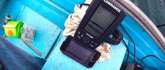
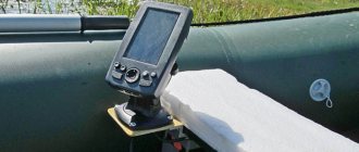
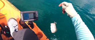
The success of fishing depends on many factors: the level of training of the fisherman himself, his knowledge of the chosen fishing method and the qualified construction of gear for it, fishing conditions, bottom topography and the presence of fish in the reservoir. In this regard, the use of an echo sounder is effective. He quite clearly sees and shows on the screen both the bottom topography and the location of the schools. The main thing remains - to choose an effective bait and catch fish. And here the experience and dexterity of the fisherman is fully demonstrated.
How does an echo sounder work?
These devices were developed in England during the war to track German submarines.
It works as follows: electrical impulses are converted into sound signals and emitted towards the bottom of the reservoir. Reflecting from its surface, they return back and fall on the receiver antennas. Since the signal travel time varies depending on the distance traveled, the bottom topography, various submerged objects, and submerged trees are reflected on the device screen. In the same way, reflection occurs from fish located in the coverage area of the device. They are displayed on the screen as arcs.
The locator screen displays the bottom topography and the fish you are looking for
Since the frequency of the pulses is high, they merge on the screen and represent continuous lines that display the shape of the bottom topography and the objects on it, as well as living objects in the water column.
The frequency most often used in the emitter is 192 kHz. But there are also devices with a parameter of 50 kHz. Both of them correspond to waves in the audible range, but do not have a repellent effect on any living object, including humans and fish.
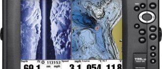
Sonar characteristics
The screen diagonal of the device reaches 4.3 inches. The device is equipped with a GPS navigator to determine location, fix waypoints, and display boat speed. Bottom maps are created by Quickdraw Contours, which can store over 8000 m2.
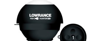
Garmin
Garmin Quickdraw Contours
Quickdraw's own map generation feature is powered by GPS and sonar data. With its help, the contours of the bottom of a reservoir (lake, river, canal) are displayed. Functionality allows you to record in HD format a depth map of the places where the fisherman moves.
Depths
Maps are created independently, that is, you can only observe your own routes with isobaths of 30 cm steps. They can be recorded and stored in the device’s memory. This approach is very convenient, since most standard maps do not reflect the real underwater terrain. High detail of the image allows you to see even the smallest outlines of the bottom, including sunken snags or stones, displaying the depth of occurrence.
Garmin Quickdraw Contours
Garmin Quickdraw Contours software is free. To use the program, you do not need to have any special knowledge. Simplicity lies in the fact that the fisherman practically does not need to do anything. While he is fishing, the software itself creates a map. It is compatible with any Garmin CHIRP or NMEA transducers, HD sonar. If there are several sonars on board, the program automatically selects the optimal device.
Because Quickdraw Contours map information is saved to the memory card, the user can see which areas have already been surveyed and which still need to be completed. You can also see the depth data.
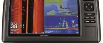
CHIRP Sonar Clarity
The Garmin Striker Plus 4 fish finder confirms the extreme clarity and detail of the image. Clarity sonars are designed using CHIRP technology. This allows for the separation of the smallest targets, like fish from algae, at varying depths (up to 579 m).
The basic sonar transducer operates at four frequencies 50/77/83/200kHz. It provides data transmission not only while trawling, but also while the boat is moving at speeds of up to 30 km/h. CHIRP Sonar Clarity is equipped with a Flasher mode, which is used for ice fishing. At depth, a noise reduction function is available, which allows interpretation of the picture under the boat.
Device setup
The fish is displayed on a bright display in the form of specific symbols.
Information about water temperature, depth, speed, and battery charge level is also available on the screen.
GPS echo sounder
The GARMIN fish finder is equipped with a GPS plotter, but the system does not work based on built-in maps. A highly sensitive sensor displays the coordinates of the boat's location, the marked waypoint (up to 5000 points can be stored in memory), and the speed of movement. Thus, you can adjust the speed of trawling depending on the properties or type of spoon.
Using a GPS receiver with a frequency of 1 Hz, a fisherman can mark various objects as places of successful fishing, piers, docks, pilings, and various objects of interest that are located under water. In addition, the fish finder has the function of recording or creating a route.
Possibility of use
A normal device for this purpose must have four main qualities:
- powerful pulse transmitter,
- an effective device for converting electrical impulses into sound waves,
- reliable device for receiving reflected signals,
- high resolution display.
The Garmin Stryker 4 echo sounders fully possess all of the above qualities.
Increased transmitter power increases the “range” of the device, allowing you to clearly see the image down to great depths.
Displaying the “feed table” on the Garmin fish finder screen
The signal converter must objectively reflect the picture in front of it, but also ensure the display of small details, right down to fish fry. In addition, a sound signal is also provided.
The receiver must distinguish signals of varying strengths and separate even large objects located nearby in a clear image, separating them and transmitting them to the display.
The display must have high resolution in the reflection of vertical pixels and high contrast to display the clearest picture of the underwater world in the area under study. This allows you to fully display the arches of the fish and the structure of the bottom at the location.
Garmin Striker 4 Worldwide
This model is the most popular and easy to use, since it is also equipped with a GPS receiver. The device is controlled from a convenient keyboard. With the Striker 4 echo sounder, searching for fish spots becomes a simple and exciting activity, after which successful fishing becomes a reality. It is possible to remember the necessary slips and docks in order to later return to promising fishing spots. It is possible to change the image scale without interrupting its presentation.
The echo sounder for searching schools of fish is equipped with a CHIRP 77/220 transducer, which increases the clarity of the display of fish and underwater objects.
Unlike other devices for finding fish, Stryker echo sounders are equipped with a fairly powerful GPS receiver, which provides accurate location determination. When scrolling images in the opposite direction, a function is provided to remember the coordinates of promising places.
The design of this echo sounder has many additional functions that increase the usability of the device. For devices sold in Russia, there are instructions for use in Russian, which describe how to properly configure the device and use it effectively.
Garmin Stryker 5 DV
Fish finders with GPS for fishing
The difference between devices of this model is its ability to operate simultaneously at several frequencies when the CHIRP function is turned on. At the same time, the image on the screen becomes clearer with increased clarity of targets.
The DovnVu mode is used to study the structure, bottom topography and nature of bottom vegetation. Using these two functions simultaneously gives an almost photographic image of the bottom.
This sonar model is equipped with a five-inch high-definition screen with a resolution of 800x500 pixels. In its split mode, the GPS sonar can operate simultaneously. In total, the screen can be divided into three windows and simultaneously show pictures using several functions.
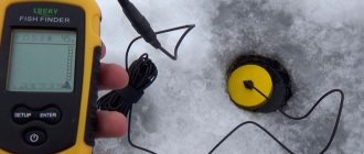
When using the A-Skope function, the device provides a vertical image, while simultaneously using a circular view. A flasher is used when fishing at one fixed point; it is especially convenient for winter fishing.
The built-in GPS receiver allows you to solve navigation problems, as well as determine the speed of movement. The device of this model is endowed with a number of positive qualities, including:
- built-in GPS receiver,
- wide frequency range,
- CHIRP and DOVNVU support.
At the same time, the 5dv/cv series sonars also have certain disadvantages, the main one of which is limited GPS functionality.
Garmin Striker 7sv echo sounder
My acquaintance with the Garmin Striker 7sv structure began with a visit to one of my favorite rivers in the Leningrad region. Having often heard about the wonders of devices of this type, I couldn’t wait to get on the water and see what kind of “beast” this is – side view. Particularly interesting was the simulation mode, which showed Stryker’s abilities even at home. But it’s one thing to watch a pre-recorded “picture” of a house, and quite another to be on a body of water in person.
And now we are on the riverbed and it’s time to see what’s underneath us. I eagerly select the SideVu mode and... nothing. No anomalies are visible, just a “bare” bottom. Suggestions crept in that something needed to be adjusted. But after walking another couple of hundred meters, we saw a stone ridge. This means everything is in order, but the bottom is really empty. The current does its job, preventing underwater vegetation from forming on the clay soil.
And now we had to see the stones to understand that fish-finding technology had really stepped forward. Stryker is direct proof of this. Considering this is the first side-scan fish finder I've tested, the experience was amazing. Using the SideVu mode allows you to see not only what is under you, but also what is on the sides. The time required to survey the water area is significantly reduced, which means more time remains for fishing.
Further, many more different objects were found that rest on the river bottom. Among them are a long-sunk boat, various snags and even an old bridge lying at the bottom of a river that was once flooded when a reservoir was formed. Stryker's detailing is excellent. This could not be done without CHIRP technology (the number of signals sent by the sensor is greater than usual), as well as the ability to work with a frequency of 800 kHz. All this, of course, is very interesting, but we came for fishing!
With side scanning you can fish completely differently. It is when you begin to understand that it is around you, and not just under you, when you can see objects lying separately on the bottom to which fish can be attached, the opportunity opens up to fish not over an area, but in a targeted manner. This device has a very useful function, namely the ability to use the arrow keys to roll back what is seen on the screen and put a dot over the object that we want to catch. Then we simply open the navigation mode, approach this point at a distance of 20-25 meters, make a cast, feel the bite and land the fish. A classic example of working with the SideVu mode in the Garmin Striker 7sv echo sounder.
Another example of side-scanning work is working along long coastal dumps. Walking along the dump, on the screen from the shore we see its structure: depressions and convexities. It is on unusual places, such as bends, that you should concentrate your attention. As a rule, fish stay there.
But before that you need to make a number of simple settings. I can give the following recommendations: 1) contrast by 60-80%; 2) color scheme – copper (you should “play” with the schemes and find the most comfortable one for yourself); 3) automatic scaling (the width of the view will change depending on the depth). It’s worth mentioning separately about the choice of frequency. The 455 kHz frequency makes it possible to work with a wider beam, i.e. You can see further to the sides, but the detail is lower. Typically, primary reconnaissance of the area is carried out at this frequency. When we find something interesting and want to look at it in more detail, we select the frequency of 800 kHz and move closer to the object that interests us.
But they are not united by one side view. There are also useful operating modes. The traditional mode gives us the picture we are used to - this is a classic type of echo sounder, where we determine the bottom topography, as well as the presence of fish in the form of given icons. We usually use this mode when moving from place to place in order to quickly determine the depth, as well as the presence of fish. DownVu mode is a variation of the classic look, but shows an image close to photographic. To more effectively search for fish sites, it is necessary to use several modes at once. Stryker's functionality allows you to do this, namely, combine mode windows on the screen.
Navigation also has its place. In the 7th Striker, as in the younger models of the series, it is possible to track the location of the boat, set points and record tracks. There is no cartography in this series, as well as the ability to download it to the device. Within relatively small bodies of water this does not play a vital role, but when using the device in large water areas it is definitely worth paying attention to models from other series where it is possible to use maps.
Nowadays, side-scan echo sounders are becoming increasingly popular because... open new horizons in fishing. Such devices allow you to better study a body of water, and as a result, consistently catch fish. Garmin Striker 7sv is suitable for those who want a side view, but do not care about the screen size and cartography.
Garmin Stryker 7 DV
These devices are a further and quite logical development of the line of sonars from a well-known and popular manufacturer. Unlike previous models, the GPS device on it works in real time by comparing with actual maps of the area. Thus, the sonar is already a full-fledged chartplotter with all its inherent positive qualities.
The remaining parameters and capabilities of the echo sounder are fully preserved as on the models described above. It should be noted that the Garmin striker 7dv/cv echo sounder is currently one of the most popular, despite the rather sensitive price - about 26,000 rubles in Moscow.
GARMIN STRIKER PLUS 7SV – for those who need side scanning
GARMIN STRIKER PLUS 7SV
You can compare an ordinary echo sounder without a side scanning option with a flashlight that can illuminate only one part of a dark room. If we continue this comparison, then the 7SV model in this case will become a full-fledged lustr.
So, devices of this modification are able to look around. On each side, the viewing range is about 80 meters.
All objects that will be located away from the craft (fish, drops, branches, etc.) can be set as waypoints where they are actually located. And not where the boat is now. This is a key difference from previous versions.
The display size has been increased by two inches. There is a Wi-Fi module, using which you can transfer tracks, points and maps to your friends (provided that the latter’s echo sounders also support Wi-Fi).
Firmware for GARMIN STRIKER PLUS 7SV is also supported via Wi-Fi. Additionally, you can download the Active-Captain application and become a member of the global card exchange network.
Technical specifications:
- Classic echo sounder with two beams, CHIRP technology, 20°/60°, 77-200 kHz. Downward scanning is present. Frequencies 455-800°, viewing range approximately 80 meters. When scanning sideways, the viewing range is up to 80 meters on each side, frequencies 455-800°;
- Power supply at current 12 V – 0.67 A;
- Navigation: frequency 1 Hertz, 5000 waypoints, online creation of depth maps QuickDraw Contours;
- 7-inch color screen with horizontal orientation, resolution 480 by 800 pixels.