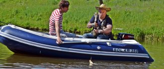
GPS navigators have introduced a lot of new things into the process of fishing. They provide new perspectives and opportunities - to use detailed electronic maps of the area being used, as well as the bottom of reservoirs, rivers and lakes with the designation of shoals, depths, etc., they remember every point of an already laid route.
With their help, you can easily find fish sites and always return to your previous successful fishing spot. Navigators are reliable assistants in extreme situations, helping you return to your starting place or easily get to your destination.
What is a forest navigator
A navigator is a device with a screen on which the user sees a map of the area, and most importantly, the route. Unlike a GPS tracker, a similar electronic device, it not only shows a person’s location, but also plots the optimal path and tells where to go to get to the desired point.
Unlike a car navigator, in a “forest” analogue, manufacturers take into account the conditions in which it has to work - in the forest, in the open air, while fishing, etc. To prevent the device from being damaged by dust, dirt and water, the walking navigator is placed in a particularly durable, dust- and moisture-resistant case.
Advantages of a forest navigator
Navigators are available in almost every smartphone, tablet and other gadgets loaded with various applications. However, people going on long walks are advised to take a separate navigation device with them.
Pros of a GPS navigator:
- chooses the best route itself, rather than asking the user to make a choice;
- even if the navigator runs out of power, you can turn it on again by installing AA batteries;
- provides much more useful information than applications.
There is an opinion that a car navigator is enough for a hike in nature. In fact, they are not suitable for rough terrain, as they are designed for city streets in driving mode.
You can also navigate the area using smartphones or sports watches. But navigators have several important advantages over these gadgets.
Why a forest navigator is better than a smartphone:
- cheaper;
- better withstands vibrations, falls, shocks, and interaction with water, which is important in the forest;
- receives a signal without the Internet and mobile communications, directly from a satellite;
- the memory stores only track descriptions, so it’s easy to find the desired route;
- holds a charge much longer.
What's better than a sports watch:
- cheaper than sports watches with a GPS receiver and map downloads;
- The display is much larger and has a good resolution - you can view maps without any problems.
Note that every year manufacturers offer more and more powerful and advanced devices. Also, the emphasis is on versatility; the same navigator can be used in a variety of situations.
Rating of navigators for the forest
There are many models on sale today for different purposes and tasks. What to choose depends on your personal needs and budget. While one person wants to buy a forest navigator cheaply, another is looking for a multifunctional device from a premium line. Experts in compiling the rating relied on several criteria:
- Supported navigation systems – GPS, GLONASS;
- Housing protection class – resistance to moisture, dust, shock;
- Stability and duration of operation – power supply;
- Display characteristics – size, compactness, picture quality;
- Option to download maps from outside – support connection to PC, Internet;
- Functionality – basic, advanced;
- Memory and processor – memory size, expandability, performance;
- Autonomy – duration of operation without recharging;
- Comfort – size, weight, ergonomics.
Demand indicators and the percentage of positive customer reviews helped us select from several dozen similar devices. Based on this information, it was possible to determine all the strengths and weaknesses of the nominees. The top five products have a price that fully corresponds to their quality and functionality.
The best car GPS navigators
How to choose a navigator for the forest
You have to carry a forest navigator with you, along with all your tourist, hunting or other belongings. Therefore, such devices should be as compact and lightweight as possible. And these are not all the requirements that apply to forest navigators.
How to choose a navigator:
- Navigation systems. The most popular technologies for determining the location of a person are GPS and GLONASS. Most of the navigators entering the market are of a hybrid type - they have both navigation modules installed. This allows you to speed up the reception and transmission of signals. The device, which works only to receive a GPS signal, is economical. But it is less universal, which means that navigators with GPS and GLONASS are preferable. You should also take into account that devices with GPS are recommended for the middle zone and southern regions, and with GLONASS - for the north.
- Display. The larger its diagonal, the more convenient it is to view information and maps. You also need to pay attention to the brightness of the screen, otherwise the user will have difficulty seeing the image under the rays of the scorching sun. A good display has a maximum of dots - this provides a clear picture.
- Protection. The best devices are able to operate correctly in the temperature range: -20...+70°C. It is mandatory to have a waterproof function. The best option is IPX7 protection. Devices with this level of security can be submerged to a meter depth for up to half an hour without any consequences.
- Routes. Note the number of waypoints. The possible range is from 2,000 to 10,000. It is from them that the route is formed. Typically, the number of points stored is 2,000.
- Memory size. The number of maps that can be loaded into the navigator depends on it, as well as on the possibility of its expansion.
- CPU. It determines the performance of the device and the ability to scale.
- Frame. It must withstand mechanical shocks and not allow water and dust to pass through. The device should fit easily into the palm or pocket.
- Battery. The larger the charge reserve, the better for the user. It is convenient if you can insert batteries.
- Control. It may be sensory - convenient and effective, but completely unsuitable for harsh climates with low temperatures. Touch models are only good for ordinary, not extreme travel. For low temperatures, navigators with mechanical buttons are more suitable. Such devices can be operated even with gloves.
- Additional functions. Having a processor and operating system, the navigator is capable of performing various tasks. In addition to navigation and route planning, it is capable of transmitting useful information, saving the last route, determining position relative to sea level, and forecasting the weather.
- Price. It depends on the brand, place of purchase, functionality, and technical parameters. It is important not only to choose a high-quality device, but also not to overpay for unnecessary functions.
There are navigators with color and black and white screens. The first option provides a more pleasant and vibrant picture, the second - more economical battery consumption.
Features of choosing a navigator
Equipment stores and specialized hunting stores offer a wide selection of navigators to suit every taste and budget. However, without understanding the issue, it can be very difficult to choose a truly high-quality device, because many models are distinguished by the presence of additional functions that are often not needed. You will have to pay extra for additional functions, so the navigator can cost a lot of money, although the advanced functionality is not always needed by the hunter.
A properly selected forest navigator will be an excellent pocket assistant that will guide you out of any terrain. In order not to get confused in the wide range of such devices, you should study in detail the criteria by which you need to choose a navigator.
Some functions can be sacrificed for the sake of economy, while a number of features are simply necessary for navigators for forests and fishing.
When choosing a navigator for hunting, you should consider several nuances:
- the device must be equipped with a high-quality communication module for uninterrupted operation and correct route planning;
- the device must be light, compact and reliable;
- The device must have a combined power supply.
A hunting navigator, like any other device of this type, operates based on the GPS protocol. To establish communication with a satellite, the device must be equipped with a high-quality communication module and receiver (antenna). At the same time, the device must be light and compact, because when hunting you have to move a lot and quickly.
There is no need to save money on a navigator for hunting and fishing, but the high cost does not always guarantee that this device will suit a particular person. The fact is that some functions can be safely abandoned without loss of convenience, which will affect the reduction in the cost of this device. To make your choice, it is recommended to carefully familiarize yourself with the main characteristics of the device.
Maps and routes
A good navigator will always easily “build” a map of the area.
The main function of the device is to build a route. The navigator receives location data from a satellite, so the most important criterion is a reliable transmitter and a high-quality, highly sensitive antenna that will pick up the signal even in areas far from settlements.
In addition, the navigator should have the ability to manually plot the route and load maps as needed. However, all modern devices are equipped with such functions.
The best manufacturers
On the world market there are several recognized global manufacturers of navigators - forestry, tourist, for hunters and fishermen, universal. It is their products that meet modern technical requirements and are of high quality.
Which manufacturers can you trust:
- Garmin. This American brand has been a leader in the production of portable navigators for many years. This brand produces devices with different capabilities and prices. The products are distinguished by high autonomy, receiver sensitivity, accuracy and long-term operation. All devices from Garmin are compact, lightweight, shockproof and waterproof, and easily fit in your pocket or palm. And most importantly, they work efficiently all over the world, maintaining communication with at least two dozen satellites.
- Prestigio. An international brand whose production facilities are located in China. The headquarters is located in Cyprus. The brand's products can be found in markets that the leading Garmin brand cannot reach. Navigators from Prestigio are distinguished by wide functionality, compactness, stylish design and very durable housing. The devices are equipped with many options, and their use is comfortable and does not raise any questions. They cost less than analogues from Garmin.
- Lowrance. This is an American brand that supplies navigators to different countries of the world. Its devices are distinguished by their stylish design, high quality and maximum data accuracy. They have a nice and friendly interface and intuitive controls. Another feature of Lowrance navigators is their reliable and completely waterproof housing. That is why the models of this brand are appreciated by fishermen, mushroom pickers, tourists and everyone who has to get caught in the rain or overcome water obstacles.
Lowrance iFinder H20
This 12-channel device is able to please the user with good functionality and ease of use, similar in popularity to Magellans. The device's display differs from other models in its amazing image clarity and high contrast.
2 inexpensive AA batteries can power the device for 12 hours. You can use both disposable products and rechargeable batteries.
The electronic part of the device is at a high level, it is possible to update the firmware and communicate with a computer. There is also a built-in world map.
All data that the device records can be transferred to an SD or MMC drive. 99 routes can be stored in the navigator's memory.
The best case of the device is completely waterproof and has a high degree of protection (IPX7). You can safely take it with you both into a dense forest, and to rivers or lakes.
For fishermen or hunters by car there is an additional advantage. The device comes with a charging cable via the cigarette lighter.
Lowrance iFinder H20 belongs to the middle class of devices for hunting and fishing, which is why its pricing starts from 9,500 rubles. The navigator does not take up much space, has a long battery life, and also provides the user with maximum useful information.
The best inexpensive navigators for the forest
Budget navigators cost no more than 10-12 thousand rubles. They are equipped with all the necessary functions for which they are purchased. Suitable for short trips. The target audience is mushroom pickers and people who go out into nature for a short time.
Magellan SporTrak Map
This is a small navigator with a monochrome LCD display, an internal antenna, a waterproof case and a 12-channel GPS receiver. There is WAAS support, thanks to which the device works in any area. Can be powered by two batteries. Duration of work - 14 hours.
The device is equipped with a built-in map, and if necessary, you can load an electronic map of the area into it. It has a travel log capacity of 2,000 points. The navigator is supplied with a CD with software, cable, strap, two AA batteries and instructions.
Main parameters:
- number of routes - 20;
- number of waypoints - 500;
- display size - 3.6x5.8 cm;
- screen resolution - 104x160 pixels;
- built-in memory - 8 MB;
- dimensions - 56x142x30 mm;
- weight - 172 g;
- operating temperature range - from -10°С to +60°С.
Pros:
- there is a sound alarm;
- does not sink;
- there is a calculator for fishermen;
- there is a lunar calendar;
- sensitive receiver;
- a large number of points;
- good level of protection;
- Russified interface.
This device has one drawback - it requires individual configuration.
Price: from 11,500 rubles.
Garmin eTrex 10
Portable universal navigator with a black and white LCD screen, GLONASS navigation system and waterproof housing. Garmin software is installed and there is WAAS support. Powered by a pair of AA batteries. Recommended for fishermen and those who like to walk in the forest.
The capacity of the travel log is 10,000 points. There is a built-in map, display backlight and Track-Back function - writes an echogram of the places passed. An internal antenna is used. Operating time: 25 hours. Supplied with USB cable and user manual.
Main parameters:
- number of routes - 50;
- number of waypoints - 1000;
- display size - 3.6x4.3 cm;
- screen resolution - 128x240 pixels;
- built-in memory - 2.8 MB;
- dimensions - 54x103x33 mm;
- weight - 142 g;
- operating temperature range - from -20°С to +70°С.
Pros:
- easy;
- supports Micro SD memory cards;
- wide range of operating temperatures;
- there is technology for active and passive screens - the display provides a high-quality image in any lighting;
- high level of autonomy;
- sensitive receiver.
The downside is the small display.
Price: from 9,500 rubles.
Garmin Montana 600
Universal travel navigator with a 4-inch color LCD screen, waterproof housing and Garmin software. There is a built-in map and the ability to download a map of the area. The device itself calculates the route and sends voice messages.
The screen here is touch-sensitive, the antenna type is internal. The capacity of the travel log is 10,000 points. Duration of work - 16 hours. Complete with compass and barometer.
Main parameters:
- number of routes - 200;
- number of waypoints - 2,000;
- display size - 5.06x8.93 cm;
- screen resolution - 272x480 pixels;
- built-in memory - 3 MB;
- dimensions -75x144x36 mm;
- weight - 289 g;
- operating temperature range - from -20°С to +60°С.
Pros:
- gives sound signals;
- Supports Micro SD memory card;
- good battery capacity;
- color screen.
Minuses:
- There are glares on the protective glass in sunny weather;
- quite heavy weight.
Price: from 6,500 rubles.
Bushnell Backtrack Original
This is the most primitive universal navigator with a black and white LCD display. One of the simplest and cheapest forest devices, which is also called a returner for mushroom pickers. The device is powered by AAA batteries. There is a Track-Back function.
The navigator is equipped with an internal antenna, a digital magnetic compass with self-calibration and a highly sensitive GPS receiver. The case is waterproof. Works without interruption - 20 hours. Designed for mushroom pickers.
Main parameters:
- dimensions - 64x80x19 mm;
- weight - 68 g;
- operating temperature range - from -10°С to +60°С.
Pros:
- there is a display backlight;
- simple controls;
- auto shut-off function;
- high level of autonomy.
The downside is glare on the screen.
Price: from 5,500 rubles.
The best mid-price models
The mid-price category includes forest navigators costing up to 20,000 rubles. These models are distinguished by wide functionality and a large amount of memory, which allows you to load a large number of maps. They are ideal for mushroom pickers, hunters, and lovers of hiking in the forest.
Garmin GPSMAP 64s
Universal navigator with a 2.6-inch color display and a waterproof housing. It uses Garmin software, the GLONASS navigation system and has memory expansion capabilities - Micro SD cards are supported. Powered by AA batteries.
It provides for loading a map of the area, there is a route calculation function, and you can use raster maps. There is a Track-Back function, support for EGNOS and WAAS. The antenna in this device is external. Duration of work - 16 hours.
WAAS is a global differential correction system, and EGNOS is a European geostationary navigation coverage service that improves GPS performance.
Main parameters:
- number of routes - 200;
- number of waypoints - 5,000;
- display size - 3.4x4.2 cm;
- screen resolution - 160x240 pixels;
- built-in memory - 4 GB;
- dimensions - 61x160x36 mm;
- weight - 230 g;
- operating temperature range - from -20°С to +60°С.
Here is a very detailed video review of this navigator due to its necessity and optimality
Pros:
- there is Bluetooth;
- can be powered by a cigarette lighter;
- there is a multimedia function, photo viewing;
- you can connect an external 12V power source;
- battery charging is provided.
Disadvantage: overpriced.
Price: from 19,500 rubles.
Garmin eTrex 32x
This universal navigator has a 2.2-inch color display and software from Garmin. Navigation system - GLONASS. The housing is impervious to water and dust. Here you can download terrain maps and you can use raster maps. The antenna is internal.
Like the previous model, there is Track-Back, support for EGNOS and WAAS, photo viewing, and a multimedia function. Duration of work - 25 hours. Powered by two batteries.
Main parameters:
- number of routes - 200;
- number of waypoints - 2,000;
- display size - 3.5x4.4 cm;
- screen resolution - 240x320 pixels;
- built-in memory - 8 GB;
- dimensions - 54x103x33 mm;
- weight - 142 g;
- operating temperature range - from -20°С to +70°С.
Pros:
- support for Micro SD memory cards;
- a sound alarm is provided;
- There is a stopwatch, a calculator, information about the moon and the sun, a tide table, and an alarm clock.
The downside is that fingerprints remain on the screen.
Price: from 24,000 rubles.
Garmin eTrex Touch 35
Portable navigator with 2.6-inch touch screen. It has a water-resistant case and a color screen. The device supports the GLONASS navigation system and Garmin software.
The device has a large amount of memory, which can be expanded using a card. This navigator supports multimedia and you can view photos.
Main parameters:
- number of routes - 200;
- number of waypoints - 4,000;
- display size - 3.6x5.5 cm;
- screen resolution - 160x240 pixels;
- built-in memory - 8 GB;
- dimensions - 58x102x33 mm;
- weight - 159 g;
- operating temperature range - from -20°С to +70°С.
Pros:
- receives messages from a smartphone;
- wireless data exchange;
- good autonomy;
- sensitive sensor;
- good readability in the sun.
The downside is that the resolution is not high enough.
Price: from 30,000 rubles.
Lowrance Endura Out&Back
Compact, universal-purpose navigator with a 2.7-inch color LCD screen. It has almost all the features that are typical for a premium level, but it costs much less. Except that it has fewer waypoints and routes than its more expensive counterparts.
The capacity of the travel log is quite decent - 4,000 points. There is support for WAAS and EGNOS. The controls here are touch-sensitive, the number of receiver channels is 42. The antenna is of an internal type. Duration of work - 15 hours. Powered by two batteries.
This portable navigator is simple and powerful at the same time, it has a built-in map and you can download local maps. There is also a Track-Back function.
Main parameters:
- number of routes - 100;
- number of waypoints - 1,000;
- display size - 2.7 inches;
- screen resolution - 320x240 pixels;
- built-in memory - 4 GB;
- dimensions - 60x130x31 mm;
- weight - 165 g;
- operating temperature range - from -20°С to +70°С.
Pros:
- viewing photos;
- Micro SD memory card;
- high-quality waterproof case;
- protection from dust and shock;
- sound signal;
- powerful processor;
- quickly finds satellites and does not lose contact with them;
- works well in any conditions, including under tree canopies;
- Can be immersed in water to a depth of 1 m without any consequences.
This universal navigator has no shortcomings; it is ideal for forests, fishing, and hiking.
Price: from 15,000 rubles.
TOP 10 best navigators for hunting
When choosing a navigator, you should not rely on the competence of the consultant; he can advise you on those models that the store is interested in selling. And, as a rule, they suggest taking the most expensive and “sophisticated” versions. In fact, the hunter does not need many of the options available in expensive devices.
It is better to trust the choice of a navigator to yourself, having understood the functionality and technical characteristics of these devices. Next are the best navigators for hunters with brief descriptions, main parameters, pros and cons.
Garmin Foretrex 701
Universal wrist-type navigator with a small monochrome display. Supports GPS, GLONASS and Galileo satellites, as well as Bluetooth wireless communication interface. The proprietary software of the manufacturer Garmin is used here. The device is powered by AA batteries. Operating time – 48 hours.
This small navigator has an internal antenna and has all the functionality necessary for comfortable operation. Includes a Velcro strap and a USB cable. The device can perform ballistic calculations, measure height and area, and receive notifications from a smartphone.
Main parameters:
- display diagonal: 2 inches;
- resolution: 200×128 pixels;
- number of waypoints: 500;
- number of routes: 20;
- dimensions (WxHxD): 74x43x23 mm;
- weight: 88 g.
Pros:
- ease of use - thanks to the wrist strap;
- high level of water resistance;
- screen backlight;
- barometer and magnetic compass;
- large reserve of autonomy;
- light weight;
- works with Jumpmaster (application for skydivers);
- reliable - receives signals from three satellite systems at once.
Minuses:
- screen size is smaller than most navigators;
- a small number of waypoints and routes;
- high price.
Price: from 59,000 rubles.
Garmin Montana 680t
Portable universal navigator with a 4-inch color touch display. Here, in addition to GPS, GLONASS support is provided and there is proprietary Garmin software. The device has 8 GB of memory and it is possible to expand the storage using a micro SD card. Powered by battery or cigarette lighter.
The navigator has a built-in map, a function for downloading an area map, calculating the optimal route and other options. EGNOS and WAAS technologies are supported. The antenna here is internal, but there is a connector for an external version. Opening hours: 16 hours.
Main parameters:
- display diagonal: 4 inches;
- resolution: 272×480 pixels;
- number of waypoints: 4000;
- number of routes: 200;
- dimensions (WxHxD): 144x75x36 mm;
- weight: 333 g.
Pros:
- very large screen compared to other navigators;
- durable and waterproof housing;
- possibility of using raster maps;
- There is a voice message function and sound alarm;
- you can view photos;
- there is a barometer and a magnetic compass;
- there is a headphone jack;
- you can work with gloves;
- there is a built-in 8 megapixel camera;
- there is a hunting and fishing calendar, information about the moon and sun, a timer, an alarm clock and other options.
There are no downsides to this model so far, except for its cost - many users will find it too high.
Price: from 53,500 rubles.
Garmin GPSMAP 64st
Portable GPS navigator with 2.6-inch color display, Garmin software and GLONASS support. Screen size – 3.6×5.5 cm. The device supports Bluetooth, has a durable waterproof case and an external antenna. It has 8 GB of internal memory and micro SD support.
The device has a built-in map, loading area maps, and route calculation. It is equipped with a trip computer and Track-Back function. There is support for WAAS and EGNOS. Operating time – 16 hours. Supplied with a USB cable. Can be powered by a cigarette lighter.
Main parameters:
- display diagonal: 2.6 inches;
- resolution: 160×240 pixels;
- number of waypoints: 5000;
- number of routes: 200;
- dimensions (WxHxD): 61x160x36 mm;
- weight: 230 g.
Pros:
- support for wireless interfaces;
- high level of brightness - comfortable to look at the sun;
- quickly searches for satellites;
- there is a sound alarm;
- there is a barometer and a magnetic compass;
- there is a carabiner for fastening;
- many additional functions - information about the area, a calendar, information about the phases of the moon and much more.
Minuses:
- there are complaints about low autonomy - this can be solved with spare batteries;
- low screen resolution.
Price: 37,000 rubles.
Garmin eTrex Touch 25
This universal GPS navigator has a 3.6x5.5 color touchscreen display, supports GLONASS and runs on Garmin software. The device has 4 GB of internal memory and micro SD card support. Powered by AA batteries.
The navigator has a built-in map; you can load maps of the area and calculate the optimal route. The device has an internal antenna and wide functionality typical of the best GPS navigators. Operating time – 16 hours. Supplied with a USB cable.
Main parameters:
- display diagonal: 2.6 inches;
- resolution: 160×240 pixels;
- number of waypoints: 4000;
- number of routes: 200;
- dimensions (WxHxD): 58x102x33 mm;
- weight: 159 g
Pros:
- high-quality touch screen;
- shockproof and waterproof housing;
- there is a barometer and a magnetic compass;
- pre-installed maps of Russia TOPO.
Minuses:
- a number of functions are supported only by subscription;
- the sensor does not work well in the cold;
- Slow loading of maps.
Price: 28,000 rubles.
Garmin GPS 73
Universal navigator with black and white display and Garmin software. There is 1 MB of built-in memory. The device is powered by AA batteries. Can be recharged from a car cigarette lighter. There is a trip computer and Track-Back function. Screen size – 3.6×5.4 cm.
There is support for EGNOS and WAAS technologies, which provide high location accuracy. An internal antenna is used. Duration of work – 18 hours. Possible power supply from an external 12 V source.
Main parameters:
- display diagonal: 2.6 inches;
- resolution: 128x160 pixels;
- number of waypoints: 1000;
- number of routes: 50;
- dimensions (WxHxD): 53x117x33 mm;
- weight: 164 g.
Pros:
- there is a sound alarm;
- simple menu and controls;
- Suitable for different purposes.
Minuses:
- low image quality;
- limited autonomy.
Price: 22,500 rubles.
BHCnav NAVA Pro F70
Universal navigator with color LCD screen. Supports GPS and GLONASS. The device has 4 GB of memory and supports micro SD. The device is powered by regular AA batteries. There is a built-in map. The SiRFstar III processor is installed and there is WAAS support.
The device has an internal antenna and a waterproof housing. A USB cable is included with the navigator.
This navigator is considered the best for use in extreme conditions.
Main parameters:
- display diagonal: 2.8 inches;
- resolution: 240×320 pixels;
- number of waypoints: 3000;
- number of routes: 200;
- dimensions (WxHxD): 62x129x36 mm;
- weight: 197 g
Pros:
- fast hot start – 2 s;
- screen backlight;
- the ability to install detailed topographic maps;
- thermometer, barometer and magnetic compass;
- high sensitivity and reliable signal reception;
- can be dropped into water without any consequences;
- relatively large screen.
Minuses:
- not the best autonomy;
- somewhat overpriced.
Price: 20,000 rubles.
Magellan Triton 1500
A universal navigator with a color touch screen and a high class of dust and moisture protection. Can work with internal and external antennas (there is a connector). This device has 64 MB of memory and can be expanded. The device is powered by AA batteries. Operating time – 10 hours.
The navigator has a twenty-channel SiRF Star III receiver, which provides navigation accuracy up to 7 m. The use of EGNOS and WAAS technologies increases accuracy up to 3 m. The navigator has a built-in map and route calculation. The hot/cold start time is 20/120 s.
Main parameters:
- display diagonal: 2.7 inches;
- resolution: 320×240 pixels;
- number of waypoints: 2000;
- number of routes: 40;
- dimensions (WxHxD): 63x146x29 mm;
- weight: 227 g
Pros:
- there are no restrictions on the number of cards used;
- suitable for use in extreme weather conditions;
- works with raster maps;
- there are multimedia functions - MP3 player and voice recorder;
- can be installed on a special mount to secure it to the handlebars of a bicycle;
- durable and waterproof housing;
- high sensitivity and stable signal reception.
Minuses:
- uses up charge too quickly;
- menu is not clear enough;
- Not enough brightness in the sun.
Price: 19,000 rubles.
Garmin GPSMAP 62s
A universal navigator with a color LCD screen, an external antenna and a waterproof housing. It has proprietary Garmin software and 1.7 GB of memory. The device has a built-in map, it is possible to download a map of the area and use raster maps.
The navigator itself calculates the optimal route from a given point to the final point. The device is powered by AA batteries or a cigarette lighter. There is a Track-Back function, support for WAAS and EGNOS (global correction systems). Duration of work – 20 hours.
In addition to maps, the device has a camera, barometer, compass and autofocus.
Main parameters:
- display diagonal: 2.6 inches;
- resolution: 160×240 pixels;
- number of waypoints: 2000;
- number of routes: 200;
- dimensions (WxHxD): 61x160x36 mm;
- weight: 222 g.
Pros:
- sound alarm;
- possibility of charging batteries;
- many additional functions - there is a hunting and fishing calendar, information about the sun and moon, area calculation and others;
- Comes with a carabiner for fastening;
- reliable body.
Minuses:
- there are slowdowns during work;
- no sensor – control is carried out via touchscreen.
Price: 18,500 rubles.
Garmin eTrex 20x
A small universal navigator with a 2.2-inch color display and software from Garmin. There is 3.7 GB of memory and it can be expanded using a memory card. The device has an internal antenna and GLONASS support. Power comes from AA batteries.
The device has built-in maps, you can load maps of the area into it, and it calculates the route itself. There is all the necessary functionality - from a trip computer to Track-Back, as well as support for EGNOS and WAAS. Operating time – 25 hours. USB cable included.
Main parameters:
- display diagonal: 2.2 inches;
- resolution: 240×320 pixels;
- number of waypoints: 2000;
- number of routes: 200;
- dimensions (WxHxD): 54x103x33 mm;
- weight: 142 g.
Pros:
- light and compact;
- reliable;
- large amount of memory;
- Receives signals well from GPS and GLONASS satellites;
- you can view photos;
- downloads satellite images;
- The map “Roads of Russia” is preinstalled.
Minuses:
- small screen;
- low performance – responds slowly to changes in scale;
- no button lock.
Price: 16,000 rubles.
Garmin eTrex 10
A universal inexpensive navigator with a black and white LCD display, support for GPS and GLONASS, and Garmin software. It has a built-in map, Track-Back function, screen backlight and internal antenna.
You can expand the memory using a micro SD memory card. The device is powered by AA batteries. Duration of work – 25 hours. There is a USB connector. The device has a durable and waterproof case, and comes with a USB cable.
Main parameters:
- display diagonal: 2.2 inches;
- resolution: 128×240 pixels;
- number of waypoints: 1000;
- number of routes: 50;
- dimensions (WxHxD): 54x103x33 mm;
- weight: 142 g.
Pros:
- holds a charge for a long time;
- supports two satellite systems;
- compact and lightweight;
- reliable case;
- price.
Minuses:
- small screen – 3.6×4.3 cm;
- the screen is not touchscreen;
- the menu is not clear enough - instructions are needed;
- The joystick stands out from the body very much, because of this, spontaneous pressing occurs in the pocket (there is no pressing blocking).
Price: 9,000 rubles.
The best premium forest navigators
Models in the highest price category cost more than 20,000 rubles and are distinguished by a particularly high-quality body, increased antenna sensitivity and wide functionality. These are the types of navigators that are taken on multi-day hikes - they are reliable and hold a charge for a long time.
Garmin GPSMAP 66st
Premium universal GPS navigator with a color 3-inch LCD display and support for GLONASS and Galileo systems. The software is from Garmin. Powered by batteries or cigarette lighter. The antenna is external.
There are all the functions typical of premium navigators - from Track-Back to route calculation. There is support for EGNOS and WAAS. Duration of work - 16 hours. Comes with a USB cable. Powered by two batteries, but you can connect an external power source.
Main parameters:
- number of routes - 250;
- number of waypoints - 10,000;
- display size - 3 inches (7.6 cm);
- screen resolution - 240x400 pixels;
- built-in memory - 16 GB;
- dimensions - 58x102x33 mm;
- weight - 230 g;
- operating temperature range - from -20°С to +70°С.
Pros:
- supports Wi-Fi and Bluetooth;
- high level of protection against water;
- you can connect additional sensors using the ANT+ protocol;
- receives notifications from a smartphone;
- photo viewing and multimedia function;
- there is a connector for an external antenna;
- there is a barometer and a magnetic compass;
- access to satellite images from the BirdsEye service;
- built-in LED flashlight;
- SOS beacon and many other functions;
- shows exactly the way back.
Cons: crude software and overpriced.
Price: from 40,000 rubles.
BHCnav Pro F78
Universal premium navigator with a 2.8-inch color display. There is support for GLONASS and WAAS. Power is supplied from batteries. The device calculates the route itself, and you can download maps of the area. External type antenna. The receiver has 72 channels.
The navigator runs on two batteries. Duration of work - 15 hours. The memory is expandable by installing Micro SD.
Main parameters:
- number of routes - 200;
- number of waypoints - 3,000;
- display size - 2.8 inches;
- screen resolution - 240x320 pixels;
- built-in memory - 4 GB;
- dimensions - 62x173x36 mm;
- weight - 197 g;
- operating temperature range - from -20°С to +70°С.
Pros:
- fast start, hot start is only 2 s;
- there is a magnetic compass, thermometer, barometer;
- stable signal reception;
- high antenna sensitivity.
The downside is that the screen brightness is insufficient.
Price: from 25,000 rubles.
Navily
Price: Free for Android and IOS (in-app purchase)
Navily is TripAdvisor's European shipping guide in French, Spanish, German and Italian. Its main feature is a fairly detailed description of anchorages, piers, information about methods of protection from the wind, types of anchorage and much more. Including reviews and photos updated by community users are the hallmark of this application. Only with Navily has the process of booking a berth at partner marinas in more than 10 countries become accessible and easier to use than ever before. Other features include calculating the cost of one night for your boat at any time of the year, 24/7 access to customer service directly from the app, and the ability to create a detailed itinerary for your next trips.