Prefecture of Japan
"Kanagawa" redirects here. For other uses, see Kanagawa (disambiguation).
Not to be confused with Kanazawa, the main city of Ishikawa Prefecture, and not to be confused with Kagawa Prefecture.
Prefecture in Kanto, Japan
| Kanagawa Prefecture 神奈川県 | |
| Prefecture | |
| Japanese transcription(s) | |
| • Japanese | 神奈川県 |
| • Romaji | Kanagawa-ken |
| Flag Symbol | |
| Coordinates: 35°26′51.03″N 139°38′32.44″E / 35.4475083°N 139.6423444°E / 35.4475083; 139.6423444 Coordinates: 35°26′51.03″N 139°38′32.44″E / 35.4475083°N 139.6423444°E / 35.4475083; 139.6423444 | |
| A country | Japan |
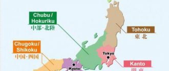
| Region | Kanto |
| Island | Honshu |
| Capital | Yokohama |
| Divisions | Districts: 6, Municipalities: 33 |
| Government | |
| • Governor | Yuji Kuroiwa (since April 2011) |
| Square | |
| • Total | 2,415.83 km 2 (932.76 sq mi) |
| Area Rank | 43rd |
| population (October 1, 2015) | |
| • Total | 9 058 094 |
| • Rank | 2nd |
| • Density | 3,770/km2 (9,800/sq mi) |
| ISO 3166 code | JP-14 |
| Web site | www.pref.kanagawa.jp |
| Symbols | |
| Bird | Common gull ( Larus canus ) |
| Flower | Golden lily ( Lilium auratum ) |
| Tree | Ginkgo ( Ginkgo biloba ) |
Kanagawa Prefectural Office Yokohama Minato Mirai 21, Yokohama The Great Wave off Kanagawa
original print
Kanagawa Prefecture
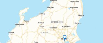
(神奈川県, Kanagawa-ken) is a prefecture of Japan located in the Kanto region of Honshu. Kanagawa Prefecture is the second most populous prefecture in Japan with a population of 9,058,094 (October 1, 2015) and has a geographic area of 2,415 km 2 (932 sq mi). Kanagawa Prefecture borders Tokyo to the north, Yamanashi Prefecture to the northwest, and Shizuoka Prefecture to the west.
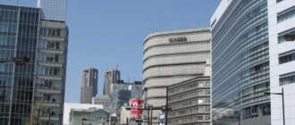
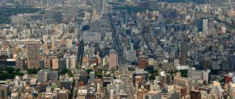
Yokohama is the capital and largest city of Kanagawa Prefecture and the second largest city in Japan, along with other major cities including Kawasaki, Sagamihara and Fujisawa. Kanagawa Prefecture is located on the eastern Pacific coast of Japan, in Tokyo Bay and Sagami Bay, separated by the Miura Peninsula, opposite Chiba Prefecture on the Boso Peninsula. Kanagawa Prefecture is part of Greater Tokyo, the most populous metropolitan area in the world, with Yokohama and many of its cities being major shopping centers and southern suburbs of Tokyo. Kanagawa Prefecture was the political and economic center of Japan during the Kamakura period, when Kamakura was de facto
the capital and largest city of Japan as the seat of the Kamakura shogunate from 1185 to 1333. Kanagawa Prefecture is a popular tourist area in the Tokyo area. Kamakura and Hakone are two popular travel destinations.
Content
- 1. History
- 2 Geography 2.1 Topography
- 2.2 Cities
- 2.3 Cities and villages
- 2.4 Mergers
- 4.1 Railways
- 5.1 University facilities
- 6.1 Facilities 6.1.1 Football and athletics
- 6.2.1 Football (soccer)
Story
See also: Historic Sites of Kanagawa Prefecture
The prefecture has several archaeological sites dating back to the Jomon period (circa 400 BC). About 3,000 years ago, Mount Hakone experienced a volcanic explosion that created Lake Ashi in the western part of the prefecture.
The Yamato dynasty is believed to have ruled the area since the 5th century. In ancient times its plains were very sparsely populated.
In medieval Japan, Kanagawa was part of the provinces of Sagami and Musashi. Kamakura, in the center of Sagami, was the capital of Japan during the Kamakura period (1185–1333).
During the Edo period, the western part of Soshu Province was governed by daimyo
from Odawara Castle, while the eastern part was directly governed by the Tokugawa shogunate in Edo (modern Tokyo).
Commodore Matthew Perry landed at Kanagawa in 1853 and 1854 and signed the Kanagawa Convention to force the opening of Japanese ports to the United States. Yokohama, the largest deep-water port in Tokyo Bay, was opened to foreign traders in 1859 after several more years of foreign pressure and eventually grew into the largest trading port in Japan. Nearby Yokosuka, closer to the mouth of Tokyo Bay, has developed into a naval port and currently serves as the headquarters of the US 7th Fleet and the Japanese Self-Defense Forces fleet. After the Meiji period, many foreigners lived in the city of Yokohama and visited Hakone. The Meiji government developed the first railways in Japan, from Shinbashi (in Tokyo) to Yokohama in 1872.
The epicenter of the Great Kanto Earthquake of 1923 was located deep beneath the island of Izu Oshima in Sagami Bay. It devastated Tokyo, the port city of Yokohama, the surrounding prefectures of Chiba, Kanagawa and Shizuoka, and caused extensive damage throughout the Kanto region. The sea retreated as much as 400 meters from the shore at Cape Manazuru, and then rushed back towards the shore in the form of a large wall of water that flooded Mitsuishi-shima. In Kamakura, the total death toll from the earthquake, tsunami and fire exceeded 2,000. In Odawara, ninety percent of the buildings immediately collapsed, and subsequent fires burned the rubble along with whatever remained intact.
Yokohama, Kawasaki and other major cities were heavily damaged by US bombing in 1945. The total losses amounted to more than several thousand people. After the war, General Douglas MacArthur, Supreme Allied Commander for the Occupation of Japan, landed at Kanagawa and then moved to other areas. US military bases still remain in Kanagawa, including Camp Zama (Army), Yokosuka Naval Base, Naval Air Atsugi (Navy).
In 1945, Kanagawa was Japan's 15th most populous prefecture, with a population of approximately 1.9 million. In the post-war years, the prefecture underwent rapid urbanization as part of Greater Tokyo. The population as of September 1, 2014 is estimated at 9.1 million. Kanagawa became the second most populous prefecture in 2006.
Notes[edit]
- Nussbaum, Louis-Frédéric. (2005). "Kanagawa" in The Japanese Encyclopedia , page 466
, page 466, on Google Books;
"Kanto" on page 479
, page 479, in Google Books. - Nussbaum, "Yokohama" in pp. 1054-1055
, p. 154, in Google Books. - Nussbaum, "Provinces and Prefectures" at p. 466
, p. 466, in Google Books. - Hammer, Joshua. (2006).Yokohama Burning: The Deadly 1923 Earthquake and Fire That Helped Pave the Way to World War II , p.
278 , page 278, in Google Books. - Jump up
↑ Hammer,
pp.
114–115 , p. 114, at Google Books. - Hammer, pp. 115-116
, p. 115, at Google Books. - Hammer, page 113
, page 113, in Google Books. - 神奈川県人口統計調査公表資料(Report). 2014. Archived October 13, 2014.
- ^ a b c d
Relief of Kanagawa (in Japanese) (Translate into English: Google, Bing) - ^ a b c
Overview of the prefecture's geography (in Japanese) (English translation: Google, Bing) - "General overview of nature park area indicators by prefecture" (PDF). Ministry of Environment. Archived from the original on April 21, 2012 (PDF). Retrieved August 16, 2012.
- Statistics Bureau of Japan
- "Friendly/kinship ties of Kanagawa Prefecture and municipalities: Kanagawa". Kanagawa Prefectural Government. February 1, 2021. Archived from the original on July 19, 2021. Retrieved July 17, 2021.
- "Memorándum de Entendimiento entre el Estado de Aguascalientes, de los Estados Unidos Mexicanos, y el Gobierno de la Prefectura de Kanagawa, Japan" (PDF). Archived (PDF) from the original on 2017-12-04. Retrieved December 4, 2021.
Geography
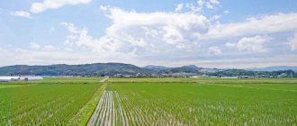
Kanagawa is a relatively small prefecture located in the southeastern corner of the Kanto Plain, sandwiched between Tokyo to the north, the foothills of Mount Fuji to the northwest, and Sagami Bay and Tokyo Bay to the south and east. The eastern part of the prefecture is relatively flat and heavily urbanized, including the major port cities of Yokohama and Kawasaki.
The southeastern region near the Miura Peninsula is less urbanized, with the ancient city of Kamakura attracting tourists to temples and shrines. The western part, bordering Yamanashi Prefecture and Shizuoka Prefecture to the west, is more mountainous and includes resort areas such as Odawara and Hakone. The territory, stretching 80 kilometers (50 mi) from west to east and 60 kilometers (37 mi) from north to south, contains 2,400 square kilometers (930 sq mi) of land, accounting for 0.64% of Japan's total land area.
As of April 1, 2012, 23% of the prefecture's total area was dedicated to nature parks, namely Fuji-Hakone-Izu National Park; Tanzawa-Oyama Quasi-National Park; and nature parks of Jinba Sagamiko, Manazuru Hanto, Okuyugawara and Tanzawa-Oyama prefectures.
Topography
Topographically, the prefecture consists of three distinct regions. The mountainous western region contains the Tanzawa mountain range and the Hakone volcano. The hilly eastern region is characterized by the Tama Hills and the Miura Peninsula. The central region, which surrounds the Tama Hills and Miura Peninsula, consists of flat terraced streams and marginal lands around major rivers including the Soshu River, Sakai River, Tsurumi River, and Tama River.
The Tama River forms most of the border between Kanagawa and Tokyo. The Sagami River flows through the middle of the prefecture. In the western region, the Sakawa River (river) flows through a small lowland, the Sakawa Lowland, between the Hakone Volcano to the west and the Kiso Hills to the east, and flows into Sagami Bay.
The Tanzawa Mountain Range, part of the Kanto Range, contains Mount Hiru (1,673 m or 5,489 ft), the highest peak in the prefecture. Other mountains measuring similar mid-range heights: Mount Hinokiboramaru (1601 m or 5253 ft), Mount Tanzawa (1567 m or 5141 ft), Mount Ōmuro (1588 m or 5210 ft), Mount Himetsugi (1433 m or 4701 ft), and Mount Wusu (1,460 m or 4,790 ft). To the south, the mountain range is lower in elevation and leads to the Hadano Basin and the Kiso Hills. At the eastern foothills of the mountain range is the Isehara Plateau, and across the Sagami River is the Sagamino Plateau.
Cities
See also: List of cities in Kanagawa Prefecture by population
Map of Kanagawa Prefecture Government Decree Places City Town Town Village
Nineteen cities are located in Kanagawa Prefecture.
- Atsugi
- Ayase
- Chigasaki
- Ebina
- Fujisawa
- Hadano
- Hiratsuka
- Isehara
- Kamakura
- Kawasaki
- Minamiashigara
- Miura
- Odawara
- Sagamihara
- Yamato
- Yokohama (capital)
- Yokosuka
- Zama
- Zushi
Cities and villages
Kanagawa Prefectural Office
These are the towns and villages in each district:
|
|
Mergers
Main article: List of mergers in Kanagawa Prefecture
What to visit in Kanagawa
- Lake Asi. Beautiful views and pirate ship cruises will captivate any tourist. And on a clear day, it also offers incredible views of the great Mount Fuji. The Hakone Temple next to the lake deserves special attention.
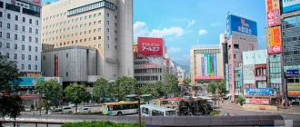
- Minato Mirai. The heart of the port city of Yokohama. Colorful night views, a huge number of museums dedicated to art, culture and history, gourmet dishes from around the world - there is something special for every visitor.
- Yokohama Chinatown. Little China in Japan. One of the largest Chinatowns in Japan, there are more than 300 Chinese shops and restaurants. Try delicious food, buy souvenirs, admire the colorful gates or visit a traditional temple. And try not to miss one of the local festivals.
- Great Buddha in Kamakura. The second tallest bronze Buddha in Japan, standing over 1.8 meters tall. You can visit not only next to him, but also look into the middle of the Buddha himself. I wonder what exactly you will find there?
Transport
Historical population
| Year | Pop. | ±% per annum |
| 1890 | 979 756 | — |
| 1903 | 1 051 433 | + 0,54% |
| 1913 | 1,228,254 | + 1,57% |
| 1920 | 1,323,390 | + 1,07% |
| 1925 | 1,416,792 | + 1,37% |
| 1930 | 1,619,606 | + 2,71% |
| 1935 | 1,840,005 | + 2,58% |
| 1940 | 2 188 974 | + 3,53% |
| 1945 | 1,865,667 | −3,15% |
| 1950 | 2 487 665 | + 5,92% |
| 1955 | 2 919 497 | + 3,25% |
| 1960 | 3 443 176 | + 3,35% |
| 1965 | 4 430 743 | + 5,17% |
| 1970 | 5 472 247 | + 4,31% |
| 1975 | 6 397 748 | + 3,17% |
| 1980 | 6 924 348 | + 1,59% |
| 1985 | 7 431 974 | + 1,43% |
| 1990 | 7 980 391 | + 1,43% |
| 1995 | 8 245 900 | + 0,66% |
| 2000 | 8 489 974 | + 0,59% |
| 2005 | 8,791,597 | + 0,70% |
| 2010 | 9 048 331 | + 0,58% |
| 2015 | 9 058 094 | + 0,02% |
| source: | ||
Kanagawa's transportation network is strongly connected to Tokyo's transportation network ( see: Transportation in Greater Tokyo
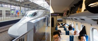
). Shin-Yokohama and Odawara stations on the Tokaido Shinkansen Line are located in the prefecture, providing high-speed rail connections to Tokyo, Nagoya, Osaka and other major cities.
Railways
- East Japan Railway Company Tokaido Main Line
- Nambu Line
- Tsurumi Line
- Yokohama Line
- Negishi Line
- Yokosuka Line
- Sagami Line
- Chuo Main Line
- Tokaido Shinkansen
- Main line
- Odawara Line
- Main line
- Choyoko Line
- Sagamihara Line
- Daiyuzan Line
Metro
- Yokohama City Subway Blue Line
- Green Line
Monorail
- Shonan Monorail
Loaders people
- Kanazawa Coastal Line
Road
Motorway
- Tomei Expressway
- Chuo Expressway
- Chouteau Expressway
- Tokyo Bay Aqua-Line
National roads
- Route 1
- Route 15
- Route 16
- Route 20
- Route 129 (Hiratsuka-Atsugi-Sagamihara)
- Route 132
- Route 133
- Route 134
- Route 135 (Shimoda - Atami - Odawara)
- Route 138
- Route 246 (Chiyoda, Tokyo - Kawasaki - Machida - Atsugi - Isehara - Gotenba - Numazu)
- Route 255
- Route 357 (Chiba - Funabashi - Daiba Tokyo - Yokohama-Yokosuka)
- Route 409
- Route 412
- Route 413 (Fujiyoshida - Lake Yamanaka-Sagamihara)
- Route 466 (Setagaya, Tokyo-Kawasaki-Yokohama)
- Route 467
Ports
- Port of Yokohama - international container port
- Misaki Port - Ferry Route to Kisarazu
Education
The Kanagawa Prefectural Board of Education administers and supervises individual municipal school districts. The Board of Education also directly administers most of the public high schools in the prefecture.
University Facilities
- Kawasaki Keio University - Shin Kawasaki Campus
- Meiji University - Ikuta Campus
- Senshu University - Ikuta Campus
- Japan Women's University
- Showa Music University
- Den-en Chofu University - Aso Ward
- Nippon Medical School
- St. Marianna University Faculty of Medicine - Miyamae
- Japanese Film School
- Tokyo City University - Aso Ward
- Tokyo Institute of Technology - Suzukedai
- Aoyama Gakuin University
- Kanagawa Dental College
- Tokai University - Hiratsuka Campus
- Tokai University - Isehara Campus
- Kanto Gakuin University - Odawara Campus
- Bunkyo University - Chigasaki Campus
- Shoin University
Sports
Nissan Stadium in Yokohama.
Services
Football and athletics
- Nissan Stadium (Yokohama International Stadium) - in Yokohama, the last venue of the 2002 FIFA World Cup and the 2005–2007 FIFA Club World Cup.
- Nippatsu Mitsuzawa Stadium (Mitsuzawa Stadium) - in Yokohama, for football only
- Todoroki Athletics Stadium - Kawasaki, final site of the 2007 IFAF (American Football) World Championships.
- Hiratsuka Athletics Stadium
Baseball
- Yokohama Stadium is for baseball (Yokohama DeNA BayStars) and has hosted Australian rules football.
- Kawasaki Stadium is the former home of the Taiyo Whales (now Yokohama BayStars) and Lotte Orions (now Chiba Lotte Marines).
- Yokosuka Stadium is the home field of Shonan Sirex, Yokohama's minor league team BayStars
In room
- Yokohama Arena - also for a music concert
- Yokohama Cultural Gymnasium was the volleyball venue for the 1964 Summer Olympics in Tokyo.
- Todoroki Arena - in Kawasaki and multi-purpose venue (including basketball)
- Odawara Arena - training facilities for the Kanagawa 2020 Games
miscellaneous
- Enoshima yacht Course 1964 used for the Summer Olympics.
- Hakone Ekiden course - Tokyo to Hakone, 108.0 km, mainly along Japan National Routes 1 and . Every year on January 2 (in Hakone) and January 3 (in Tokyo), runners run along a divided route into ten sections.
- Lake Sagami was the site of canoeing and rowing at the 1964 Summer Olympics.
Teams
Football)
- Kawasaki Frontale (Kawasaki)—Todoroki Athletics
- Yokohama F. Marinos (Yokohama, Yokosuka) - Nissan Stadium
- Yokohama (Yokohama) - Mizzawa Stadium
- Shonan Bellmare (Hiratsuka, Odawara and some cities in central and western Kanagawa) - Hiratsuka Athletic Stadium (football) and Odawara Arena (futsal)
Baseball
- Yokohama BayStars (Yokohama) - Yokohama Stadium and Yokosuka Stadium (for its farm team "Shonan Searex").
Basketball
- Toshiba Brave Thunders Kanagawa (Kawasaki) - Todoroki Arena
Volleyball
- NEC Red Rockets (Kawasaki) - Todoroki Arena
Sports [edit]
Nissan Stadium in Yokohama.
Services [edit]
Football and athletics[edit]
- Nissan Stadium (Yokohama International Stadium) - in Yokohama, the last venue of the 2002 FIFA World Cup and the 2005–2007 FIFA Club World Cup.
- Nippatsu Mitsuzawa Stadium (Mitsuzawa Stadium) - in Yokohama, for football only.
- Todoroki Athletics Stadium - Kawasaki, final site of the 2007 IFAF World Cup (American football).
- Hiratsuka Athletics Stadium
Baseball [edit]
- Yokohama Stadium is for baseball (Yokohama DeNA BayStars) and has hosted Australian rules football.
- Kawasaki Stadium is the former home of the Taiyo Whales (now Yokohama BayStars) and Lotte Orions (now Chiba Lotte Marines).
- Yokosuka Stadium is the home field of Shonan Sirex, Yokohama's minor league team BayStars
Indoors[edit]
- Yokohama Arena - also for a music concert
- Yokohama Cultural Gymnasium was the volleyball venue for the 1964 Summer Olympics in Tokyo.
- Todoroki Arena - in Kawasaki and multi-purpose venue (including basketball)
- Odawara Arena - training facilities for the Kanagawa 2020 Games
Other[edit]
- Enoshima Yacht Course - used for the 1964 Summer Olympics.
- Hakone Ekiden course - Tokyo to Hakone, 108.0 km, mainly on National Routes 1 and Japan. Every year on January 2 (in Hakone) and January 3 (in Tokyo), runners run along a divided route into ten sections.
- Lake Sagami was the site of canoeing and rowing at the 1964 Summer Olympics.
Teams[edit]
Soccer [edit]
- Kawasaki Frontale (Kawasaki)—Todoroki Athletics
- Yokohama F. Marinos (Yokohama, Yokosuka) - Nissan Stadium
- Yokohama (Yokohama) - Mitsuzawa Soccer Stadium
- Shonan Bellmare (Hiratsuka, Odawara and some cities in central and western Kanagawa) - Hiratsuka Athletic Stadium (football) and Odawara Arena (futsal)
Baseball [edit]
- Yokohama BayStars (Yokohama) - Yokohama Stadium and Yokosuka Stadium (for its farm team "Shonan Searex").
Basketball[edit]
- Toshiba Brave Thunders Kanagawa (Kawasaki) - Todoroki Arena
Volleyball[edit]
- NEC Red Rockets (Kawasaki) - Todoroki Arena
In popular culture
- Stephen Sondheim's stage musical Pacific Overture
, which deals with the "opening" of Japan to Western influence by Commodore Perry, contains the song "Welcome to Kanagawa". - The main team of the Japanese manga and anime series Slam Dunk
, Shohoku, are from Kanagawa. - Hinata Inn and the surrounding town from the manga and anime series Love Hina
are located in Kanagawa. - The Japanese manga Elfen Lied
is set in Kanagawa, mainly Kamakura and Enoshima (Fujisawa). - The Japanese anime series S-CRY-ED
is set in Kanagawa Prefecture after a seismic event lifts it from the ground. - The Japanese manga and anime series Kenko Zenrakei Suieibu Umishō
takes place in the fictional city of Kanagawa from Umineko. - The Japanese anime series Gundam Wing's
early episodes feature Kanagawa prominently, mainly Yokohama and Yokosuka. - The Japanese anime and manga series Area no Kishi
takes place in Kanagawa, mainly Kamakura. - The Japanese anime and manga series Hamatora
takes place in Kanagawa, mainly in Yokohama. - The Japanese anime and manga His and Her Circumstances
is set in Kanagawa Prefecture, mainly in the city of Kawasaki and Yokohama. - The Japanese anime and manga series Neon Genesis Evangelion
takes place in Tokyo-3, which is located in the village of Hakone, in the Ashigarashimo district - A team from the Japanese anime and manga series Kuroko's Basketball
, Kaijo, from Kanagawa. - The manga Sonan Junai Gumi, along with the prequel Bad Great Teacher Onizuka (sequel to Shonan Junai Gumi), takes place in Sonan, Kanagawa.
- Japanese anime and manga series Yowamushi Pedal
, Hakone Academy is taken from Hakone, Kanagawa. - The Japanese anime and manga series Initial D
Fifth Stage is set in Kanagawa, and the final stage is set in Hakone. - Japanese anime and manga series Bungo Stray Dogs
is set in Yokohama - Japanese anime and manga series Aoi Hana is located in Kamakura
- The Japanese anime and manga series Fool Doesn't Dream of a Bunny Girl
is set in various locations in Kanagawa Prefecture such as Fujisawa and Yokohama.
Festivals and events[edit]
| In this section do not cite any sources . |
Odawara Hojo Festival
- Fireworks on the Tama River
- Yokohama Port Anniversary Festival (June)
- Kamakura Festival (April)
- Hiratsuka Tanabata Festival (July)
- Odawara Hojo Godai Festival (May)
- Yugawara Kifune Festival (July)