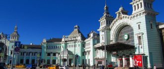
In the Middle Ages and Modern times, most large European cities were surrounded by fortress walls. Moscow was no exception. On maps of the 17th century, the capital consists of four parts: the Kremlin, Kitay-Gorod, White City and Zemlyanoy. The townspeople managed to preserve the walls of the first two virtually unchanged, but with the second and third it was more difficult - one can only remember the towering fortresses by looking at individual buildings and street names.
Map of the White City. Photo: wikipedia.org
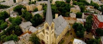
The Belgorod Wall appeared on the map of Moscow in 1581–93 on the site of wooden and earthen fortifications that burned down in 1571 during the Crimean Tatars’ raids on Moscow. The construction of a new stone fortification around the Kremlin and Kitai-Gorod, by decision of the government of Boris Godunov, was initially led by the architect Fyodor Kon, who became famous during the construction of the Smolensk Kremlin.
Boulevard Ring
Due to constant external influence, the wall and towers of the White City began to collapse and threaten the townspeople. Thus, according to Moscow newspapers, in February 1750, in the area of the All Saints Gate, several bourgeois houses were buried, and 4 people died. After the initiated inspection, Chief of Police General Alexei Tatishchev reported Catherine II : “Many stones fell out, and in some places they settled and collapsed, which is why people traveling and walking of any rank have extreme fear.”
Chertol Gate
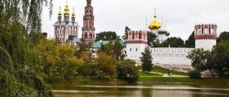
We were located opposite the lobby of the Kropotkinskaya station. It was named after the Chertoriya stream, which is still hidden in the sewer under the lower passage of Gogolevsky Boulevard. And the drop of the boulevard itself is the slope of its high bank. In March 1611, a dashing drama took place here. The day after the uprising began, Muscovites tried to besiege the Kremlin and began building barricades at the beginning of Volkhonka, opposite the Borovitsky Gate. The interventionists, watching their maneuvers from the walls, noticed that the Russians had not locked the Chertol Gate behind them. The Poles entered the still strong ice of the Moscow River through the Tainitsky Gate, quickly bypassed the bastion of the Seven-Top Tower, broke into Volkhonka from the west, “beat everyone to death” and completely burned out the wooden quarters of Zaneglimenye.
The Poles remained firmly in the Kremlin and Kitai-Gorod, but made regular forays. They were sometimes supported by Polish detachments that made their way from the outside, delivering food convoys to the besieged. It was the western part of the fortress that especially distinguished itself in the battles, and on the hill opposite the Chertol Gate, near the Church of Ilya the Obydenny, there was a small wooden fort, from which Prince Pozharsky led the assault in August 1612.
Orphanage
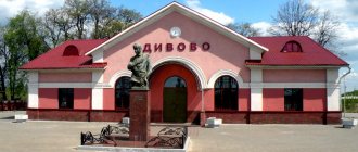
The complex of buildings of the military academy of the Strategic Missile Forces named after Peter the Great at the intersection of Moskvoretskaya embankment and Kitaigorodsky passage was built from the remains of the Belgorod wall in 1764–1781. by decree of Catherine II. True, the building’s original purpose was completely different: the architect Karl Blank designed and built the largest educational home for orphans in Russia. “The establishment of a special house, following the example of those that I have seen in Holland, France, Italy and other places, can completely eliminate the above-mentioned atrocities. The babies brought in will be brought up profitably and profitably, as a result of which, over time, the number of young people wandering around all the streets and shamelessly begging will decrease. Give me a place called Granatnaya Yard with the Vasilievsky Garden near the Moscow River, with all the state-owned land and buildings lying nearby, together with the mill given away from the Admiralty, which is on the Yauza, and use the old city wall for the building,” wrote Catherine’s Minister of Education Ivan Betskoy . The workers had to carry construction materials not far: literally a few hundred meters from the site lay the remains of the Yauz Gate of the Belgorod Fortress, which were dismantled during construction.
Orphanage. Photo: wikipedia.org
The building constantly housed 1,200–1,400 infants under three years of age, and there was a children's hospital with a department for poor mothers in labor. The orphanage became a rare Moscow monument that was not damaged during the fire of 1812: the building was defended by the servants. During the occupation of the city, the employees and students of the institution did not leave the building, and wounded Russians and French were admitted to the local hospital. After the revolution, the house was occupied for a long time by various trade union institutions, and in the second half of the 20th century the premises were given over to the academy.
White City and its walls
How long have you, fellow Muscovites and guests of the capital, been to Khokhlovskaya Square?
Its main interest, of course, is not in the title. It’s quite simple - next to it is Maroseyka Street, next to it is the beautifully winding Khokhlovsky Lane, and not far away is the Church of the Life-Giving Trinity in Khokhly. In a word, here in the neighborhood there was the Khokhlovka tract - a place where Little Russians, or more precisely, Zaporozhye Cossacks, settled after the entry of the Zaporozhye Army into Russian citizenship from the middle of the 17th century. Somewhere here, as is commonly believed, stood the courtyard of Hetman Ivan Mazepa, where he stayed during his visit to Moscow (although the ownership of the ancient chambers preserved in one of the neighboring alleys by Mazepa has not been proven).
Let us, however, leave toponymy. More precisely, let's turn to another of its terms - “White City”.
The ring layout of Moscow is well known - and, however, it is not too different from many other cities with a long history. The defense systems traditional for the Middle Ages - simply, walls - covered in Moscow first the Kremlin, then Kitay-Gorod, and finally the White City (later both the Zemlyanoy Val and the Kamer-Kollezhsky Val would appear - but for now, for the 15th-16th centuries, we will limit ourselves to this ).
In the old diagram, the White City is highlighted, somewhat inconsistent with its name, in yellow. But why was he himself nicknamed “White”? There are several versions, but they are still more often inclined towards the color of the walls: it is assumed that the brick fortifications built under Tsar Fyodor Ioannovich (and under the head of government Boris Godunov) to replace the previous wooden ones were painted with white lime (although Muscovites themselves prefer to think that the wall was completely white stone).
The wall was 4 to 6 meters thick, it had a dozen gates with towers, as well as several impassable towers, but with several combat tiers. The height of the towers could reach up to 25 meters.
The mentioned square is located in a symbolic place for Moscow. This is the Pokrovsky Gate - the place where Maroseyka Street turns into Pokrovka at the intersection with the Boulevard Ring. But where did this ring itself come from?
Alas, just instead of the wall of the White City. In the 18th century, the wall lost its fortification significance. First, the guards were removed from the gate, then they gradually began to dismantle it altogether (well, the ancestors did not appreciate the significance of architectural monuments - but the architect Fyodor Kon built the wall of the White City). The boulevards themselves were ordered to be planted already in 1774, under Catherine (we have lived like this ever since).
On the plan from the late 17th century, the gate and wall are still in place.
Well, years have passed. The wall of the White City remained in memories. On Khokhlovskaya Square, located in the part of Pokrovsky Boulevard closest to Maroseyka-Pokrovka, in the early 2000s they intended to build something with an underground parking lot. But after digging into the ground, we discovered something interesting. Here's a shot from 2007.
And what is that, citizens, turning white? And this is exactly the foundation of the wall of the White City. And the foundation is just white stone (the broken brick walls are what was above).
Construction was stopped. Further proceedings dragged on for a long time. Local historians, archaeologists and other interested people fought for the safety of the found fragment of the wall. The investor continued to dream of his own shopping or business center, and then came to the conclusion that the whole story had become unprofitable for him. The area remained fenced off for years. And in the end, a decision was made: there should be a museum on Khokhlovskaya Square!
An original solution was found: the archaeological site remained in the open air. The wall fragment is 51 meters long, 4.5 meters wide, and 120 centimeters high. The stones, reinforced and treated with a water-repellent solution, are available for viewing.
Just in case, citizens are warned:
Well, the configuration of the monument itself is original: a kind of amphitheater was built around the wall. Where in good weather people sit with pleasure - some read, some chew a sandwich, some just bask in the sun.
Alas, archaeological finds do not always have such a happy fate...
1418 Forward to a friend
to bookmarks
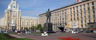
Moscow City Hall
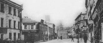
The residence of the city authorities, house 13 on Tverskaya Street, was built for the Moscow Governor-General Zakhar Chernyshev in 1782. The project was carried out by the popular Moscow architect, author of the Novo-Ekaterininskaya Hospital building, Mikhail Kazakov . The three-story building was built from massive rubble of bricks - the remains of the Tverskaya Gate of the White City dismantled on modern Pushkin Square. According to historians, the work was carried out by prisoners on the basis of a state decree.
The future building of the Moscow City Hall. 1902 Photo: Commons.wikimedia.org
Initially, a three-story yellow mansion was built for Chernyshev; the building received an additional three floors and a memorable red color already under Soviet rule. After the death of the Governor-General in 1785, the authorities bought the mansion from his widow and transferred it for temporary use to all Moscow mayors. The interior decoration of the house and layout changed many times, but, oddly enough, the house never changed its function - almost immediately after the revolution, the premises were occupied by the Moscow City Council.
Seven-peaked tower
It was located on the corner facing the Crimean Ford, then this place was the most dangerous. Well, it had to look as menacing as possible, therefore, according to graphic sources, the tower was completely folded or lined with white stone. Its faceted walls looked at the enemy like the chest of an icebreaker, and the top was crowned with seven sharp tents. The height according to the descriptions is over 25 meters (a modern 12-story building), and this, apparently, does not take into account the roof. The formidable image played its role - the fortress was not yet completely finished when Khan Kazy-girey approached Moscow. But he didn’t even bother crossing the river - he appreciated the scale of the new building, listened to the thunderous cannonade of Moscow cannons and turned back.
However, twenty years later the fortress turned against its builders. In 1604 and 1609, “embarrassed” Muscovites twice allowed Polish invaders into the city. And when, in 1611, Russian militias began to knock out the guests who had stayed too long, they had to evaluate the skill of Fyodor Kon for themselves. Many towers changed hands several times, but it was the mighty Seven-Top Tower that the Poles nicknamed “the devil’s kitchen.” After a series of grueling attacks, the Russians learned from a defector about gunpowder reserves in the lower tier of the tower and managed to set them on fire with a burning arrow. At this moment there were about 300 Poles in the tower. One of the survivors recalled: “The flames engulfed the entire building, there was only one way left: to go down the rope to the river. Although even there death was before our eyes, for as soon as anyone descended to the ground, the Muscovites immediately cut him open, but ours wanted to die under a saber rather than in fire.”
Moscow. Soymonovsky proezd. Approximate view and location of the Seven-Top Tower Photo: Pavel Pelevin / Strana.ru
origin of name
There are different explanations for the name White City
. P. V. Sytin in his book “From the History of Moscow Streets” explains the origin of the name of the themes,
that in the XVI-XVII centuries. Here lived mainly boyars and nobles who were in permanent royal service, which is why the land occupied by their yards was called “white” - that is, it was exempt from land taxes that were levied on the “black” lands of artisans, traders and cultivators.
Name White City
may also be due to the fact that the brick walls of the fortress were painted
white
lime.
In this first wooden wall lies another city, surrounded by a stone wall, white-plastered and decorated with many towers and battlements; residents call this part of the city “Tsar Grad”.[1]
Tsarev city found in chronicles
could be explained by the fact that mainly tsarevs and sovereign people lived here.
Literature
- Libson V. Ya., Domshlak M. I. and others.
White City // Monuments of Moscow architecture. - M.: Art, 1989. - 380 p. — 50,000 copies. - Vaskin A.
A. Save Pushkinskaya Square. M., 2011. - A. L. Batalov, L. A. Belyaev.
Sacred space of medieval Moscow. — M.: Feoriya, Design. Information. Cartography, 2010. - 400 p. — ISBN 978-5-4284-0001-4. - Naydenov N. A.
- Moscow. Cathedrals, monasteries and churches. Part II: White City. M., 1882, 6 p., 59 p. - Architectural monuments of Moscow. White City. M., 1989, 378 p.
- Palamarchuk P. G.
- Forty forty. T. 2: Moscow within the boundaries of the Garden Ring. M., 2004, 744 pp., 16 l. ill. — ISBN 5-7119-0013-7 (vol. 2); ISBN 5-212-00500-0. - Sytin P.V.
- From the history of Moscow streets. — 3rd edition, add. - M.: Moscow worker, 1958-843 pp., illus. pp. 117-124. - Kudryavtsev M.P.
- “Moscow is the Third Rome.” - M.: Sol System, 1994. - ISBN 5-85316-008-7. - Church archeology of Moscow. Temples and parishes of Ivanovskaya Gorka and Kulishki. - Under the general editorship of Doctor of Art History Batalov A. L.
- M., 2006. - ISBN 5-91150-014-0. - Falkovsky N.I.
— Moscow in the history of technology. - M.: Moscow. worker, 1950, White City, pp. 35-40.
Sretensky Gate
Another sad, vague story is connected with the Sretensky Gate, which occurred shortly before the destruction of the city in the battles of 1611. When Moscow was ruled by the interventionists who were allowed into the city by the Seven Boyars, a certain Pan Blinsky, who suffered from severe delirium, distinguished himself in the chronicles of events. For no apparent reason, he opened fire on the icon of the Mother of God “at the Sretensky Gate” - either above the entrance to the monastery, or above the gate itself. But, as we see, Muscovites always treated their religious feelings with trepidation and were quick to carry out strict but fair punishment in the name of the highest ideals: “they brought them to the mentioned gate, cut off both hands on the block and nailed them to the wall under the image of St. Mary, then They took him through the same gate and burned him to ashes in the square.”
Petrovsky Gate
The Petrovsky Gate above the gentle slope of the Neglimensky coast also played a noticeable role, especially during the days of the Troubled Devastation. Imagine the picture: for almost a year, Moscow was a field of incessant battle. The city was not only completely burned out, but trampled down many times, plowed up and turned inside out, only the skeletons of several stone churches were visible above the black plain, the smoky Wall curled like a ribbon, and there were islands of camps and forts, broken by Russians and Poles on its different sides. The Klimentovsky fort in Zamoskvorechye and Obydensky on Ostozhenka are well known, but here, on the outer side of Strastnoy Boulevard (possibly in the area of the Hermitage Garden), a camp of four hundred Russian militias was set up under the command of Mikhail Samsonov, about whom the lords recalled: “Ours are against them now We made a sortie, and a happy one.” The Poles had a fort on Tverskaya Street (probably not far from the Eliseevsky grocery store), which repelled frequent attacks by the Russians entrenched on the Tverskaya Gate.
Pipe
At this point, the Wall allowed the Neglinka River into the city - probably through an arch closed by a lifting valve, similar to the Pskov Grilles on the Pskov River known from the drawings. The Moscow name for this obstacle is interesting - not the Grid, but the Pipe, as if Neglinka, who went into an underground sewer in the 19th century, already in ancient times had a presentiment of her reclusive future. In 1991, well-preserved white stone foundations appeared in a construction pit on Trubnaya Square. In all likelihood, there were two towers on the banks of the river, and between them there was a barred arch. From the north, the Pipe was supported by a dam embankment - on the site of the current Tsvetnoy Boulevard, Neglinka turned into a small lake. The inventories also indicate a “tent over the chimney,” in which the operator of the lifting mechanism may have kept watch.
Moscow. View of Trubnaya Square from Rozhdestvensky Boulevard Photo: Pavel Pelevin / Strana.ru
Myasnitsky Gate
In 1658, Alexey Mikhailovich ordered to rename the Chertolsky Gate to Prechistensky (he goes through it to Novodevichy on pilgrimage, and here, you know, this is the case - the Poles were not shy and directly called the gate Devil), and Myasnitsky - to Frolovsky. At the same time, it was ordered to call the Frolovsky gates of the Kremlin Spassky, that is, the old dedication of the main gates of the city was moved to a new milestone. And at the beginning of the twentieth century, when both the name, which had not taken root among the people, and the Frolov Gate itself were forgotten, the ancient image returned to the square again - in the form of a corner turret of the apartment building of the Rossiya society. It not only resembles the Spassky Gate in appearance, but is also equipped with a clock with a bell chime.
Yauza Gate
The span of the fortress wall from the Pokrovsky to the Yauzsky gates is the longest; according to various sources, there were from 3 to 5 blind towers on it. Yauzsky Boulevard goes down quite sharply and, perhaps, to emphasize the urban planning role of the tower standing under the mountain, it was made the tallest among the gate towers - according to the inventories, it is 9 fathoms, that is, 20 meters. In 1612, not far from here, a half-thousand-strong Polish detachment of “the most chosen men, armed horsemen” was driven into the Yauza. The next day, the townspeople fished out a pile of weapons and armor from the river, and some may still lie under the muddy waters.
Arbat Gate
They stood along the axis of Arbat Street, at the site of the current entrance to the tunnel. Who now knows that the stupid Arbat Square is also a place of Russian military glory?.. “80 Muscovites were locked at the Arbat Gate, abandoned by the rest. We spent a lot of time on them with considerable damage to ourselves, but the efforts were in vain.”
These are the events of 1611. And in 1618, six years after the liberation of Moscow by the army of Minin and Pozharsky, the army of the Polish prince Vladislav tried to take revenge by advancing from Zvenigorod to the Arbat and Tver Gates. Muscovites, under the cover of artillery, made a successful counterattack towards the Arbat and defeated superior enemy forces - this victory ends the Time of Troubles for the capital. The Scotsman Georg Learmont (an ancestor of the eponymous Mikhail Yuryevich), who was in the service of the Russian Tsar, wrote in a petition: “And how the Polish, Lithuanian and German people attacked the fortress and the Arbat Gate, and we your servants served you the sovereign, fought clearly, and many of our brothers were beaten in that attack.”
Forgotten are the places where the blind, impassable towers stood, which were also important boundaries of the siege of the city by its own citizens. Without archaeological data, it is difficult to guess the exact locations of their locations, but the address, for example, of the “blank tower opposite Sivtsev Vrazhek” is determined quite accurately - the bend of the boulevard 30 meters from the monument to Sholokhov’s horses. All blind towers were square in plan, unlike the previously built Kitay-Gorod - there they did not have a back wall (like the surviving tower at Tretyakovsky Proezd). It is said that this design originates from Europe, where the defense of the city was often entrusted to mercenaries. During the siege, the attacking side could shout out a better price, so the inside of the tower had to be shot from the city - if such a scheme was repeated in the White Fortress, the Russian militia would have had a much harder time retaking their capital.