The largest tributary of the Moscow River within the Russian capital is the Yauza River. The area of the basin in which it is located is 452 km2. Its length is 48 km, and its width varies from 20 to 65 m; this discrepancy is mainly due to the artificial expansion of the channel. The river flows in the northeastern and central regions of Moscow. In 1908, it was named the official border of Moscow, in the area between the Kamer-Kollezhsky Val and the confluence of the river. Kopytovki. The floodplain of the Yauza River is located in the North-Eastern district of the capital. It is surrounded by small meadows and fields. The water flow is fed 90% by snow.
Description
The Yauza River has 12 right tributaries (Chernogryazka, Sukromka and others) and 5 left ones (Zolotoy Rozhok, Ichka). The Moscow State Technical University named after N. E. Bauman was built on its banks. The water flow flows through the villages of Taininka, Perlovka, the cities of Moscow and Mytishchi. On its banks are the temples of Seraphim of Sarov and Sergius of Radonezh, as well as the Andronikov Monastery. However, these are not all the sights that can be seen while sailing along it. On its banks there are palaces: Ekaterininsky and Lefortovo. It flows into the Moscow River. This place is located in the area of the Bolshoi Ustinsky Bridge. The source of the Yauza River is a swamp in the Losiny Ostrov park.
Yauza
View all photos (8)
- Add a photo
- Add an article
- Add a comment
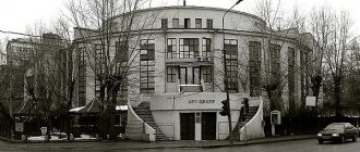
Boat rafting on the underground river in the center of Moscow
It’s hard to believe, but Moscow is ahead of St. Petersburg in terms of the number of rivers. Many of the capital's rivers are simply hidden underground.
08/26/06/Added by the editors/
- Show object on map
- Show similar properties
- Address: Source - South-eastern part of Korolev, Losiny Island, mouth - Moscow, Bolshoi Ustinsky Bridge
- Coordinates: 37°38′50.79″E; 55°44′57.09″N
Print information about an object
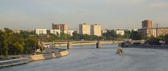
The Yauza River is a left tributary of the Moscow River. Within the city limits is the largest of the tributaries. The length of Yauza is 48 km, the length within the city is 27.6 km. The width of the Yauza in the “navigable” section (for small ships from the mouth to Preobrazhenskaya Square) is 20-25 meters, in the section of the upper water area adjacent to the Yauza hydroelectric complex it reaches 65 meters.
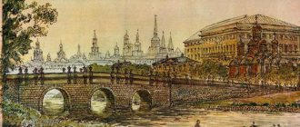
The mouth of the Yauza is located directly in the city center (where the Boulevard Ring joins the river). The river originates from the swamps on the territory of Losiny Ostrov. The river bed passes through the city of Mytishchi, the villages of Taininka and Perlovka, then enters Moscow, flows in the areas of Medvedkov and Babushkin, crosses the Okruzhnaya Railway, Prospekt Mira, Yaroslavskoe, Kazanskoe and Kursk directions of the Moscow Railway, the Garden Ring and flows into the Moscow River at the Bolshoi Ustinsky Bridge.
The river is known as Auza according to the chronicle of 1156. The name is presumably related to the Slavic and Finno-Ugric languages. “Auzes” from the Latvian “stem of oats, awn, straw”, and the presence of the Stebelka river next to the Yauza makes this version plausible.
In the period from the 9th to the 12th centuries, trade routes from the southern part of Russia to Vladimir passed along the Yauza. Until the 18th century the river was part of the trade route from the Moscow basin to the Klyazma basin with a portage in the Mytishchi region. In the 17th century, Peter I built a sail-making factory here, and from the beginning of the 18th century. The Yauza bed was blocked by numerous dams with mills, which negatively affected the purity of the water. Already in the 19th century. a section of the river in the center of Moscow was significantly polluted.
The river has 80 tributaries, among which are the right tributaries - Chermyanka, Likhoborka, Kamenka, Goryachka, Kopytovka, Putyaevsky Stream, Oleniy Stream, Rybinka, Chechera, Chernogryazka, Okhotnichiy Stream; left - Ichka, Budaika, Khapilovka, Sinichka, Zolotoy Rozhok, Golyanovsky Stream, Leonovsky (Vysokovsky) Stream.
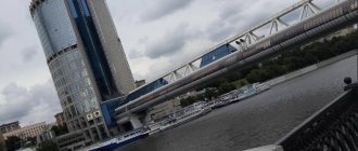
The attractions of Yauza are its bridges, embankments, and the construction of a waterworks. Within Moscow, 14 road bridges, 6 railway bridges, 2 metro bridges, 1 tram bridge and 2 pedestrian bridges were built across the Yauza.
The entire undeveloped part of the river valley from the Moscow Ring Road to the Yaroslavl direction of the Moscow Railway was declared a natural monument in 1991.
Book a tour of this site
I have not been hereI have been hereMy notes on visiting this site
Add to visit planAdded to visit planMy visit plan
Geographical features
The Yauza stretches across Moscow for 27 km, emerging from the MKAD area onto Shirokaya Street. It flows through the Babushkinsky district and Sviblovo, the Botanical Garden, Mira Avenue, then falls into the “embraces” of the embankment in Sokolniki. Before entering the Moscow River, it flows through Lefortovo and Zemlyanoy Val.
The floodplain of the Yauza River has been preserved in an almost natural state only in the area between Losiny Ostrov and Sokolniki. We can say that this area is not at all affected by the age of technology. Here it is partially covered with forest. While other areas are mostly swampy or weedy wastelands. In the 60-70s. Due to constant work to widen the channel, the water level in the Yauza has dropped significantly. In order to fill it, canals were built connecting the Volga basin, the Khimki reservoir and the Golovinsky ponds. Thanks to the construction of such a path, the Likhoborka tributary was filled with water, which it carried throughout the Yauza River.
Straightening the Yauza riverbed
- In the 50s of the twentieth century, work was carried out in the area of the Elektrozavod to straighten the riverbed of the Yauza, as part of the implementation of the Master Plan for the Reconstruction of Moscow in 1935. As part of the work to straighten the riverbed, a new Elektrozavodsky bridge was built. The difference between the old and new channels of the Yauza is visible on comparative maps of Moscow in 1952 and a modern map.
- In the 70s of the twentieth century, work was carried out in the Medvedkovo area to straighten the Yauza channel. They were caused by the complexity of the construction of the metro bridge of the new section of the Kaluzhsko-Rizhskaya line of the Moscow Metro, as well as the proposed development of the right bank of the river (in the place where the old bed of the Yauza was located, two residential blocks were subsequently built between Shokalsky passage and Sukhonskaya street). Work to straighten the Yauza riverbed in the Medvedkovo area was completed in 1979.
Historical information about the Yauza River
The Yauza water flow has almost always been navigable, connecting the south of Russia with Vladimir. In ancient chronicles it was said that it was a fairly important waterway for the city. In the 17th century, a fleet was created on it. Peter I, the last tsar and first emperor of Rus', dreamed that it would be the one that would connect the Volga and the Moscow River. A factory was built here where sails were made.
On the islands near Yauza there were mills that ground grain, so people living in the area were mainly engaged in selling bread. In ancient times, the river was an important trading point, but with the rapid development of technology, it quickly lost its importance. Now it is used to conduct excursions around the largest city in Russia, telling people the history and showing the sights.
Shipping development
The Yauza River in Moscow is navigable, but only in the interval from Preobrazhenskaya Square to the Moskva River. There are 23 bridges on the waterway for pedestrians, 28 for cars, 6 for trams, and 6 for railways. Small ships can be seen here. And during technical work, you can often meet large ships of the Mosvodostok organization. It is this enterprise that maintains the condition of the river, ensuring its cleanliness.
The distance of two kilometers from the Yaroslavskoye Highway to the Bogatyrsky Bridge can also be called a navigable section. Motorcycle boots appear here most often. Previously, in 2000, this zone was used during the reconstruction of the Yauza, using technical vessels. The water flow is not very wide. Almost all navigable zones are quite narrow - no more than 25 m, with the exception of the pool area adjacent to the Yauzsky hydroelectric complex. Its width is almost 65 m. Here the river is surrounded by concrete embankments whose height reaches 3 m.
Navigation areas are represented by a “Do Not Drop Anchor” sign. The dam is equipped with red lights, the gateway of the Syromyatnichesky hydroelectric complex is equipped with traffic lights.
Unfortunately, in the Middle Ages, the Yauza River, the photos present in the sources are striking in its beauty, was of great importance for the state than it is now.
Dredging
Previously, when the Yauza was used as a city snow machine, dredging work was regularly carried out on the river.
2008
At the end of August 2008, after a many-year break, dredging work was carried out on the Yauza, which continued until the end of October. In two months, a section several hundred meters long was cleared along the right bank of the river on Rubtsovskaya embankment above the Hospital Bridge. The work involved the floating crane "PK-141", towing boats "Neptune" and "Jupiter" with two scows with a capacity of 40 cubic meters. meters each. In the upper tail of the Yauzsky hydroelectric complex at the lock and dam, the water area was cleared using a refuler dredger.
Sunmood1981, GNU 1.2
2009
In 2009, work was continued, but in small quantities. The airlock chamber was cleaned using a dredger.
2010
In 2010, selective clearing of the Yauza riverbed was carried out in the area of the Elektrozavodsky Bridge. Due to the shallow waters of the area, it was necessary to use shallow-draft boats of the KS-100 type - Skhodnya and Setun - to tow the scows.
2011
In July 2011, dredging work was carried out in the lower pool, in the water area adjacent to the hydroelectric complex.
2013
- In 2013, work continued. The riverbed was cleared with a floating crane "PK-141" along the right bank downstream from Syromyatnicheskaya to Serebryanicheskaya embankments.
- In November 2013, clearing of the Yauza riverbed began in the area of the Oleniy Bridge using the WATERMASTER dredger.
2014
In the spring of 2014, work continued in the area of the Matrossky Bridge. In April 2014, WATERMASTER began work in the Lefortovo Bridge area. A screening “plant” was installed on the shore near the bridge to process the slurry supplied from the dredger.
Syromyatnichesky waterworks
The Syromyatniche waterworks complex was built in 1940. It is located on the Yauza River near its mouth. The name comes from the Syromyatnaya Sloboda, which was located nearby. There is a Modovodostok parking lot here. The vessels of this organization transport garbage collected on the Yauza and Moscow Rivers to a special base, carry out general cleaning work and monitor the environmental condition.
Ten years ago, repairs were carried out at the waterworks. During this work, the lock was completely repaired and the dam gate was replaced. Even earlier, the city administration repaired the embankment walls.
Yauza reconstruction plan
Work on the construction of embankments on the navigable section of the river was mainly completed by 1940. According to the General Plan of 1935, Yauza was supposed to be included in the Water Ring of Moscow. The plan provided for the construction of the Northern Canal (Khimki Reservoir - Yauza) and sluicing of the Yauza through the construction of several low-pressure waterworks. In total, it was planned to build six waterworks: a lock and a ship lift on the Northern Canal and four locks on the Yauza. Apparently the plan for a major reconstruction of the Yauza lasted until the mid-1960s. This can be judged by the construction of embankments, which was carried out until the early 1970s above the Rostokinsky aqueduct and above the Oleniy Bridge. The “planned” width of the channel (the distance between the walls of the embankments) is 20-25 m, which significantly exceeds the size of the Yauza channel in its natural state. However, this plan was not implemented except for the construction in 1940 of the Syromyatnichesky hydroelectric complex with a shipping lock, 3 km from the mouth of the river. To “water” the Yauza, a small Likhoborsky (Golovinsky) diversion canal was built in 1940, through which the Volga water flows through the Moscow Canal and the Khimki Reservoir into the Golovinsky Ponds and further into the Yauza tributary Likhoborka. The canal ran along the route of one of the sections of the Northern Canal.
Animal and plant life
The source of the Yauza River is not particularly rich in fish. The upper reaches of the water stream are inhabited by perch and roach, and in the lower reaches you can find asp, bleak, and pike. Geese, mallards, reed buntings, Canada goose often appear here, and many birds also nest.
As with all polluted rivers, plants and animals such as phyto- and zooplankton, zoobenthos (leeches and pond snails are most common), emergent, with floating leaves and underwater algae are characteristic. This poverty of flora and fauna was mainly influenced by the location. Being located within the boundaries of a large city and having a huge number of plants and factories on its banks, the river often succumbs to severe pollution: oil waste and untreated sewage. Fish are simply not able to survive in such conditions. Scientists have recorded several cases of mass poisoning.
A few words about the Moscow River
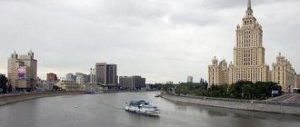
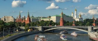
Talking about r. Yauza, one cannot ignore its mouth - the Moscow River. It is the main artery of the capital of the Russian Federation. Its total length is 502 km. The Moscow River originates from a large swamp near Starky (Smolensk region). It flows into the Oka near the city of Kolomna. Since ancient times, it has been a fairly important water body for the state, uniting Novgorod and Smolensk, the Volga and Don. Its meaning remains the same today. The origin of the river's name is associated with the Finno-Ugric, Baltic and Slavic languages. There is no exact version.
There are about 30-35 species of fish in the Moscow River. The most common species are bream, roach and perch; pike, silver bream, asp, carp, pike perch and chub are much less common. Only a true fisherman will be lucky enough to catch catfish, ide, vendace and podust. In order to increase the population of fish such as sterlet, juveniles are released into the river and hatched artificially. Thanks to human actions, fish from nearby reservoirs and fisheries swim into the Moscow River. Populations of such species as carp, eel, silver carp, saberfish and trout appear.
Ecology
Due to the fact that the Yauza River is rich in industrial enterprises, in certain areas the stream is filled with garbage, wastewater, and oil products. For this reason, the water acquired a persistent unpleasant odor.
Basically, river pollution occurs due to metals, organics, and suspended substances, which are practically insoluble and accumulate in the riverbed. All this enters the water flow from enterprises that stand on its banks. In the city center, the river is polluted by melt, storm and industrial waters. Therefore, water quality is constantly deteriorating.
Since ancient times, the river has had an unpleasant odor, because so much harmful waste is released into this stream. For this reason, already in the 19th century, water was declared unfit for drinking. But the Yauza River valley was still able to retain its charm. It flows in the northeastern part of Moscow. Its nature looks very natural and attracts local residents who happily come to relax and have a good time. Several years ago, the city administration tidied up this part of the river, giving it a cozy and aesthetic appearance: they installed benches and fortifications for the bank, and laid a path.
The capital of Russia has more than 100 reservoirs. At the same time, the Yauza River plays an important role in the life of the city and is not inferior in its importance to the main artery, the Moscow River. It affects the work of many enterprises, and the ecological state of the environment also depends on it. Humanity has known about the Yauza River for several centuries; it is associated with many historical figures and significant events in the life of Russia. On its banks there are factories and monasteries, educational institutions and parks, stadiums and palaces, libraries and buildings that are striking in their height and architectural individuality. The floodplain of the Yauza River includes a pond, very beautiful and mesmerizing in its appearance.