The Kaliningrad region is located in the Northwestern Federal District. This is the westernmost point of the country. A satellite map of the Kaliningrad region allows us to see that this region does not border the Russian Federation on land, but is connected to it by the Baltic Sea. The region has land borders with Poland and Lithuania.
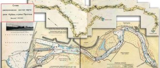
By zooming in on the map and moving around it, you can get a complete picture of the region, find large cities and small towns, and examine various objects. On the map of the Kaliningrad region with diagrams you can see that 2 large rivers flow through the territory - Pregolya and Neman. In total, there are about 140 rivers in the region, including the following:
- Pissa;
- Lava;
- Sheshupe;
- Instruch;
- Angrapa.
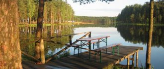
There are 38 lakes in the region, most of which belong to the southwestern regions. And if you look at the map of the Kaliningrad region by region, then in the east you can find the largest lake - Vyshtynetskoye. The most significant bodies of water in the region are the Curonian and Kaliningrad Lagoons. The water in them is fresh, and the bays are separated from the sea by long, sandy spits.
Districts of the Kaliningrad region on the map
The online service also allows you to get an idea of the territorial division of the region. The area of the region is small, it is the smallest subject of the Russian Federation in terms of territory occupied - it occupies only 15 thousand km2 and is divided into 11 districts. You can view each district on the map of the Kaliningrad region in more detail, find cities, roads, bridges over rivers and reservoirs.
Most of the region's population (more than 70%) lives in large cities. The most densely populated is Chernyakhovsky. More than 38 thousand people live here. And the largest in area is Zelenogradsky district.
To move around the region and beyond, residents of the region can use rail and road transport, but the majority of the population prefers to travel by car. The detailed road map of the Kaliningrad region shows the main highways A-216 and A-229, as well as the Primorskoe Ring highway, which connects Kaliningrad with cities such as:
- Zelenogradsk;
- Svetlogorsk;
- Pionersky;
- Baltiysk;
- Light.
Along this modern route you can quickly get to Khrabrovo Airport, which is the only regional “air gate”.
On a detailed map of the Kaliningrad region you can find a small but very remarkable region - Baltic. One of the largest naval bases of the Russian Federation is located here. There are also many attractions, recreation centers, shipbuilding and ship repair docks.
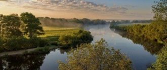
The most beautiful rivers of the Kaliningrad region
The Kaliningrad region is an area where many small rivers and streams flow. In total there are more than 4.5 thousand (4610) springs. Most waterways belong to small rivers - their length does not exceed 50 km. There are only 6 relatively large (more than 100 km) streams in the region.
Sheshupe River
- Coordinates on the map: 54.967581, 22.714524.
This water artery flows through the territory of 3 countries. Its total length is 298 km, and Sheshupe carries its waters across Russia for 63 km. Of these, 51 km is the border between the Russian Federation and Lithuania. The river belongs to the Baltic Sea basin. It has always been considered one of the most beautiful places in the region.
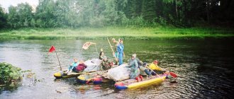
The water flow is very tortuous: it flows through protected areas of the Kaliningrad region. In addition to centuries-old trees, the banks of the river are beautiful meadows and sandy beaches. Kayaking is popular here. Along the river coast there are many estates and bases where you can stop and relax, spending several days communing with nature.
Neman River
- Coordinates: 55.184773, 21.507753.
The history of this almost thousand-kilometer river (its length is 937 km) is interesting. Neman has many names. These are the Belarusian Neman and Nemanets, the Polish Nieman, and the German Memel. The river originates in Belarus and flows into the Baltic Sea in the area of the Curonian Spit.
The upper reaches of the Neman are moraine ridges formed by descending glaciers. In these places the river bed is rocky and has many rapids. In the middle reaches, the bottom of the water flow becomes mostly sandy, and the banks of the river move apart. If in the upper reaches the width of the Neman is about 30-40 m, then in the middle reaches it is already 150 m, and in the lower reaches – 400 m or more.
The river is navigable along most of its course. Its depths range from 1 m in the upper reaches to 5 meters in the lower reaches. Several hydroelectric power stations were built on the Neman, the famous Queen Louise Bridge, and 109 km of the river bed is the border of Lithuania and Russia.
Angrapa River
- Coordinates: 54.476646, 22.044280.
The river originates in neighboring Poland. Lake Mamry is its source. Angrapa (translated from Prussian) is an eel river. In the old days, this rather rare fish was caught here using traps.
The length of the waterway is 172 km, most of the river bed passes through the Kaliningrad region. Angrapa is very popular among lovers of water tourism. Various kayaking events and numerous competitions often take place here.
Back in 1880, a hydroelectric power station was built on the river. It was already in our time that it was able to be launched again (two new turbines were installed here in 2000). Angrapa is rich in fish. Its shores have long been favored by those who like to relax with a fishing rod.
Lava River
- GPS coordinates: 54.398260, 21.022336.
This water flow begins among the Masurian lakes in Poland. The Lava River, with its waterfall, is considered one of the most picturesque places in the region.
In the vicinity of the waterfall (and they are famous for their beauty and picturesqueness) you can often meet local residents and visiting tourists. The banks of the stream, noisily carrying its waters, are surrounded by trees entwined with some plants similar to vines. From the foliage you can hear the voices of birds who have chosen these places.
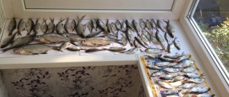
The Lava Coast is not littered. Here you can find traces of fishing enthusiasts - bream, carp, chub, and silver bream are found in the river.
A river bus, which has its own name “Lavakhod”, quickly scurries along the water. Tourists enjoy going on a short trip along the river, taking beautiful pictures as a souvenir of these picturesque places.
Instruch River
- Coordinates: 54.812260, 22.072855.
The Instruch River begins its path through the territory of the Kaliningrad region in the east of the region, near the village of Pravdino. The length of the stream is 101 km, and the area of its basin is about 1250 square kilometers.
The banks of the river are often steep and steep, but there are also gently sloping sections of the coast. The natural landscapes in the Intruchi valley are quite diverse. Pine forests grow in higher areas, while in the lowlands, in wetlands, there are mainly spruce forests.
The waters of the river are quite clean and there are many species of fish here. Instruch is popular among fishermen and outdoor enthusiasts. Water tourism and river rafting on catamarans, kayaks and rafts are developed here.
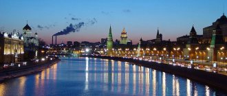
Pregolya River
- Coordinates: 54.645994, 21.070219.
It is the largest of those flowing through the region. Its length is 123 km, and with its tributary, the Angrapa River, it is quite an impressive 292 km. The Pregolya begins near the city of Chernyakhovsk and flows into the Kaliningrad Bay of the Baltic Sea. Its width in the upper reaches is about 20 m and depth is up to 3 m. In the lower reaches, the river is much wider (up to 80 m) and deeper - in places up to 16 m.
Although after the construction of the railway line connecting Chernyakhovsk and Kaliningrad, the river lost its significance as an important transport artery, commercial shipping remained here. Until 2003, passenger ships of the river fleet were based on the Pregolya River and were used as floating hotels in the capital of the region.
Map of the Kaliningrad region with cities and villages
The settlements of the region are characterized by a small population living in them. Only about 500 thousand people live in the largest city of Kaliningrad. A map of the Kaliningrad region with settlements allows you to view any of the 22 cities in the region, as well as villages and hamlets.
Kaliningrad has numerous museums, attractions, and parks. In addition, it is a major economic center, containing:
- carriage factory;
- shipyard;
- port;
- amber processing enterprises.
On the map of the Kaliningrad region with cities and villages, it is easy to see the location of the second largest settlement, Sovetsk. It is located on the border with Lithuania and attracts tourists with pine forests, quiet beaches, clean air and unique architecture.
Another resort city is Zelenogradsk. It is located in the north-west of the region on the shores of the Curonian Lagoon. Many come here not only to stroll along the pebble beaches and quiet streets, admire the bridges and German architecture, but also for medicinal purposes. If you look in detail at a map of the Kaliningrad region with villages, you will see many small villages near Zelenogradsk, in which there are sanatoriums specializing in treatment with mud and water from mineral springs.
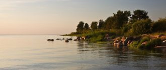
Sights of the Baltic Sea coast
When talking about the Kaliningrad region, one cannot help but recall one of its main attractions - the Baltic Sea and its coast. Although holidays in these places are not as popular as in the South, the Baltic attracts tourists with its relaxed, somehow special beauty.
"Window to Europe" (Baltic Sea)
- Coordinates: 55.105065, 19.620257.
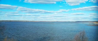
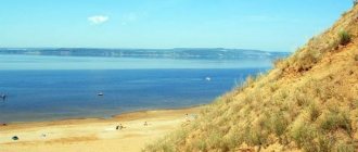
The Kaliningrad region is the largest region of Russia, washed by the Baltic Sea, if you do not take into account the Leningrad region. Like other similar natural sites, there is a swimming season here, although it does not last long (only from the end of June to the beginning of September).
But more often people come to the Baltic to breathe clean, healing air, visit spa resorts, take a break from big cities and gain new experiences.
The Baltic Sea is shallow, but attracts tourists with its variability and unpredictability. A sudden storm can blow up here, or everything can calm down literally in an instant. In bad weather the sea is heavy and gloomy, but the sun has come out - the waves are gently splashing at your feet.
Local sanatoriums that use mud and hydrotherapy are in no way inferior to foreign resorts. Most tourists who have visited the Baltic often return here again and again.
Curonian Spit
- Coordinates: 55.141223, 20.796987.
This natural site is part of the UNESCO World Heritage Site. The Curonian Spit is one of the main attractions of the region. It separates the waters of the bay of the same name from the waters of the Baltic Sea.
The Curonian Spit is 98 km of sand dunes and pine forests. Most tourists coming to Kaliningrad strive to get to these places with unique natural landscapes. The oldest ornithological station in Europe is also located here. Scientists have been studying the birds that have chosen these lands for more than 100 years.
There is a fish restaurant famous throughout the region. But in order not to go hungry, it is better to stock up on food in advance - there are not many catering outlets here. It is better to plan an excursion here in advance - during the holiday season it is crowded, and as a result, it is difficult to find a suitable tourist tour.
Baltic Spit
- Coordinates: 54.537583, 19.765389.
This spit, stretching for 65 km, can be considered the westernmost point of Russia. It is located between two bays - Kaliningrad and Gdansk. This is an area of white dunes covered with forest.
The spit is connected to the mainland only on the territory of a neighboring state. From the Russian coast you can get here by ferry. In good weather it leaves Baltiysk every 2 hours.
On the spit you can admire beautiful landscape views, visit the ruins of a former German air base, and see the ruins of the Western Fort. Upon returning to Baltiysk, you can get acquainted with the monuments and visit the museums of the city.
Economy and industry of the Kaliningrad region
The region's economy is based on mining and manufacturing. Main industries in the region:
- furniture;
- electrical engineering;
- woodworking;
- food
Several hundred tons of amber are mined annually in the region, which is exported and used in Russian jewelry production. There is also a small oil field, the production platform of which is located in the Baltic Sea not far from the Curonian Spit.
Traditionally, industrial fishing is actively developing in the region. Yandex maps of the Kaliningrad region will help you find fishing ports located in the cities of Svetly and Pionersky, as well as other industrial zones in the region.