general information
Surface waters of Udmurtia are represented by rivers, lakes, ponds, reservoirs and swamps.
The territory of the Republic entirely belongs to the Kama River basin. In total, in the Udmurt Republic there are 8925 large, medium and small rivers, about 2700 ponds and reservoirs, over 2000 springs.
Two large rivers of the European territory of Russia - the Kama and Vyatka - originate in Udmurtia, the formation of the source of the Izha, Vala, Cheptsy, Umyaka, Kilmezi takes place.
The Kama River originates on the Verkhnekamsk Upland in the northeastern part of the republic in the village of Karpushata (near the village of Kuliga). Its length is 2032 km, and within the republic - 225 km. The pool area is 521,700 sq. km.
The Kama belongs to the rivers of medium mineralization. The lowest water hardness is observed during spring floods, the highest - at the end of winter.
The largest left tributary of the Kama River is the Belaya River, along which the southeastern border of the republic partially passes. The right tributaries of the Kama River on the territory of the Republic are the Vyatka, Siva, and Izh rivers.
The Izh River is the right tributary of the Kama. The source of the Bolshoy Izh is located north of the village of Malye Oshvortsy in the Yakshur-Bodinsky district. In the area of the village of Krasnoye Lesnichestvo, the Bolshoy Izh merges with the Maly Izh River. Its total length is 270 km, the basin area is 8,510 square meters. km.
The Cheptsa is the largest tributary of the Vyatka. The Cheptsa River begins near the village of Ignatievo in the Perm region and flows northwest, crossing the northern part of Udmurtia. Its total length is 524 km, of which 285 km the river flows through the territory of Udmurtia.
The rivers of the republic are of great economic importance. Water supply to large cities is based on surface sources of the Kama, Cheptsa, Izh, and Votka rivers. The role of surface water in the domestic and drinking water supply of large cities is: for Izhevsk - 98%, Votkinsk - 89%, Glazov - 61%, Sarapul - 99%, Kambarka - 91%; urban-type settlements: Balezino - 100%.
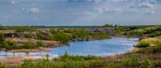
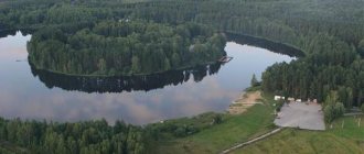
There are few lakes - natural depressions filled with water - in the republic . There are only lakes - oxbow lakes on the floodplains of the valleys of the Kama, Cheptsa, Kilmezi, Izha and other rivers. Oxbow lakes are most often of shallow depth; their bottom is composed of sandy-clayey or silty sediments. The water has a slight yellowish tint due to the abundance of suspended organic matter.
Udmurtia is dominated by lakes characterized by diverse vegetation and rich in fish.
Oxbow lakes gradually become overgrown and turn into low-lying swamps.
The second significant source of surface water is ponds and reservoirs. There are about 2,700 ponds on the territory of the Udmurt Republic. Their size varies: from several hundred square meters to several square kilometers. The area of the Izhevsk reservoir is 2640 hectares, the Votkinsk reservoir is 2180 hectares, the Kambarsky reservoir is 400 hectares, and the Pudemsky reservoir is 291 hectares.
The Izhevsk reservoir was built in 1760 for the needs of an ironworks under construction. It has a length of 12 km, a maximum width of 2.5 km, an average depth of 3 m, and a maximum depth of 10 m. The total volume of the reservoir is 76 million m3.
The Izhevsk reservoir must be protected from pollution by wastewater and industrial waste from city enterprises.
The Votkinsk reservoir was created in 1759 in the valley of the Votka River. In terms of size and volume of water, the Votkinsk reservoir ranks second after Izhevsk. Its length is 18 km, its greatest width is 2 km. The total volume is 12.5 million m3. The Votkinsk reservoir is intended for domestic, drinking and technical water supply.
The smaller Kambarsky and Pudemsky ponds also serve the same purposes. The Pudem pond, the third largest in the republic, was created in 1759 on the river. Pudemka, a tributary of the Cheptsa. The area of the Kambarsky pond, created in 1767, is 400 hectares, it is located on the river. Kambarka, a tributary of the Kama. Its length is 6 km, width is 0.80 km. The water of the pond is used by the population and enterprises of Kambarka.
Lakes and swamps of Udmurtia
lakes - natural depressions filled with water - in the republic. Only oxbow lakes are found on the floodplains of the Kama, Cheptsa, Kilmezi, Izha and other rivers (their total area is 2416 hectares). Oxbow lakes are most often of small depth, crescent-shaped or elongated, their bottom is composed of sandy-clayey and silty sediments. They are often connected to the river bed by channels. Such lakes are replenished with water during spring floods, from atmospheric precipitation and groundwater. Their water has a faint yellowish tint due to the abundance of suspended organic matter. There is a lack of oxygen at the bottom, and sapropel is formed, which can be used to fertilize fields. In Udmurtia, lakes predominate, characterized by good nutritional conditions for the body, diverse vegetation, and abundant plankton; they are rich in fish. Oxbow lakes gradually become overgrown and turn into low-lying swamps.
Swamps are areas of the land surface with excess moisture, covered with moisture-loving vegetation and characterized by the formation of peat, the layer of which has a thickness of at least 0.3 m. In Udmurtia there are about 650 swamps with a total area of 59 thousand hectares. Lowland (eutrophic) swamps with a concave or flat surface predominate. Lowland swamps are fed by precipitation, as well as surface and underground runoff waters rich in minerals. In such swamps grow black alder, birch, sedges, horsetails, weiiik, reeds, mosses, etc. According to the predominant type of vegetation, forest, grass and moss swamps are distinguished. Significant lowland swamps are developed in the floodplains of the Kama, Cheptsa, Kylmezi, Vala, Uva, Nylga, Lumpun, Izhan and other rivers. Most often they are oblong in shape and elongated according to the direction of the river valley. Raised (oligotrophic) and transitional (mesotrophic) bogs occur sporadically in those areas where thick sandy deposits are developed, in the interfluve of Kilmezi and Lumpuna, on the terraces of the Kama and Siva, in the upper reaches of the Vyatka. The largest number of swamps is found in the west and north of the republic, the smallest in the east and south, especially in places where Permian limestones lie close to the surface. The areas of swamps in Udmurtia are predominantly small. The maximum peat massif, exceeding 3000 hectares, is found in the Dzyakinskoye swamp of the Yara region. There are only 8 swamps with an area of over 1000 hectares, from 500 to 1000 hectares - 15, from 100 to 500 hectares - 99. The largest swamps with an area of over 1000 hectares are Akhmety, Orlovskoye (Syumsinsky district), Chibyanshur, Egorovtsy (Seltinsky district), Dulesovskoye (Sarapulsky district). district), Nyurdor-Kotya (Vavozhsky district). Based on the depth of peat, the Orlovskoe (3.49 m), Dzyakinskoe (2.10 m), Nyurdor-Kotya (1.73 m) and other swamps are distinguished. In Udmurtia, woody and woody-sedge peat deposits predominate, and hypnotic and sedge peat deposits are less common. It can be noted as a certain pattern that in many deposits there is a significant amount of sediment of sphagnum mosses at a depth of 1.5-2.5 m, with a complete absence or much smaller quantity in the upper layers of the deposits and in very small quantities in the lowest layers. The stratigraphy of the lowland peat bogs of Udmurtia suggests that during the period corresponding to the deposition of the layers currently located at a depth of 2.5-3.0 m, the climate was wetter than in the later period corresponding to the time of deposition of the upper layers of the deposit. The peat bogs of Udmurtia began to be developed in the mid-30s. Peat is used as industrial and domestic fuel. According to its agrotechnical indicators (calcium, phosphorus, nitrogen content, etc.), peat can be used for the production of various types of peat fertilizers, and the surface of peat bogs after drainage is suitable for sowing various agricultural crops. In Udmurtia, as in other regions of the country with sufficient and excessive moisture, wetlands are drained, podzolic soils are limed, organic and mineral fertilizers are systematically applied, crop rotations are developed, water erosion is combated, and long-term cultivated pastures are organized. From 1966 to 1969, 6,800 hectares of wetlands were drained. Drainage was carried out along the river valleys. Izha, Pozimi, Kyrykmasa, Cheptsy, Vali, the right bank of the Kama. On drained lands, collective farms receive high yields of hay up to 30-33 centners per hectare, barley - from 10 to 20 centners, rye - from 8 to 20 centners per hectare. Currently, an average of 2 tons of peat per 1 hectare is applied. It is planned to increase the application of peat fertilizer to 5 tons. More than 8 million rubles are spent annually on reclamation work in Udmurtia.
Interesting things in Udmurtia: 5 main rivers of the republic
Alena Grigorieva
The river is a metaphor for life, characteristic of many peoples of the world. In ancient Greek mythology, the River Styx was a passage to the other world. However, it was in Styx that Hephaestus tempered the sword forged for Dawn, and it was there that the goddess Thetis bathed her son Achilles. Among the Udmurts, the river is an indispensable element of all key rituals. To wash the deceased, water must be scooped up from a river, strictly along the flow, and during the wedding, the newly-made daughter-in-law must be bathed in the river. The Udmurtia news agency decided to talk about the 5 main rivers of Udmurtia.
Kama
The name of the river comes from the Finno-Ugric “kam”, which means “big river”. It originates in the Kezsky district of Udmurtia, flows through the Kirov region, Perm region, Bashkortostan and connects with the Volga in Tatarstan.
The Kama is the largest river in Udmurtia, the left tributary of the Volga. Although one can argue here: according to ardent patriots of the region and many scientists, the Volga flows into the Kama, and not vice versa, as is commonly believed. The fact is that, according to geological characteristics (number of tributaries, size of the basin, age of the channel), the Kama is older than the Volga. Before the Ice Age, the Kama flowed directly into the Caspian Sea, and the Volga into the Don. The equivalence of the two rivers is proven, for example, by the fact that Stalin’s favorite film “Volga-Volga” with the legendary Lyubov Orlova in the title role in the 1930s was filmed not on the Volga, but on the Kama, 5 km from Sarapul.
1805 km – length
6th in Europe in length
74 thousand rivers flow into it
Vyatka
If you believe the most common version today, the name “Vyatka” is related to the ancient Russian word “vyatshe” and is translated as “big”.
The Vyatka is the largest tributary of the Kama and the main river of the Kirov region. In the Russian Empire, the Vyatka province (extended to the Nizhny Novgorod, Kostroma and Vologda lands) was the second most populous.
Vyatka (Udm. - Vatka) is also the name of one of the two territorial groups of the ancient Udmurts. The Vatka Udmurts, who settled in the Upper and Middle Cheptsa, formed an ethno-territorial group of northern Udmurts by the 18th century. The Russians had a huge influence on the culture and language of the Vatka Udmurts. Therefore, in the modern speech of the northern Udmurts there are many Russian borrowings.
Shipping traffic began in 1874
1314 km – length of the river
In the 15th century, the Udmurts of Vatka, oppressed by the Russians, went north
Kilmez
The name of the river can be associated with the Mari word “kylmysh”, which means “frozen” - that is, a freezing river. The Kilmez is a tributary of the Vyatka and covers Udmurtia and the Kirov region.
In 2012, a totemic sculpture was installed at the source of the river, designating this place as a modern Udmurt prayer site. The Udmurts have a legend: allegedly, it was on the Kilmez River that battles between the Udmurts and Mari took place in ancient times. The decisive battle, in which the Udmurts won, took place in the modern Uvinsky or Seltinsky district. To prevent the souls of the dead Mari from taking revenge on the Udmurts, on the night of Maundy Thursday the Udmurts defended their homes with heather branches.
In addition, the Udmurt territorial group Kalmez became the basis for the origin of the southern Udmurts, who are distinguished by strong influences from the Turkic-Islamic world. The plot of the confrontation between the Udmurts Vatka and Kalmez is very popular in the Udmurt epic (for example, “Dorvyzhy”).
270 km – length of the river
900 cm – the highest river level during the flood in 1979
17 thousand sq. km – basin area
Cap
Scientists are inclined to believe that the name of the river comes from the Proto-Slavic root “tsep” (to split, split) and the suffix “tsa” - in ancient times the mouth of the river was split.
The Cheptsa is the largest tributary of the Vyatka. It begins its journey in the Perm region, flows in Udmurtia and flows into Vyatka in the Kirov region. In Udmurtia, on the banks of the Cheptsa, there are the village of Balezino, the village of Debesy and the city of Glazov.
A modern Udmurt joke, which was popular 10 years ago, is connected with the river and its tributary, the Pyzep River. So, “An ancient legend about how the Udmurts learned to smoke.”
“On the bank of the Cheptsa River stood the Udmurt prince Pozdey.
On the bank of the Pyzepa River stood the Udmurt prince Korepa.
One yells at the other in an inhuman voice: “Smoking, no?!”
- Yes, why are you yelling? Swim and smoke. What a fool, he's still yelling. I have Prima..."
501 km – length
120 m – maximum channel width
the area of the Cheptsa basin is approximately 25 times smaller than that of the Kama
Pyzep
In Komi-Permyak “py” is a water source, “zep” is a pocket. An ancient translation might have sounded like “a river that goes around areas of land in the form of pockets.”
Pyzep is a river in the Balezinsky and Glazovsky regions, small, but historically very important for Udmurtia. It is at the place where Pyzep and Cheptsa merge that the Idnakar settlement is located (a medieval monument of the 9th-13th centuries of federal significance). During the spring holiday of seeing off the ice, the Udmurts prayed to Pyzep-mumy (the mother of the river) for happiness and contentment.
The Pyzep River has always been fast and dangerous - during the spring flood, the current often carried away mills, bridges, dams, and later even small hydroelectric power stations. And in 1949, on the site where a merchant’s mill had previously stood, near the village of Polom, the construction of the Turaevskaya hydroelectric power station began (hydroelectric power stations on small rivers were quite rare in Udmurtia). It worked until the 1970s - until the creation of a unified energy network.
46 km – river length
The Idnakar Nature Reserve is located 500 meters from the mouth.
25 m – maximum width of the river bed
Read IA "Udmurtia":
Tags: Society, Tourism, Kama, Cheptsa, Udmurtia, recreation
- Suggest news
- We are on VKontakte
- Comments (0)
Reservoirs of Udmurtia: rivers and ponds
The territory that now belongs to Udmurtia has long been called the spring region.
There are about 7,000 large and small rivers, more than 800 ponds, many swamps and even more springs. The largest rivers are Kama, Vyatka, Cheptsa, Kilmez, Izh. They all start with springs.
The track is fed by rain, snow and groundwater. In the upper reaches the river flow is fast, and then slows down. In the spring they spread widely, and in the summer they become very shallow. The rivers of Udmurtia are flat and have a calm flow in the lower reaches.
The largest river in Udmurtia is the Kama. It originates in the northeastern part of the Verkhnekamsk Upland, which is poetically called “the land of springs and fast-flowing rivers.” It flows as a fast river north to the Kirov region, then east to the Perm region, and then south and returns to Udmurtia on the eastern border as a deep river near the city of Votkinsk.
The Kama flows through the south-eastern republic for 225 km, the banks are picturesque, the current is calm. For a long time, Kama connected people with other territories. It was a road to the Volga region, the Center, the Urals, and the south of Russia. The emergence of industry in Udmurtia and the development of the cities of Sarapul, Votkinsk and Kambarka are associated with it. In 1961, a hydroelectric power station was built near the town of Tchaikovsky and a reservoir was constructed. The Kama is called a working river; timber is floated along it, cargo and passengers are transported. Navigation on it lasts more than 6 months.
The Vyatka River is the right tributary of the Kama. It starts in the north of the Yarsky district and goes to the Kirov region. And only in the extreme southeast does it return to Udmurtia. In its lower reaches, in a small area, it forms the border with Tatarstan.
The Izh River is the largest tributary of the Kama, which flows into it on the territory of Tatarstan. The source of the Izha is located in the Yakshur-Bodiinsky district. It starts with a large spring. Scientists suggest that Izh in the Udmurt language means spring. But there are other versions of the origin of the name “Izh”. The water of the Izh and its numerous tributaries is used to supply water to residents, industrial enterprises and thermal power plants.
There are many ponds in Udmurtia. The largest of them were created on the rivers Izh, Votka, Kambarka. Many are created for breeding fish and waterfowl. On the Izh River the largest is Izhevsky Pond. It was created in 1760 for the needs of the Izhevsk ironworks. The length of the pond is about 12 km, width 2.5 km, average depth 3.5 m. This is one of the largest Ural ponds. It creates a favorable microclimate for the capital of the republic, supplies the population, industrial enterprises, and thermal power plants with water.
Pond water is not enough for the city's needs. To provide water to Izhevsk, a unique canal was built - the Kama water conduit, 54 km long. Through its pipes, Kama water flows into the Izhevsky pond. The eastern and northern districts of the capital use Kama water.
The republic has a lot of fresh underground and mineral waters, and also has medicinal mud from the Izhevsk spring, the Varzi-Yatchi resort and the Uva sanatorium.
There are many small lakes on the territory of the republic, mostly of static origin. They gradually become overgrown with grass and turn into swamps. There are many peat-rich swamps in the republic. In addition, they replenish groundwater and serve as natural moisture collectors.
Water supply to the population, as well as industrial and agricultural enterprises in Udmurtia is quite good. The republic is rich in water resources. But in recent years, the quality of drinking water has begun to deteriorate. To preserve medium and small rivers, water protection zones are needed. Trees and shrubs cannot be cut down on the coast; it is necessary to prohibit the use of fertilizers, the discharge of polluted wastewater, garbage dumping, and the construction of parking lots and enterprises.
Unfortunately, water protection zones are often violated and lead to water pollution with household, domestic and industrial wastewater, which contains poorly soluble substances.
Oil workers in Udmurtia build special “oil traps” at wells to purify water, install treatment facilities at industrial enterprises, improve springs, and clean river banks from debris.
Source
« Home / Category: «»
Lakes in the Republic of Udmurtia
One of the popular types of recreation in the Volga Federal District is fishing in the Republic of Udmurtia. Fishing enthusiasts from all over the region come to these places.
There are about 600 ponds and lakes on the territory of the Republic, of which the largest in area are the Kambarsky, Pudemsky and Izhevsky ponds. Udmurtia is famous for its unique pristine nature. Sometimes it is compared with Polesie, on whose territory there are lakes with rich fish resources, superior to European ones. This relationship is explained by the richness of the fauna of local water bodies.
Lakes in the Republic of Udmurtia have their own unique characteristics. The thing is that in this area there are no natural reservoirs formed as a result of the filling of depressions with water. Local lakes formed in floodplains and oxbow lakes.
Oxbow lakes have little depth and are elongated or crescent-shaped. Their bottom is covered with silt or a mixture of sand and clay. Often oxbow lakes are connected to rivers through channels.
Such lakes in Udmurtia are filled with water in the spring due to precipitation, spills and groundwater. The water here has a yellowish tint. This is due to the large amount of organic matter present in it. Since oxygen does not reach the bottom of the reservoir, sapropel is formed, which is used as a natural fertilizer for land.
On the territory of the Republic of Udmurtia there are many lakes with excellent conditions for creating the nutritional environment necessary for underwater inhabitants. They contain a lot of plankton and vegetation, which has a beneficial effect on fish reproduction. As a result of the overgrowth of oxbow lakes, lowland swamps appear in their places. The main part of the lakes of the Republic of Udmurtia are located in the floodplains of the Kama, Kilmezi, Izh and Chepets rivers. These reservoirs occupy a total area of 2.5 thousand hectares in this region. They are not very deep and are very swampy, and the bottom contains a large layer of silt. For this reason, people rarely come to these places to swim, but there is plenty of fish here.
It is worth noting that the Wild Lake, which territorially belongs to the Pudemsky forestry, as well as the Votkinsk and Nizhnekamsk reservoirs, are very popular among fishing enthusiasts in Udmurtia. In these places you can catch both typical lake fish and round goby, Cherkhala sprat and some other unexpected fauna for these bodies of water, which, according to assumptions, ended up here thanks to ships plying the rivers of the Republic of Udmurtia.
TOP-15 natural objects of Udmurtia
Evgeniy Merzlyakov
More than 350 objects are under special protection in Udmurtia. More than 150 of them are declared natural monuments of local significance. These include national and natural parks, state reserves and botanical gardens.
The beauty of the nature of Udmurtia is in no way inferior to the expanses of Switzerland or Austria.
Cedar Zayakinskaya Grove
Zayakinskaya cedar grove. Photo: openingudmurtia.rf (Alexander Skobelev) ©
In the village of Zayakino, Igrinsky district, there has been a cedar grove for almost a century. There are about 80 trees, real giants, towering in it.
Zayakinskaya Grove appeared thanks to school teacher Alexei Smirnov from the village of Zura. At the beginning of the last century, he somehow obtained cedar seeds from Siberia. At first, Alexey Smirnov allegedly planted them in his garden. And then he transported the trees to Zayakino when they became stronger. The village has been gone for many years, but the picturesque grove is still there.
The grove is famous for its clean, fragrant and healing air. Around it are three colorful ponds and a coniferous forest.
The cedar grove in Zayakino is the winner of the international competition “Seven Wonders of the Finno-Ugric World” in the “Nature” category.
Mount Baigurez
Mount Baigurez. Photo: shixaro.livejournal.com ©
Mount Baigurez is a hill on the banks of the Cheptsa River and one of the picturesque places in Udmurtia. At its top, from a bird's eye view, wonderful views open up. The maximum height of the hill is about 20 meters.
In ancient times, the Udmurts believed that Mount Baigurez was guarded by a good spirit that also took care of the people living nearby. Hence one of the versions of the origin of the name of the hill: Bai is the name of the guardian spirit, “gurez” means “mountain”.
Zuev's Keys
Zuev's Keys. Photo: shixaro.livejournal.com ©
Zuevy Klyuchi - one of the most beautiful places in Udmurtia is located in the Karakulinsky district. Its feature is the landscape in the form of the expanses of the Kama River.
On the territory of Zuev Klyuchi there are the Holy and Gremyachiy springs with healing water. The springs are visited by pilgrims from all over Russia.
Natural Park "Ust-Belsk"
Natural park "Ust-Belsk". Photo: vk.com (Ust-Belsk Nature Park, Karakulinsky district) ©
In the Ust-Belsk natural park in the Karakulinsky district on the right bank of the Kama River there are not only beautiful views of the southeast of Udmurtia. This is the place where the Kama merges with the Belaya River.
The natural park was created in August 2001, and its total area is 1,770 hectares. The park was formed to preserve rare species of plants and animals from the Red Book of Russia and Udmurtia.
Ust-Belsk Park is divided into three functional zones. The reserved zone includes the most valuable territories for science. In the area of organized tourism and recreation, you can pick berries, and amateur hunting and fishing are allowed. The rest of the park is a zone of traditional management.
Chegandinsky caves
Chegandinsky caves. Photo: shixaro.livejournal.com ©
Chegandinsky caves are located in the Karakulinsky district of Udmurtia, located near Zuevy Klyuchi - on the banks of the Kama, between Ust-Belsk and Cheganda. Another name for them is Belaya Cave.
Sidorov Mountains
Sidorov Mountains. Photo: shixaro.livejournal.com ©
Just 50 kilometers from Izhevsk there are real picturesque open spaces. To do this, you just need to drive through Golyany and Doksha towards Votkinsk and get to the Kama.
Sidorov Mountains is the name of a nearby village. It would be more appropriate to call the place itself Pazdy. Previously, there was a village of the same name located there.
Nature Park "Sharkan"
Natural Park "Sharkan". Photo: vk.com (Natural Park “Sharkan”) ©
The Sharkan Natural Park is located in the village of the same name and is located in the interfluve of the Ita and Sharkan rivers, its area is about 16 thousand hectares. The main attraction of the park is a special landscape called pugas. Pugi are small cone-shaped hills 10-25 meters high.
There are 507 species of higher plants in the natural park - almost half of the total species composition of the flora of Udmurtia. The Sharkan Park has five functional zones: reserved, reserved, buffer, organized tourism and recreation, traditional management.
National Park "Nechkinsky"
National Park "Nechkinsky". Photo: Y. Genze / vk.com (Nechkinsky National Park) ©
The Nechkinsky National Park in the village of Novy, Votkinsk district, is located on the territory of three municipalities: Votkinsk, Zavyalovsky and Sarapulsky districts.
The national park contains several natural monuments: Lake Zabornoe, the Makarovsky mineral spring, two peat bogs and much more.
State Nature Reserve "Kokmansky"
State nature reserve "Kokmansky". Photo: goru.travel ©
In the Kokmansky nature reserve in the Krasnogorsk region of Udmurtia there is an amazing landscape - continental dunes and raised bogs.
Also in the reserve there are plants that are atypical for Udmurtia. In addition, larches that are more than 400 years old grow on its territory.
Relict pine in the village of Zura
Relict pine in the village of Zura. Photo: ok.ru (Travel in dreams and in reality) ©
In the Igrinsky district, on the top of a high hill there is a pine tree that is 360 years old.
The tree is included in the register of old-growth trees in Russia.
Kama River
Kama. Photo: eco-turism.net ©
The name of the river comes from the Finno-Ugric “kam”, which means “big river”. It originates in the Kezsky district of Udmurtia, flows through the Kirov region, Perm region, Bashkortostan and connects with the Volga in Tatarstan.
The Kama is the largest river in Udmurtia, the left tributary of the Volga. Although one can argue here: according to ardent patriots of the region and many scientists, the Volga flows into the Kama, and not vice versa, as is commonly believed. The fact is that, according to geological characteristics (number of tributaries, size of the basin, age of the channel), the Kama is older than the Volga. Before the Ice Age, the Kama flowed directly into the Caspian Sea, and the Volga into the Don. The equivalence of the two rivers is proven, for example, by the fact that Stalin’s favorite film “Volga-Volga” with the legendary Lyubov Orlova in the title role in the 1930s was filmed not on the Volga, but on the Kama, 5 km from Sarapul.
1805 km – length
6th in Europe in length
74 thousand rivers flow into it
Vyatka River
Vyatka. Photo: bolshayaribalka.ru ©
If you believe the most common version today, the name “Vyatka” is related to the ancient Russian word “vyatshe” and is translated as “big”.
The Vyatka is the largest tributary of the Kama and the main river of the Kirov region. In the Russian Empire, the Vyatka province (extended to the Nizhny Novgorod, Kostroma and Vologda lands) was the second most populous.
Vyatka (Udm. - Vatka) is also the name of one of the two territorial groups of the ancient Udmurts. The Vatka Udmurts, who settled in the Upper and Middle Cheptsa, formed an ethno-territorial group of northern Udmurts by the 18th century. The Russians had a huge influence on the culture and language of the Vatka Udmurts. Therefore, in the modern speech of the northern Udmurts there are many Russian borrowings.
Shipping traffic began in 1874
1314 km – length of the river
In the 15th century, the Udmurts of Vatka, oppressed by the Russians, went north
Kilmez River
Kilmez. Photo: Elena Bazilevskikh ©
The name of the river can be associated with the Mari word “kylmysh”, which means “frozen” - that is, a freezing river. The Kilmez is a tributary of the Vyatka and covers Udmurtia and the Kirov region.
In 2012, a totemic sculpture was installed at the source of the river, designating this place as a modern Udmurt prayer site. The Udmurts have a legend: allegedly, it was on the Kilmez River that battles between the Udmurts and Mari took place in ancient times. The decisive battle, in which the Udmurts won, took place in the modern Uvinsky or Seltinsky district. To prevent the souls of the dead Mari from taking revenge on the Udmurts, on the night of Maundy Thursday the Udmurts defended their homes with heather branches.
In addition, the Udmurt territorial group Kalmez became the basis for the origin of the southern Udmurts, who are distinguished by strong influences from the Turkic-Islamic world. The plot of the confrontation between the Udmurts Vatka and Kalmez is very popular in the Udmurt epic (for example, “Dorvyzhy”).
270 km – length of the river
900 cm – the highest river level during the flood in 1979
17 thousand sq. km – basin area
Cheptsa River
Cap. Photo: Elena Bazilevskikh ©
Scientists are inclined to believe that the name of the river comes from the Proto-Slavic root “tsep” (to split, split) and the suffix “tsa” - in ancient times the mouth of the river was split.
The Cheptsa is the largest tributary of the Vyatka. It begins its journey in the Perm region, flows in Udmurtia and flows into Vyatka in the Kirov region. In Udmurtia, on the banks of the Cheptsa, there are the village of Balezino, the village of Debesy and the city of Glazov.
A modern Udmurt joke, which was popular 10 years ago, is connected with the river and its tributary, the Pyzep River. So, “An ancient legend about how the Udmurts learned to smoke.”
“On the bank of the Cheptsa River stood the Udmurt prince Pozdey.
On the bank of the Pyzepa River stood the Udmurt prince Korepa.
One yells at the other in an inhuman voice: “Smoking, no?!”
- Yes, why are you yelling? Swim and smoke. What a fool, he's still yelling. I have Prima..."
501 km – length
120 m – maximum channel width
the area of the Cheptsa basin is approximately 25 times smaller than that of the Kama
Pyzep River
Pyzep. Photo: fotoham.ru ©
In Komi-Permyak “py” is a water source, “zep” is a pocket. An ancient translation might have sounded like “a river that goes around areas of land in the form of pockets.”
Pyzep is a river in the Balezinsky and Glazovsky regions, small, but historically very important for Udmurtia. It is at the place where Pyzep and Cheptsa merge that the Idnakar settlement is located (a medieval monument of the 9th-13th centuries of federal significance). During the spring holiday of seeing off the ice, the Udmurts prayed to Pyzep-mumy (the mother of the river) for happiness and contentment.
The Pyzep River has always been fast and dangerous - during the spring flood, the current often carried away mills, bridges, dams, and later even small hydroelectric power stations. And in 1949, on the site where a merchant’s mill had previously stood, near the village of Polom, the construction of the Turaevskaya hydroelectric power station began (hydroelectric power stations on small rivers were quite rare in Udmurtia). It worked until the 1970s - until the creation of a unified energy network.
46 km – river length
The Idnakar Nature Reserve is located 500 meters from the mouth.
25 m – maximum width of the river bed
Read IA "Udmurtia":
Tags: Tourism, Izhevsk, Votkinsk, Sarapul, Kama, Game, Karakulino, Krasnogorye, Sharkan, Cheptsa, Parks, Udmurtia, Zavyalovo, nature, Tourism of Udmurtia, rivers, Vyatka, Krasnogorsk district
- Suggest news
- We are on VKontakte
- Comments (0)
