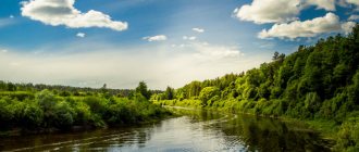
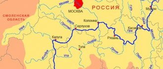
The river is 603 kilometers long, flowing through the territory of the Sverdlovsk and Tyumen regions. Within the Sverdlovsk region it is suitable for tourist rafting and is interesting for its rocks and caves.
The Pyshma River originates from a small swampy lake called Klyuchi near the cities of Verkhnyaya Pyshma and Yekaterinburg. River basin: Tura – Tobol – Irtysh – Ob – Kara Sea. The area of the river basin is 19,700 km2. This is the eighth longest river in the Sverdlovsk region.
What does the name of the river mean?
Let's look into the book of the famous Ural linguist A.K. Matveev “Geographical names of the Sverdlovsk region”:
“In the “Book of the Big Drawing” of 1627 it appears as the “Pysh River”, but already in one document of 1629 it was called Pyshma three times, so in the “Book of the Big Drawing” there is apparently an error. This toponym, which is very difficult to explain, has been unlucky from the very beginning: the famous Johann von Stralenberg, a captive Swede who lived in Siberia for a long time and wrote a large study about it, talking about the writings on Pyshma, put forward the assumption that Pyshma is from the Russian word ... letter. Historian G.F. Miller noted in this regard that there are no writings on Pyshma, and the word is not Russian, but Tatar, which the Tatars themselves pronounce Pishni.
Later studies added almost nothing. Among local historians, the opinion has spread that Pyshma translated from Tatar means “Calm” (there is a Tatar word poshmas - “unhurried”, “slow”), but this is a very dubious version. It is also assumed that Pyshma goes back to Pyshva, where va means “water” from the Komi-Permyak language, but even this cannot be proven.
Most likely, the toponym Pyshma penetrated into the Tatar language from some more ancient pre-Turkic language. Since the immediate predecessors of the Turkic peoples on the territory of the Trans-Urals were, apparently, the Ob Ugrians, the explanation for this mysterious name must be sought primarily in the Mansi and Khanty languages. But the Mansi lived closer to the Urals, and in the Mansi language there are no obvious correspondences to the hydronym Pyshma, but in the Khanty language there is a very interesting adjective pysyng - a parallel word to emyng - “saint”. Since the final ng is often conveyed to Russian m, one might think that pysyng was perceived as pysym. Mutual transitions s–w are very widespread. The names of the sources of Pyshma are also very remarkable: the right one is Pyshma itself, and the left one is the Molebka River, which originates in the Molebnoye swamp. Thus, the version that Pyshma is “Holy (river, water)” begins to acquire more or less serious grounds.”
Features of the Pyshma River
The Beloyarsk reservoir was created on the river, intended for the needs of the Beloyarsk NPP. In the first years of operation, radioactive waste entered the Pyshma River basin. However, this had almost no effect on the Beloyarsk Reservoir, in particular, the fish there are completely normal and do not have an elevated background. There are also several small ponds.
The largest settlements on the banks of the Pyshma River: Verkhnyaya Pyshma, Berezovsky, Staropyshminsk, Zarechny, Beloyarsky, Sukhoi Log, Kamyshlov, Pyshma, Talitsa. Due to enterprises and other human activities, the river is heavily polluted.
In 1745, in the upper reaches of the Pyshma, peasant Erofey Markov from the village of Shartash discovered what is believed to be the first gold in Russia (although not so long ago local historians established that the first gold was discovered on the Iset River - at the Shilovo-Isetsky mine).
On the Pyshma River near the village of Stanovaya, a dredge still operates today to extract gold. According to local historian Boris Maidanik, this dredge was manufactured in the city of Votkinsk; it has been operating on the Pyshma River since 1934. Over time, having completely worked out the upper reaches of the river, the dredge reached the railway bridge near the Berezit station. The three-story dredge, naturally, could not pass under it. To allow it to pass, they decided to temporarily raise the bridge. For this purpose, four vertical trusses with lifting winches were built nearby. A dam was built below the bridge, causing the river to overflow and form a pond. And so, on July 9, 1962, the bridge was raised and the dredge passed downstream. The whole operation took 2 hours 20 minutes. This was the first time this had been done in the USSR.
Preparation for raising the railway bridge across Pyshma for the passage of the dredge.
In the past, Old Believers hid in some places on the Pyshma River. According to researcher S.A. Beloborodov, after the authorities destroyed the Kazan monastery on Shartash, 15 versts from the village of Beloyarsky, Yekaterinburg district, Mother Faina settled on the left bank of the Pyshma (in the world - Marfa Grigorievna Chuvakova). It was possible to get to the settlement only through a single bridge, which was dismantled in case of danger. Bishop Gennady of Perm, one of the most significant figures among the Old Believers of the Belokrinitsky Consent (the so-called “Austrians”), often stayed with Mother Faina. The name of Gennady (Grigory Vasilyevich Belyaev) is associated with a significant increase in the activities of representatives of the Belokrinitsky Church in the Urals and Siberia. He held the rank of Bishop of Perm from 1857 to 1862. Gennady was arrested several times, he was in prisons and prison companies, but he did not renounce his faith.
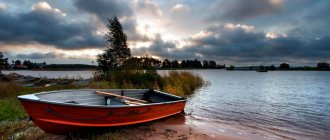
In the spring, tourist rafting takes place along the Pyshma River. Although there are few tourists here. Rafting can start in Beloyarskoye or from Belokamenny, and end in Sukhoi Log or Kuryakh. These places are also interesting for hiking.
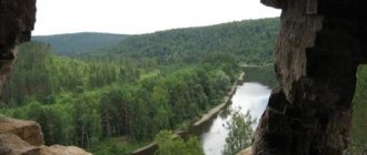
The main highlight of the river is the coastal rocks. Fossils are found on them in places.
The first rocks downstream are found in the village of Staropyshminsk. For the rare plants growing on them, they received the status of a natural monument of the Sverdlovsk region.
Some rocks have their own names: the Diviy (or Divya Gora) stones, Kovrizhka, Bryukhanov, Devil's Chair, Three Sisters. Others are nameless.
The Divy Stone is located on the left bank of the river near the village of Znamenskoye. These are the remains of an ancient volcano. At the base of the rock you can see tuffs and jaspers of purple and red color. At the end of July - beginning of August, the student song festival “Znamenka” is held here.
And in front of Sukhoi Log, a small river Shata flows into the right. The Shata (or Shatsky) waterfall of the same name was formed on it. You need to see it in the spring, because in summer it is only a small trickle of water.
The most picturesque rocks are within the city of Sukhoi Log. They have many caves.
The most famous of these caves is named after the mining engineer F.Yu. Gebauer, who studied it in the 1870s. In the cave he discovered traces of an ancient man.
Downstream there are also a number of rocks. And in front of the village of Kurya, hidden behind the forest, is the Devil’s Chair rock, named for its characteristic shape. Finding the rock is not easy, since in recent years it has been heavily overgrown with forest.
There is a stone rotunda on the Three Sisters rock. According to legend, three sisters, having fallen in love with one young man, threw themselves off a cliff into the river so as not to build their happiness on the misfortune of their sisters. On the mountain there is the resort-sanatorium “Kuryi”, which has long been famous for its mineral waters.
V.A. Vesnovsky wrote about these places in his “Guide to the Resorts of the Urals” in 1902:
“Here the Pyshma River has cut through a mountain ridge, spurs of the Ural ridge, and emerges into the open space from rocky, rocky shores. Higher up from the sources, the banks of Pyshma amaze with their bizarre outlines and stretch like a continuous rocky ridge. Some rocks rise up several tens of fathoms. In some places, such a steep barrier stretches along the shore for several fathoms, presenting an original spectacle... The area occupied by the resort is one of the most beautiful places in the vicinity of the Urals. Nature has given everything here to live calmly and happily in its bosom for several summer weeks, taking a break from the usual squabbles and city prose, and breathing in the clean, healthy mountain air, full of ozone. The main beauty of the resort is the rocks. They are sometimes brown, sometimes brown, but majestically proud, rising now on the right and now on the left bank of the river. Pyshma. At their foot the river spreads like a snake, silvering with its smooth mirror surface. Masses of brown stone protrude like humps above the water, piled on top of each other, forming figures of bizarre shape. Where possible, pine trees have strengthened along their ridges and slopes and stand proudly in their evergreen attire. Right there, like an orphan, the birch tree got lost, lowering its curly branches to the ground. All these rocks are masses of limestone of a brownish-dirty color, speckled with rusty spots and covered with moss.”
Characteristics of the rivers of the Sverdlovsk region and Kushvinsky district
Water is one of the main sources of life on Earth. It constantly circulates around the planet and is found everywhere: on the ground and underground; in the atmosphere and in living beings. Its circulation around the planet is called the water cycle in nature. In general, there will be no life without water. Water is the most amazing mineral. It also has healing properties: distilled water flushes salts from our body. Of course, it is not recommended for a healthy person to drink such water, but it is necessary for the treatment of diseases associated with the deposition of harmful salts. Man has revered water since ancient times. He wrote many poems and stories about her. For example:
Take care of these lands, these waters,
Loving even a small blade of grass,
Take care of all animals within nature,
Kill only the beasts within you
These wonderful, in my opinion, lines were written by our contemporary Yevgeny Yevtushenko. Through this verse, we see the author’s love for nature, his understanding of today’s environmental problems and his desire to help nature in some way. I believe that every person should follow the example of a writer. Even ancient people worshiped water. Here, for example, is the inscription of the ancient Indians, written about five thousand years ago:
Oh sacred waters
Be our protection
Quench our thirst
Oh, water! Give us gracious consolation
Rivers and lakes have always played and will play a key role in human life. Water contains salts that are part of blood plasma. Typically these are NaCl and CaCl. And therefore the “source of life” is useful for our body. The following sciences are closely related to water: hydrology; hydrography; hydrogeology.
2. Hydrology of the Urals
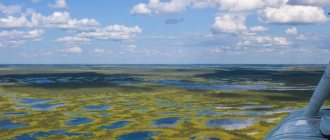
We live in a beautiful region - the Urals. This region surprises not only with its flora and fauna, but also with its waters. Beautiful lakes, working rivers, healing underground waters, swamps - all this is the result of an excessively humid climate. There are a lot of rivers in the Urals, and they flow from the Ural ridge either to the west (carry their waters into the Caspian Sea) or to the east (the waters of these rivers are carried through the Tobol, Irtysh and Ob into the Arctic Ocean). The largest rivers of our region are the Kama, Belaya, Tavda, Chusovaya, Tura - it’s impossible to list them all. The area of our “Stone Belt” is about 824 thousand square kilometers. The drainage from this huge territory is 136 cubic kilometers per year. This is a colossal amount. Whatever rivers there are in the Urals: mountainous or flat, stormy or calm, they bring great benefits to people. There are even such amazing rivers, in the bed of which there is no water in the winter! It seeps through the soil and goes underground! For example, a tributary of the Sosva River is the Vagran stream, translated it means “river with whirlpools” (Mansi). You can break through the ice on Vagran and not find water in it, you can go down to the bottom of the river and walk along the riverbed. As a rule, such underground rivers are short and low-water. Walking along the bed of some northern low-water river, for example, a tributary of the Lozva, Sosva or Pelym, you can notice a river that, frolicking and winding, either disappears underground or emerges again on the surface of the earth. Such rivers are called “diving” rivers. Some rivers flow through several regions of the Urals at once. For example, the Chusovaya River. Its source is located in the Chelyabinsk region, and its mouth is in the Perm region. Chusovaya flows into the Kama River and flows through the Chelyabinsk, Sverdlovsk and Perm regions. The same story is with the Ufa River. It begins, like Chusovaya, in the Chelyabinsk region. The mouth of the Ufa is located on the border of the republics of Bashkortostan and Tatarstan, and it flows into the Belaya River. Our native land is rich in rivers!
3. General overview of the rivers of the Sverdlovsk region
Rivers in the Sverdlovsk region are of great importance and use. They do a lot of useful work: they provide water to villages, towns, cities, factories; rotate turbines of hydroelectric power stations (Tura River); carry river vessels - boats, barges - on their shoulders; timber is floated down them. In general, the rivers are hard workers. And they have been working for a long time. Since the 17th-18th century. With the help of our rivers, non-ferrous metals, steel, and cast iron began to be transported from the Urals to central Russia. In those days, among the impenetrable taiga, it was possible to get to Siberia only by rivers. “The Ural beauties” were then like a “window to Siberia.” Water pumped from rivers is widely used in human economic activity: 59% of the water used is used for industry; for drinking and housekeeping – 26%; for agriculture – 3%; for land irrigation – 1%; others – 11%. Indeed, there are many rivers in the Sverdlovsk region - over 18 thousand, and their total length is about 68 thousand km. There are few long rivers, more than 200 kilometers long, only 18, but their total length is 8000 km. There are 1027 medium-sized rivers (from 10 to 200 km), their total length is over 26,000 km. But there are quite a lot of streams - 17,370, their total length is 34,000 km. The longest and most abundant rivers in our region are Tavda, Tura, Sosva, Lozva, Pelym, Ufa, Chusovaya. The Iset and Pyshma rivers are long, but very shallow and polluted. Their low water content is explained by the fact that they flow through the most populated area of the region, and their water is pumped out for the needs of the population and the needs of industrial enterprises. The average drainage of all these enchanting creations is 29 cubic km per year. But more than half of the total annual flow of all rivers in the region falls on the Tavda River, which flows through the sparsely populated swampy north and northeast of our region. And some industrial centers of the Middle Urals are experiencing a shortage of water resources, since a lot of water is spent on municipal, domestic, and agricultural needs. And there is a project to transfer excess water from the northeast to the industrial zone of the Sverdlovsk region. But this project is still in doubt. And if you use water correctly and avoid accidents and leaks in water pipelines, then the shortage of water supplies will disappear. On the territory of the Sverdlovsk region, rivers originate and flow beyond its borders. These are mainly rivers flowing to the east and southeast of the region. As a rule, they are long and high-water (for example, Tavda, Tura), the only exceptions are Iset and Pyshma, since they are low-water. The Iset River flows through three regions of the Sverdlovsk, Kurgan and Tyumen regions at once, providing them with water. It flows into the Siberian Tobol River.
4. Characteristics of the rivers of the Kushvinsky district.
a) the Serebryannaya River
There are interesting rivers in our Kushvinsky district. For example, the Serebryannaya River is one of the tributaries of the Chusovaya. Its source is in our area and is located on the slope of Mount Podpor at an altitude of 450 meters above sea level. Its mouth at the confluence with Chusovaya is at an altitude of 177 meters. Serebryanka is a mountain river; in its narrow places the flow speed reaches one meter per second, although the average speed of this river is 80 cm per second. The river runs to the southwest, covering 152 kilometers. Her pool area is 1240 sq. kilometers, and over the course of a year in this territory, Serebryannaya collects 400 million cubic meters of water, while the second flow of the river is 12.7 cubic meters per second. Like all rivers, Serebryannaya has tributaries. The largest of them are: Shurysh, Klyktan, Kokuy. Ermak’s path passed along Serebryannaya. There are even hypotheses that his squad spent the winter on the Kokuy River, in the so-called Kokuy town. And they chose this place because there is a lot of fish, forest, animals, birds, little wind - in general, all the conditions for wintering.
b) the Barancha River and its tributaries
Ermak’s path also passed along the Barancha River, the right tributary of the Tagil River. There are several versions of the origin of the name Barancha. Perhaps this is a Bashkir word, translated meaning “small” or “winding”. Once upon a time, the Tatars ousted the Mansi tribes from these territories, and a Tatar warrior nicknamed “Baranchuk” became the master of this area. And the Tatar and Bashkian languages are similar, and therefore in translation the nickname was translated as “small”. Obviously, since then the fast, winding river has received the name Barancha. A document confirming Baranchuk’s right to own this territory has survived to this day. The river is really winding, narrow, fast and low-water. It starts at 355 meters. Flowing into the Tagil River, Barancha is 75 meters above sea level. The length of this narrow river is about 78 kilometers, and its basin area is 632 square kilometers. Barancha is a mountain river, its fall is approximately 5.6 meters per kilometer. The average current speed is 0.5 m per second. It carries its waters to the southeast, giving them to the Tagil River. The speed in some places reaches 3 m per second. Two ponds have been created on this river: Verkhnebaranchinsky, on which the village of Verkhnyaya Barancha (the so-called Plotinka) is located; and Nizhnebaranchinsky, on which the village of Baranchinsky is located. To the south of this settlement, the river flows through a marshy area, through the Shumikhinsky swamp. Barancha always remains a high-water river, even in summer. And it owes this to the swamps through which it flows, which level the “peaks” of the river (high water and summer low water). Indeed, when Barancha is full of water, the swamps absorb excess water; when the river dries up, the swamps “give” the accumulated moisture to it. Barancha has a lot of tributaries: Chernushka, Tatarka, Bobrovka, Ak-Tai, the Zhuravlik River, the Sofyanka River, Pesyanka, Kamenka, Olkhovka - you can’t count them all. But its most famous and largest tributary is the Ak-Tai River. "Ak-Tai" translated from Tatar means "white foal". This river was named so because it foams with white foam and frolics like a foal. Ak-Tak is a mountain river, its average speed is one meter per second. The drop is large - 7.4 meters per kilometer. First, the river runs to the west, then makes a sharp turn, accepting the tributary river Svetlaya, and continues its flow to the north, northwest. Before turning east, the Olkhovka River flows into Ak-Tai. It should be noted that Svetlaya and Olkhovka are environmentally friendly rivers, but still the hydrology is disrupted by deforestation (forests collect water for the rivers). To the east, the “white foal” runs about 15 km, flowing into the Nizhnebaranchinsky pond, from which only the Barancha River continues to flow. The length of Ak-Tai is 33 km. Unfortunately, the forests located along the banks of this river have been cut down. And the hydrology of Ak-Tai is disturbed, since forests accumulate and release water to rivers, but there are no swamps and lakes in the bed of Ak-Tai itself. And in summer the river becomes low-water, as it is not fed by surface waters. One of the first tributaries of Barancha, the Tatarka River, flows entirely through marshy areas, giving its owner a large amount of water. And this actually explains the high water level in this place for Baranchi. Many of its tributaries flow through swamps: the Chernaya, Pesyanka, Bolshaya Gorevaya, and Poludenka rivers. Unfortunately, there are many clearings along the banks of Barancha, which consequently left an imprint on the flow and water abundance of the river. And it is fed only with the help of its tributaries, streams and surface waters.
c) Kushva River
Yes, there are no ugly rivers in the Urals! For example, the Kushva River, on which our city stands, also has several versions of its name. “Kushva” translated means “swampy water”, as it has a yellowish, swampy tint. But there may be such a translation: “a river sandwiched between mountains.” Indeed, Kushva deftly runs between the ridges. But another translation is possible: “Kush” in the Komi language means “naked”, “empty”, “va” - water. It is obvious that there was once a strong fire here, which destroyed all the vegetation on the hills between which the river flows. The length of the river is about 24 kilometers. Its source is located at an altitude of 290 meters above sea level, and at the confluence with the pond it is 221 meters. The fall of Kushva is on average 3.2 meters per kilometer. Mountain river. In the upper reaches it is stormy and fast. But before flowing into the pond, the Kushva flows through a swampy area. This amazing river has several sources: the main source begins from the slopes of Mount Razrubnaya Kamen, its elevation is 275 m. There is another source near the river: from the Valuevsky mine. Here the Kushva flows from a mark of 270 meters, and after 6 km it receives the Korablyovka tributary stream. The Kushvinsky pond was created on the “swampy” water, but it should be taken into account that after the pond the river continues its flow, flowing into the Verkhneturinsky pond. I want to tell you a little more about Kushva: the area from which it collects water, before it flows into the pond, is 56 square kilometers. The flow speed in swampy areas decreases to 30 cm per second, although in the upper reaches of the river the speed is 4-5 times higher. Kushva can be considered a river with a balanced drainage, and the river owes this to the swamps through which it flows. The role of the Poymensky swamp is especially great, its area is 5 square kilometers. The water in the river is polluted with a large amount of carbolic acid and other organic compounds and mineral impurities, which are contained in excess, and it is from them that the water takes on a swampy hue.
d) the Tura River and its tributaries
The sources of the Tura River are located in the Kushvinsky district. From the source to the water pump (the water pump supplies our city with water) it is 40 km, but to the confluence with the Verkhneturinsky pond it is 50 kilometers. The river in this area is mountainous, as its fall is 5.7 meters per kilometer. The sources of the Tura are fast, but its lower course is swampy (5-6 km before the confluence with the Verkhneturinsky pond). The second flow of the river in this section is 1.8 cubic meters, the catchment area is 56.6 million cubic meters. The regime of the Tura practically coincides with the regime of the other rivers of the Middle Urals: spring flood, summer and winter low water, freeze-up. In August and October there is a slight increase in flow. This is due to rain. The maximum “peak” of the Tura flow occurs at the end of April – beginning of May, during high water. The river's flow rate at this time is 6.84 cubic meters per second, and the minimum "peak" is observed during the winter low water period, at the end of February. The second flow rate is 0.55 cubic meters per second. That is, at the beginning of May, water flows down 12.5 times more than at the end of February. In general, in winter, 9.7% of the total annual flow flows down the Tura, but in spring - 46.8%, which is correspondingly 5 times higher, in summer - 25.1%, in autumn - 18.4%. The Tura has the smallest flow in winter, and, therefore, winter is the least water period in the life of the Tura River. The Tura begins its flow from the watershed of the Tura and Serebryannaya basins at an elevation of 450 meters above sea level. It joins the tributaries Berezovka, Olkhovka and Dalnyaya Garevka, Blizhnaya Garevka, and the Berezovyi stream. But the largest river flowing into the Tura in the Kushvinsky district is the Dolgaya River. This influx begins from the watershed of the Serebryanaya and Tura basins, that is, from the hills (the watershed, as a rule, is hills, hills, and mountains). The descent of this river is steep - seven meters per kilometer. Dolgaya is a mountainous, stormy river, its flow is fast. During the spring flood, the melted snow immediately flows into the lower reaches of the river and is carried into the Tura. And in the summer, the river becomes low-water and dries up, which accordingly leaves an imprint on the flora located along the banks of this river. I also want to talk a little about the tributaries of the Tura River. For example, the river Berezovaya and Dalnyaya Garevka. These two “toilers”, unlike Dolgaya, do not dry out much in the summer (they are located in a swampy area) and give a lot of water to the “hostess-Tura”, even during the hot period. All tributaries of the Tura River in the Kushvinsky district are mountain rivers. Their fall is quite large, for example, the Olkhovka River. Its source is located at an altitude of 390 meters above sea level, and its mouth, falling into the Tura Dolgaya River, is 254 meters. The length of Olkhovka is about 13 km. Its fall is approximately 10.5 meters per 1 km. The river is turbulent, with a fairly fast current that can turn over large stones. And in general, all the local tributaries of the Tura are mountain rivers. The only exception is Nizhnyaya Garevka. Its fall is 4.5 meters per 1 km. It has a mountainous character, but it can no longer be compared with previous tributaries and, especially with Olkhovka. Tura has quite a lot of tributary streams, it’s impossible to count them all. But now, during deforestation, most of them have ceased to exist. In my opinion, it is necessary to plant coniferous trees along the banks of these rivers, since pine needles are especially good at trapping harmful gases and “excellently” collecting moisture, giving it to the rivers. This will increase the abundance of water and the flow of streams of tributaries of the Tura River.
5. Social ecology of rivers in the Sverdlovsk region
The ecological situation in the Urals is critical, especially in the Sverdlovsk region (the industrial region of the Middle Urals is located here). Not only the air and soil are polluted, but also water. Industrial, agricultural and municipal wastewater is discharged into rivers. The situation near the Pyshma River is especially deplorable. This is the dirtiest river in the Sverdlovsk region. Along its banks there are many industrial enterprises, a high population density, and besides, forests have been cut down. All this led to severe pollution of the river and a reduction in river flow. Indeed, the Lozva River (a tributary of the Tavda) has a total basin area of 17,800 square kilometers, and the Pyshma has 2,000 less, but the Lozva has an annual flow of 3.76 cubic kilometers, and the “lifeless river” has 0.79 cubic kilometers, that is, the flow of the Pyshma very small, the river died as a result of human activity. Iset was in a catastrophic state. Its drainage is even less than that of Pyshma (0.44 cubic kilometers), although its basin area is 58,900 square kilometers. I would like to continue the conversation about the Pyshma River. Near it (and about 30 kilometers from the outskirts of Yekaterinburg) the Beloyarskaya nuclear power plant is located. Not far from this station, on one of the rivers, a dam was created that formed a pond. And “Beloyarka” dumps radioactive water into this pond. Sometimes cracks appear in the dam, and poisoned water flows into Pyshma. But Pyshma carries its waters through a densely populated area, and therefore you cannot drink the water, swim, or wash yourself in the river. I believe that active chemical compounds must be introduced into the pond into which radioactive water is dumped, which neutralize the radiation. Forests have been cut down near the Serebryannaya River. Its middle course is even called “scalped land.” The trees remained only in the water protection zone. The forest collects moisture for the rivers, and when it is gone, the river dries up. Once upon a time, Ermak, on his large river vessels, went from the Chusovaya River to Serebryannaya, and now the water level in Serebryannaya at the confluence with Chusovaya in the summer does not exceed 40 cm! This is so small that even a simple boat would not fit here! And all this is due to logging. It is necessary to plant coniferous trees in the area of the Serebryannaya River and its tributaries. The rivers of our region are poisoned so badly that some industrial cities have to take water for domestic needs not from the rivers on which they are located, but from underground wells or reservoirs. The following cities are fed by groundwater: Berezovsky, Pervouralsk, Verkhnyaya Pyshma, Bogdanovich, Kamyshlov, Asbest, Artemovsky, Severouralsk, Karpinsk. The two largest industrial cities of the Sverdlovsk region - Nizhny Tagil and Yekaterinburg - take water from reservoirs. If you look at the geography of the above cities, you will notice that they are located on the dirtiest rivers in the region: Pyshma, Iset, Tagil. Particularly acute in relation to hydrology is the unreasonable attitude of man towards the “lungs of nature”; previously, forests were floated down rivers using the so-called “mole” method. In this case, the trees were simply thrown into the water, and the current of the river carried the logs to a certain place, fenced with a net. But there are trees that drown in water! For example, birch, larch. They immediately go to the bottom of the river, clogging it. Birch quickly rots, clogging the water. But larch, unlike other trees, rots for a very long time. And at the bottom of the Tavda River, along which the timber was floated using the moth method, piles of larch trunks formed, which polluted absolutely its entire bottom. And the thickness of the leaf cover in some places reaches 1.5 m. The ecology of the river is disturbed. And despite the fact that larch is a very expensive tree, lifting it from the bottom of the river is not economically profitable. Attempts are being made to raise the trunks, but at this rate the rise will continue for over 100 years. And it’s better than spending money on cutting down deciduous forests to raise trees from the bottom of the river, but, unfortunately, few people care about this problem. Man pollutes rivers not only with timber rafting, but also with logging. The destruction of forests along river banks is especially terrible. Indeed, at the cutting sites there remains a lot of sawdust, stumps, twigs, and diseased trees also remain. And now it all rots. And the muddy mud remaining after humus is washed into the river, clogging it. And, besides, the forest is not only the “lungs of the planet”, it is also the “breadwinner of the rivers”. It collects moisture, retains water during spring floods, and then releases it to the rivers. I also want to talk about the so-called “water breads”. “Water farmers” are industrial and agricultural enterprises that pump out a lot of water from rivers for their needs, reducing its flow and water abundance. Here, for example, is the famous industrial center of the Middle Urals - Kamensk-Uralsky. Now there are 11 enterprises in the city, including agriculture. And they all pump clean water from the Iset River and dump semi-poisoned liquid. These plants and factories need to switch to a closed water supply system. If this condition is met, the ecology of the Iset River will significantly improve: dirty wastewater will not be discharged into the river. Scientists have calculated that the Iset drainage contains 0.1% solids. This is a lot, the water from such a large percentage of impurities and feces takes on a dark gray color and smells bad. The city of Yekaterinburg throws out 200 tons of feces (in dry form) into the Iset every day, and despite the fact that this large city has two treatment facilities, municipal wastewater still enters the Iset, and those that pass through treatment facilities are treated rather poorly . Poisoned water must be purified by 95%, but in Yekaterinburg the water is purified only by 85%. Water supplied to the city from reservoirs for municipal needs is chlorinated. And chlorine has a very negative effect on human health, especially on the stomach. Many countries have introduced the so-called water ozonation system. The essence of this method is that microorganisms are destroyed with the help of ozone. This type of purification is environmentally beneficial: the water becomes completely clean, causing virtually no harm to humans. In order to make the Iset River cleaner, it is necessary: 1) to introduce a closed water supply cycle at enterprises; 2) it is necessary to achieve a higher quality of water purification in the cities of Kamensk-Uralsky and Yekaterinburg; 3) introduce water ozonation systems instead of chlorination.
6. Ecological situation of the rivers of the Kushvinsky district
Now a little about the ecology of the rivers of the Kushvinsky district. Here, from the top of one of the ridges, the Tura River begins. One of its tributaries is the Berezovy stream, which flows through the Asiatskaya station. This stream is very polluted by municipal wastewater. Tura receives environmentally polluted waters. But after a few kilometers, another tributary flows into this river - the Berezovka River. At Berezovka, the water contains a small amount of carbolic acid. Phenol introduced into Tura purifies its waters; this substance is environmentally friendly, it is formed in swamps. But in large quantities this substance harms the river. But Tura has another problem in the Kushvinsky district. The fact is that almost along the very shore of the Tura there is a railway to Perm and a highway to the Asiatskaya station. Dust raised by wheels and other waste (tires, car parts) are washed into the river by water. And due to the cutting down of the local forests, the river flow has become very small. It is necessary to stop cutting down coniferous trees and willows, at least along river banks, since these trees are especially good at trapping gases and collecting a very large amount of water. A particularly critical situation has developed regarding the groundwater of the city of Kushva. The thing is that a large amount of dissolved harmful salts accumulate in the places where the ore deposits are located. As the depth of the mine increases, the content of hydrosulfates gradually decreases, but aqueous solutions of hydrochloric acid increase, the concentration of which at great depths is quite high, and the content of chlorides also increases. As a result of human activity, the above substances enter underground waters. Copper compounds are especially harmful to our body. All pollution is divided into biological, mechanical and chemical. These pollutants also exist near the Kushva River. Here, for example, is its tributary – the Korablevka River. In its upper reaches, public livestock are grazed. And because of this, Korablyovka is heavily polluted. All sewage goes first into the Kushva River, and then into the Kushva Pond, so swimming and drinking water in the pond is strictly prohibited. In addition, leaks from sewer networks occur very often in the city of Kushva. These contaminants are classified as biological. Mechanical contamination includes dust and dirt. As a rule, it increases with the number of cars. In spring, all the snow from the city is washed into the Kushvinsky pond. But there are a lot of oil and gasoline stains on this snow. They end up in the pond, polluting it. This is chemical pollution, and besides, the pond is greatly damaged by chemicals from the Yuzhnaya mine and the roll-mechanical shop. Particular attention should be paid to garbage dumps. As a rule, garbage from the city is transported to the Sosnovskoe swamp, through which the Kushva River flows. Garbage ends up in the river. There is a river called Polovinka in our area. It flows into the Verkhneturinsky pond. It is heavily polluted, since at its source there is a sludge storage facility, or rather a sludge dump.
7. Conclusion
The water resources of our region are large: swamps, lakes, healing underground waters, working rivers - all this is the result of an excessively humid climate. But due to the widespread, unreasonable use of inland waters, environmental problems arise in the region. Purification of agricultural, municipal and industrial wastewater, protection of our rivers, forests, lakes, animals, birds is the most pressing environmental problem of the Sverdlovsk region today. By polluting water and air, people poison not only themselves, but also animals, flora, and geosystems. The region is rich in water, but it is necessary to use it in the most optimal way, without destroying the geosystem of pristine nature. We must love, cherish and protect nature. And I want to finish my work with the following lines:
“Or a person will reduce the amount of pollution,
Or pollution will reduce the number of people.”